Kill the Land, Kill the People: There Are 532 Superfund Sites in Indian Country!

by Terri Hansen, Intercontinental Cry

Of a total of 1,322 Superfund sites as of June 5, 2014, nearly 25 percent of them are in Indian country. Manufacturing, mining and extractive industries are responsible for our list of some of the most environmentally devastated places in Indian country, as specified under the Comprehensive Environmental Response, Compensation and Liability Act (CERCLA), the official name of the Superfund law enacted by Congress on December 11, 1980.

Most of these sites are not cleaned up, though not all of the ones listed below are still active. Some sites are capped, sealing up toxics that persist in the environment. In cases like the Navajo, the Akwesasne Mohawk and the Quapaw Tribe, the human health impacts are known because some doctors and scientists took enough interest to do studies in their regions. Some of those impacts may persist through generations given the involvement, as in the case of the Mohawk, of endocrine disrupters. Read on.


1. Salt Chuck Mine, Organized Village of Kasaan, Alaska

salt-chuck-mine-tailings-alaska_dec

The Salt Chuck Mine Superfund site in southeast Alaska operated as a copper-palladium-gold-silver mine from 1916 to 1941. Members of the Organized Village of Kasaan, a federally recognized tribe, traditionally harvested fish, clams, cockles, crab and shrimp from the waters in and around Salt Chuck, unaware for decades that areas of impact were saturated with tailings from the former mine. As if that weren’t enough, Pure Nickel Inc. holds rights to mining leases in the area and began active exploration to do even more mining in summer 2012, according to Ground Truth Trekking.


2. Sulfur Bank Mine, Elem Band of Pomo Indians, California

sulpher_bank_mine_superfund_site-jared_blumenfeld_epa_r9


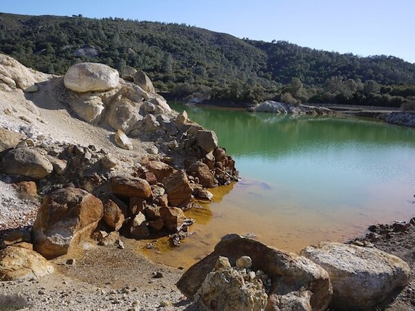
The Elem Band of Pomo Indians, whose colony was built on top of the waste of what would become California’s Sulfur Bank Mine Superfund site in 1970, have elevated levels of mercury in their bodies, and now fear for their health. According to an NBC News investigation, nearby Clear Lake is the most mercury-polluted lake in the world, despite the EPA’s spending about $40 million over two decades trying to keep mercury contamination out of the water. Although the EPA cleaned soil from beneath Pomo homes and roads, pollution still seeps beneath the earthen dam built by the former mine operator, Bradley Mining Co. For years, Bradley Mining has fought the government’s efforts to recoup cleanup costs.


3. Leviathan Mine, Washoe Tribe of Nevada and California

leviathan_mine_california-wikimedia_commons


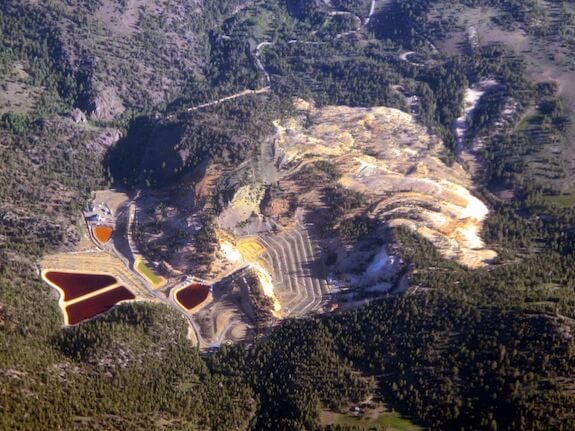
The Washoe Tribe of Nevada and California requested EPA involvement in the cleanup of an abandoned open pit sulfur mine on the eastern slope of California’s Sierra Nevada that became the Leviathan Mine Superfund site. The Washoe Tribe had become concerned that contaminated waters were affecting their lands downstream, causing impacts to culture and health, environmental damage, remediation, monitoring and testing, posting of health advisories, drinking water, effects on pregnancy, and cancer. Aluminum, arsenic, cadmium, iron, manganese, nickel and thallium have been detected in surface water and sediment downstream from the mine. The U.S. Centers for Disease Control and Prevention (CDC) concluded that exposures could result in cancerous and non-cancerous health effects.


4. Eastern Michaud Flats, Shoshone-Bannock Tribes, Idaho

4-waste_ponds_fmc_site_-_anne_minard


The abandoned FMC phosphorus facility occupies more than 1,000 acres of the Shoshone-Bannock Tribes’ Fort Hall Reservation in Idaho, and lies within Eastern Michaud Flats Superfund site. The primary contaminants of concern at the site are arsenic, elemental phosphorous and gamma radiation. FMC left a legacy of contamination in the air, groundwater, soil and the nearby Portneuf River, which threatened plants, wildlife and human health on the reservation and in surrounding communities. The Shoshone-Bannock have long asked for a cleanup of contaminated soils, but instead the EPA’s 2012 interim remedy is to cap and fill, including areas containing gamma radiation and radionuclides.


5. Bunker Hill Mining and Metallurgical Complex, Coeur d’Alene Tribe, Idaho

tundra-swans-in-cda-basin-usfws


The Bunker Hill Mining and Metallurgical Complex Superfund site, located in the Coeur d’Alene River Basin, is one of the largest environmental and human health cleanup efforts in the country.

Its contamination, the result of decades of mining, milling and smelting, affected more than 150 miles of the river, lake and its tributaries. The area, listed a Superfund site in 1983, is one of the “largest and most complex” in the country, according to the EPA. Studies revealed that three quarters of children living in the area in the 1970s had unhealthy levels of lead in their bloodstream. The United States, the Coeur d’Alene Tribe and the state of Idaho settled with the Hecla Mining Co. in June 2011 for $263.4 million to resolve claims stemming from releases of wastes from its mining operations, an agreement that will protect people’s health by ensuring the cleanup of areas heavily polluted with lead, cadmium, arsenic and other contaminants.


6. Rio Tinto Copper Mine, Shoshone Paiute Tribes of Duck Valley, Nevada

rio-tinto-cleanup


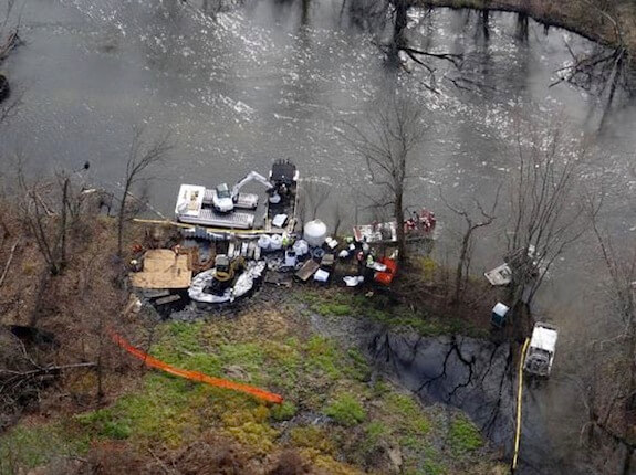
The Shoshone Paiute Tribes of Duck Valley and the state of Nevada will oversee cleanup of the abandoned Rio Tinto Copper Mine Superfund site with $25 million paid by the Atlantic Richfield Co., DuPont and Co., the Cleveland-Cliffs Iron Co. and Teck American Inc., all corporate successors to companies that operated the copper mine between 1932 and 1976. The agreement was worked out last year by the EPA, U.S. Department of Justice (DOJ) and the Nevada Division of Environmental Protection. The cleanup will remove mine tailings from Mill Creek, make the creek habitable for redband trout and improve the water quality of Mill Creek and the East Fork Owyhee River.


7. Alcoa Superfund Site, Akwesasne and Saint Regis Mohawk, New York

alcoa_aluminum_superfund_site-noaa


The Alcoa Superfund aluminum manufacturing facility in Massena, New York, released hazardous substances including polychlorinated biphenyls (PCBs) onto property and into the Grasse River, contaminating sediments in the river system to approximately seven miles downstream, a traditional area of the Akwesasne Mohawk. Analysis of fish in the Grasse River revealed high levels of PCB contamination. PCBs are linked to cancer, low birth weight and thyroid disease, as well as learning, memory and immune system disorders. When in April 2012 the EPA finalized a cleanup plan that requires dredging and capping of contaminated sediment in a 7.2 mile stretch of the river in April 2012, the Saint Regis Mohawk Tribe were not satisfied with the capping solution.


8. General Motors Massena, Akwesasne Mohawk

OLYMPUS DIGITAL CAMERA


Some 4,000 Saint Regis Mohawks live adjacent to the General Motors Massena Superfund site in Massena, New York, which while in operation used PCBs, plus generated and disposed of various industrial wastes onsite. PCBs have been found in the groundwater, on- and off-site soils and sediments in the St. Lawrence and Raquette Rivers, Turtle Cove and Turtle Creek. PCBs are probable human carcinogens that can also affect the immune, reproductive, nervous and endocrine systems, as well as cause other health effects. Groundwater was also found to be contaminated with volatile organic compounds (VOCs), which are potentially harmful substances that easily evaporate in the air. Phenols have been detected in lagoons left behind.

Under an August 2010 EPA order, Motors Liquidation Co., formerly GM, and then RACER Trust became responsible for additional sampling, decontamination of the building and contents, demolition of the building, removal of PCB-contaminated soil beneath the building and restoration of the area. A controversial landfill of capped contamination will be moved 150 feet from the tribal border in 2014, EPA regional administrator Judith Enck told the Associated Press in 2012.

The bodies of young Akwesasne Mohawk adults contain twice the levels of PCBs as the national average, compared to those studied by the CDC. Researchers have already established that PCBs have altered thyroid gland function in the Akwesasne community. Prior studies found lower testosterone levels and established links to autoimmune disorders.

“Endocrine disruption seems to be the effect which is most far reaching, because other effects on the reproductive system may be well tied into that,” said Lawrence Schell, a professor at the State University of New York (SUNY at Albany) and director of its Center for the Elimination of Minority Health Disparities who was involved in an exposure research study at the St. Regis Mohawk Nation.


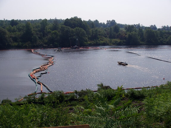
9. Onondaga Lake, Onondaga Nation, New York

onondaga-lake-aerial


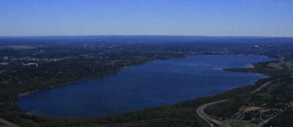
Onondaga Lake is a sacred place. The Great Peacemaker formed the Haudenosaunee, known as the Iroquois Confederacy, on its shores.

That the 4.5 square mile lake in Syracuse, New York is spoiled is a painful thing. Sewage overflows contaminated the lake over the years, as did industrial pollutants and heavy metals such as PCBs, pesticides, benzene, toluene, xylene, creosotes and polycyclic aromatic hydrocarbons (PAHs), lead, cobalt, and mercury. The Onondaga Lake Superfund site, listed in 1994, consists of the lake itself and seven major and minor tributaries. Completion of the dredging work is being performed by Honeywell International with oversight by the New York State Department of Environmental Conservation, the EPA and the New York State Department of Health, and capping is expected in 2016. The Onondaga Nation states the Honeywell cleanup plan does not effectively contain toxic chemicals and heavy metals that will be left beneath caps in the lake-bottom sediments.

“Caps are not a reliable form of containment—they will fail, and whether it is in 10 years or 110 years, it is only a matter of time,” the Onondaga said in a statement. “And when that happens, the chemicals will be re-released into the ecosystem.”

Nor does the plan set any goals for making the lake ‘swimmable’ or ‘fishable’ they say—a requirement under the Clean Water Act, the Onondaga added.


10. Tar Creek, Quapaw Tribe

tar_creek_superfund-quapaw_tribe


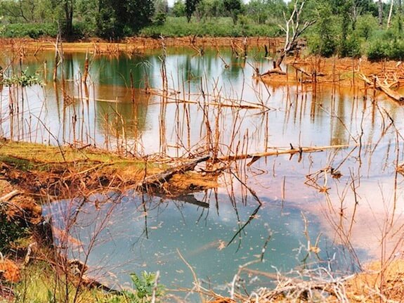
Picher, Oklahoma, part of the Quapaw’s tribal jurisdictional area, was home to productive zinc and lead mining until 1967, when mining companies abandoned 14,000 mine shafts, 70 million tons of lead-laced tailings, 36 million tons of mill sand and sludge and contaminated water, leaving residents with high lead levels in blood and tissues. The area was declared the Tar Creek Superfund site in 1983, but Picher was deemed too toxic to clean up after a 1993 study found that 34 percent of the children tested in Picher had blood lead levels exceeding the point at which there is a risk of brain or nervous system damage.  Cancers skyrocketed. A federal buyout paid people to leave. The Quapaw Tribe has cleaned up part of the Tar Creek Superfund site known as the Catholic Forty and has signed agreements to clean up two other sections of the contamination. Their goal is to make the land productive again.


11. Midnite Mine, Spokane Indian Reservation, Washington

midnitemine-hillside-epa

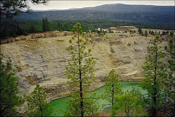
The 350-acre Midnite Mine Superfund site on the Spokane Indian Reservation in eastern Washington is centered around a former open pit uranium mine that poses a threat to human health due to elevated levels of radioactivity and the presence of heavy metals. Years of digging for uranium from 1954 to 1964, and again from 1969 to 1981, have disturbed 350 acres, left two open mine pits and piles of toxic rock on the landscape. Under a September 2011 agreement, Newmont USA Limited and Dawn Mining Company LLC would design, construct and implement the cleanup plan for the site that EPA selected in 2006. They will also reimburse EPA’s costs for overseeing the work. The United States will contribute a share of the cleanup costs. EPA will oversee the cleanup work in coordination with the Spokane Tribe. Cleanup is expected to cost $193 million.


12-532. Uranium Mining, Navajo Nation

abandoned-uranium-mines-navajo-epa


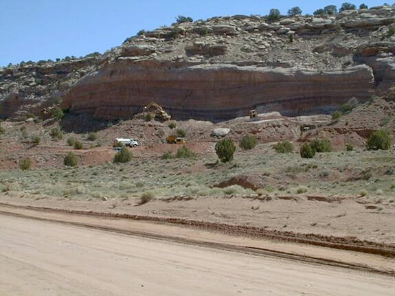
The legacy of uranium mining on the Navajo Nation is radioactive uranium contamination from 521 abandoned Superfund mine sites spread over 27,000 acres of Nevada, New Mexico and Arizona in the Four Corners area, leaving many homes and drinking water sources on the reservation with elevated levels of radiation. The health effects to Navajo citizens include lung cancer from inhalation of radioactive particles, bone cancer and impaired kidney function from exposure to radionuclides in drinking water. The EPA has completed on-the-ground screening of the mine sites, and with the Navajo EPA is determining the order of site cleanup. Cleanup of some sites has begun while the US EPA continues to research and identify Potentially Responsible Parties under Superfund laws to contribute to cleanup costs.

Alaska Natives and First Nations Unite to Fight Mining Threat to Salmon Habitat

Tongass Conservation SocietyThe headwaters of the Unuk River, where a company called KSM wants to build a humongous open-pit mine for cold, copper and other metals.
Tongass Conservation Society
The headwaters of the Unuk River, where a company called KSM wants to build a humongous open-pit mine for cold, copper and other metals.


Paula Dobbyn, Indian Country Today


It has become an all-too-familiar story: Pristine waters. Salmon habitat. Sacred significance. Mining.

The Unuk River watershed, straddling the border between British Columbia and Alaska, is on track to become ground zero in a struggle to stop the world’s largest open-pit mine, Kerr-Sulphurets-Mitchell (KSM). The fight against it is uniting First Nations and Alaska Natives as they battle to preserve stewardship of the pristine region. And it is just one of five massive projects proposed for the region.

If KSM secures the financing and the regulatory go-ahead, the giant mine would turn 6,500 acres of pristine land into an industrial zone that would generate more than 10 billion pounds of copper and 38 million ounces of gold, according to a project summary. As with any large mine, it would employ a hefty workforce—in this case mostly Canadians—and create taxes and royalty payments for Canada. But it would also produce a slew of waste. And that’s what critics say downstream Alaska communities stand to take on: none of the economic benefits but much of the environmental risk.

With its remote headwaters in British Columbia, the Unuk River is one of the world’s most prolific salmon waters. An international river, the Unuk flows into neighboring Southeast Alaska and its temperate rainforest, the 17-million-acre Tongass National Forest, a place of towering coastal mountains, tidewater glaciers and fog-shrouded islands. The Unuk empties into Misty Fjords National Monument, an attraction for cruise ship passengers viewing glaciers, bears and whales that dot Alaska’s Inside Passage. The Unuk, known as Joonáx̱ in Tlingit, supports large runs of king salmon, a cultural icon prized by commercial, sport and subsistence fishermen alike.

“The consequences for salmon runs on both sides of the border could be devastating, yet Alaskans would see none of the economic benefit,” wrote National Geographic Explorer-in-Residence Michael Fay in a 2011 letter to British Columbia Premier Christy Clark, signed by nearly 40 other scientists.

Seabridge Gold, the mine developer, expects KSM to generate more than two billion tons of acidic waste rock called tailings, a byproduct of the mining process than can be lethal to fish. The tailings would be held behind two huge dams—each taller than the Hoover dam—built in the headwaters of the Nass River, one of British Columbia’s most important salmon rivers.

Because KSM is located in sensitive fish habitat, it has raised the ire of Southeast Alaska tribes, fishermen and some Canadian First Nations. They joined forces in early April, forming a cross-border working group to develop a unified strategy to protect their interests.

It’s not just KSM that worries them. KSM is one of more than a dozen mines planned for northern B.C., including five located in salmon-bearing watersheds that arise in Canada and drain into Alaska. The British Columbia government is encouraging the mines’ development, offering tax breaks and relaxed environmental rules. Also spurring development is the construction of a new power line extending electricity into the northwest corner of the province, bordering Alaska. The transboundary projects include Red Chris, Schaft Creek, Galore Creek and Tulsequah Chief. The international rivers they could affect are the Taku, Stikine and Unuk, some of Southeast Alaska’s top salmon rivers.

“These projects could not be in a worse location. Salmon is our traditional food. If anything happens to them, we would be in a world of hurt,” said Ketchikan fisherman and tribal leader Rob Sanderson Jr.

Fishing, seafood processing and tourism are key economic drivers in Southeast Alaska. The seafood industry produced $641 million worth of fish in 2011, which created 17,500 jobs and $468 million in wages. A million visitors tour the area every year, spending about copy billion.

Tribes have passed numerous resolutions of concern about how KSM and the other transboundary mines could potentially contaminate the region, including their traditional fishing grounds. Recently a delegation of tribal leaders and fishermen flew to Washington, D.C.  to lobby for State Department intervention. They delivered a letter signed by 40 businesses, groups and individuals asking for help.

Alaska’s congressional delegation got the message. Shortly after the Alaskans flew home, Senators Lisa Murkowski and Mark Begich, along with Congressman Don Young, contacted the office of Secretary of State John Kerry by letter asking him to get involved to protect Alaska’s interests. Because the mines are located in Canada, Alaska tribes feel they have less influence over the outcome than if they were on U.S. soil.

“It’s happening in a foreign country. We don’t have a lot of control over it,” said Sanderson. “They don’t even have to consult with Alaska tribes.”

The U.S. Environmental Protect Agency has raised issues regarding the KSM project, mirroring the tribes’ concerns. The U.S Interior Department has urged Seabridge Gold to consult with Alaska tribes regarding fishing and clean water.

Recently Seabridge sent its vice president for environmental affairs to Alaska to participate in a tribal meeting on Prince of Wales Island near Ketchikan regarding KSM. Seabridge’s Brent Murphy told the Juneau Empire that “the overwhelming design philosophy for the KSM project is the protection of downstream environments and that is ensuring protection also for Alaskans.”

On its website, Seabridge notes that KSM has undergone extensive review by environmental and technical experts over the past five years to see that salmon and other wild resources are protected.

But Seabridge’s assurances have done little to allay skepticism on the U.S. side. Since the meeting on Prince of Wales in late March, the newly elected president of Alaska’s largest tribe, the Juneau-based Central Council of the Tlingit and Haida Indian Tribes of Alaska, has elevated the matter.

“This is a direct threat to the lifestyle and culture of our tribes’ 29,000-plus members,” said Richard Peterson, tribal president.

At Peterson’s urging, the Central Council adopted a resolution giving Southeast Alaska’s 19 federally recognized tribes the green light to work with First Nations to try to slow the development of the transboundary mines.

“We need a collective call to arms,” said Peterson.

Not all B.C. First Nations oppose the KSM mine or the other transboundary projects. The Gitxsan and Nisga’a Nations support the mine’s development. But others, including the Gitanyow Hereditary Chiefs, who live downstream from where the KSM waste facility would be located, are opposed.

“Nass River fish are critical for the food security of the Gitanyow,” said Kevin Koch, a fish and wildlife biologist with Gitanyow Fisheries Authority. “KSM poses a major threat to the Gitanyow way of life.”

Koch noted that the Gitanyow have constitutionally protected aboriginal rights to fish in the Nass. Seabridge maintains that any ill effects from mine waste on Nass River salmon would be minimal.

Peterson is unconvinced.

“I think John Kerry should be sitting in my office talking to me right now,” he said. “We need face-to-face consultation on this. We’re a sovereign nation.”


Read more at http://indiancountrytodaymedianetwork.com/2014/05/02/tribes-and-first-nations-unite-halt-bc-mine-threatens-salmon-habitat-154681?page=0%2C0

Corps Announces The Scope Of Longview Coal Export Review

Source: Cassandra Profita, OPB

The U.S. Army Corps of Engineers has announced which environmental impacts it will consider in its review of the Millennium Bulk Terminals coal export project in Longview, Wash.

The Millennium project would export 48 million tons of coal a year to Asia. It would ship the coal by rail from Montana and Wyoming to a terminal in Longview, where it would be loaded onto vessels and sent overseas.

In a 12-page memo, the Corps on Tuesday outlined which parts of that process it will consider in reviewing the project’s environmental impacts to the air, water, wildlife and people.

Despite requests from the public to include broader impacts of mining, shipping and burning the coal, the Corps is limiting the scope of its environmental review to the project site.

Washington state recently announced it will include a wider array of environmental impacts in its review of the project.

The decision comes after public agencies collected more than 200,000 comments from the public. Many people asked the Corps to consider the impacts of railroad traffic congestion along the entire delivery route, as well as the pollution created by mining the coal and burning it in power plants overseas.

But in its memo, the agency says:

“Many activities of concern to the public, such as rail traffic, coal mining, shipping coal and burning it overseas are outside the Corps’ responsibility.”

Instead, its environmental review will be limited to the 190-acre project site and the immediate vicinity around Longview. It includes about 50 acres of the Columbia River, where the project would build piers and dredge for ships.

In addition to environmental impacts, the review will also look at the jobs and tax benefits created by the project as well as the demand on public services and utilities.

When the Corps completes its review, the public will be invited to comment on a draft document. A final environmental impact statement will outline what the developer needs to do to offset the impacts of the project.

Millenium Bulk Terminals: Longview, Wash.

A $640 million terminal that would eventually export 44 million tons of coal at a private brownfield site near Longview, Wash. It’s a joint venture of Australia’s Ambre Energy and Arch Coal, the second-largest coal producer in the U.S.

Longview, Wash. Locator Map

Players: Alcoa, Ambre Energy, Arch Coal

Full Capacity: To be reached by 2018

Export Plans: 48.5 million short tons/year

Trains: 16 trains/day (8 full and 8 empty)

Train Cars: 960/day

Vessels: 2/day

What’s Next: On Feb. 12, 2014 the Washington Department of Ecology announced what environmental impacts it will consider in its review of the Millennium Bulk Terminal. In September 2013, U.S. Army Corps of Engineers announced split from what was to be a joint review process. They will conduct a “separate but synchronized environmental review and public scoping process.” The corps’ review will be narrower in scope than that of Washington state. For more information on how to submit comments and to learn details for the public meetings visit the official EIS website.

Sacred Arizona Site Under Siege Pending House Vote

Source: Indian Country Today Media Network

On Thursday, the House will vote on a bill that would direct the Secretary of Agriculture to convey more than 2,400 acres of U.S. Forest Service land in southeast Arizona to the Resolution Cooper Mining Co. Enactment of the bill would allow Resolution Cooper, dually owed by Rio Tinto Mining and BHP Billiton, to operate a large-scale cooper mine on Oak Flat disrupting sacred tribal grounds.

If passed, this bill referred to as the Southeast Arizona Land Exchange Act, could potentially destroy sacred tribal places of worship by allowing the foreign mining giants to extract one cubic mile of ore from beneath the surface of the earth. The mining companies would extract the ore through an ecologically destructive process called block cave mining.

In 2011, ICTMN reported that Resolution Copper would use controversial block-cave method, in which explosives are set off below the ore body, creating a space underneath and allowing the ore to collapse from its own weight, after which it’s extracted. Opponents fear the method could damage Native American sacred lands, among them the historical Apache Leap, where tribal warriors leaped to their deaths rather than surrender to Arizona soldiers, according to historical accounts like this one.

In a press release, Rep. Gwen Moore (D-WI) urged colleagues to vote “no” on the bill and said that Oak Flat has been a place where Native Americans have prayed, gathered medical herbs and plants, healed in holy perennial springs, and performed religious ceremonies for decades.

“The protection of places of worship is a fight for which we should all be united,” Moore wrote in a press release to her colleagues. “We must stand together to protect places of worship, including tribal sacred sites because these sites are part of the rich heritage and culture of our country and the essence of our moral identies.” She said the bills passage would jeopardize the cultural history of other sacred sites by setting a precedent with regard to federal protection of tribal sites.

The bill was introduced by Rep. Paul Gosar (R-AZ) in February. Last month, Gosar invited the public to a town hall meeting to gage support of his efforts to bring thousands of jobs to Arizona’s Copper Corridor. He said this goal could be achieved if 678 is passed. “Getting this critical jobs bill across the finish line requires Arizonans to rise up and let their voices be heard. Nearly 4,000 jobs and billions of dollars in economic activity are at stake.”

The withdrawal of Resolution Cooper’s controversial block cave mining process is supported by the San Carlos Apache Tribes, local tribes, and some environmentalists.

Arizona Rep. Raúl M. Grijalva (D-AZ)


The project has also been opposed by Arizona Rep. Raúl M. Grijalva (D-AZ) whowrote about his oppositionto the bill saying that he was not opposed to mining, in principle, but said that they should not come at the expense of Native American rights.

ICTMN also reported that the bill would give around 2,400 acres of public land in southeastern Arizona to Resolution Cooper Co. in exchange for around 5,000 acres in several parcels around the state. As it stands, the bill has largely remained the same.

The federal government has acknowledged its obligation to protect sacred tribal grounds, but if the land swap bill passes, Moore said, Oak Bluff would be transferred to Resolution Copper for private ownership, and out of the domain of regulation by federal law.

“People who think money is first over water and land, such as some people in Washington, are destroying the earth and that’s where our argument is,” San Carlos Apache Tribe Chairman Wendsler Nosie, told ICTMN in 2010. “That’s wrong. You cannot do that, and that’s why I’m standing up for this.”


Read more at http://indiancountrytodaymedianetwork.com/2013/09/17/sacred-az-site-under-siege-pending-house-vote-151326

Meet the town that’s being swallowed by a sinkhole

By Tim Murphy, Grist

About once a month, the residents of Bayou Corne, La., meet at the Assumption Parish library in the early evening to talk about the hole in their lives. “It was just like going through cancer all over again,” says one. “You fight and you fight and you fight and you think, ‘Doggone it, I’ve beaten this thing,’ and then it’s back.” Another spent last Thanksgiving at a 24-hour washateria because she and her disabled husband had nowhere else to go. As the box of tissues circulates, a third woman confesses that after 20 years of sobriety she recently testified at a public meeting under the influence.

“The God of my understanding says, ‘As you sow, so shall you reap,’” says Kenny Simoneaux, a balding man in a Harley-Davidson T-shirt. He has instructed his grandchildren to lock up the ammunition. “I’m so goddamn mad I could kill somebody.”

But the support group isn’t for addiction, PTSD, or cancer, though all of these maladies are present. The hole in their lives is a literal one. One night in August 2012, after months of unexplained seismic activity and mysterious bubbling on the bayou, a sinkhole opened up on a plot of land leased by the petrochemical company Texas Brine, forcing an immediate evacuation of Bayou Corne’s 350 residents — an exodus that still has no end in sight. Last week, Louisiana filed a lawsuit against the company and the principal landowner, Occidental Chemical Corporation, for damages stemming from the cavern collapse.

Texas Brine’s operation sits atop a three-mile-wide, mile-plus-deep salt deposit known as the Napoleonville Dome, which is sheathed by a layer of oil and natural gas, a common feature of the salt domes prevalent in Gulf Coast states. The company specializes in a process known as injection mining, and it had sunk a series of wells deep into the salt dome, flushing them out with high-pressure streams of freshwater and pumping the resulting saltwater to the surface. From there, the brine is piped and trucked to refineries along the Mississippi River and broken down into sodium hydroxide and chlorine for use in manufacturing everything from paper to medical supplies.

What happened in Bayou Corne, as near as anyone can tell, is that one of the salt caverns Texas Brine hollowed out — a mine dubbed Oxy3 — collapsed. The sinkhole initially spanned about an acre. Today it covers more than 24 acres and is an estimated 750 feet deep. It subsists on a diet of swamp life and cypress trees, which it occasionally swallows whole. It celebrated its first birthday recently, and like most 1-year-olds, it is both growing and prone to uncontrollable burps, in which a noxious brew of crude oil and rotten debris bubbles to the surface. But the biggest danger is invisible; the collapse unlocked tens of millions of cubic feet of explosive gases, which have seeped into the aquifer and wafted up to the community. The town blames the regulators. The regulators blame Texas Brine. Texas Brine blames some other company, or maybe the regulators, or maybe just God.

Bayou Corne is the biggest ongoing industrial disaster in the United States you haven’t heard of. In addition to creating a massive sinkhole, it has unearthed an uncomfortable truth: Modern mining and drilling techniques are disturbing the geological order in ways that scientists still don’t fully understand. Humans have been extracting natural resources from the earth since the dawn of mankind, but never before at the rate and magnitude of today’s petrochemical industry. And the side effects are becoming clear. It’s not just sinkholes and town-clearing natural gas leaks: Recently, the drilling process known as fracking has been linked to an increased risk of earthquakes.

“When you keep drilling over and over and over again, whether it’s into bedrock or into salt caverns, at some point you have fractured the integrity of this underground structure enough that something is in danger of collapsing,” observes ecologist and author Sandra Steingraber, whose work has focused on fracking and injection wells. “It’s an inherently dangerous situation.”

sinkhole
Jerry Dubinsky for Leanweb.org/LMRK.org
The sinkhole forced the entire town of Bayou Corne to evacuate.

The domes are not just harvested for their salt. Over the last 60 years, in the Gulf Coast — and to a lesser extent in Kansas, Michigan, and New York — industry has increasingly used the sprawling caverns that result from injection mining as a handy place to store things — namely crude oil, pressurized gases, and even radioactive materials. The federal government considers salt tombs in Louisiana and Texas ideal for the U.S. Strategic Petroleum Reserve. The hundreds of salt caverns that honeycomb the substrata, as companies like Texas Brine take pains to point out, are mostly safe, most of the time. But when something goes wrong, the results are disastrous — sometimes spelling the end for nearby communities. The dangers are myriad, from sinkholes to natural gas explosions to toxic-fume releases. Salt caverns account for just 7 percent of all natural gas storage facilities in the United States (although that number is increasing) but 100 percent of all major accidents, according to one industry analyst.

Bayou Corne residents need only drive a quarter mile down Highway 70 to see the worst-case scenario. On Christmas Day 2003, a methane leak from a Napoleonville Dome salt cavern storing natural gas forced residents of Grand Bayou, a neighboring hamlet, to evacuate. Dow Chemical, which owned the cavern, bought out the mostly elderly residents, leaving only concrete slabs behind. In places like Barbers Hill, Texas, similar leaks have turned once-thriving neighborhoods into ghost towns. A 2001 cavern leak in Hutchinson, Kan., spewed 30-foot-tall geysers of gas and water and caused an explosion that left two people dead.

“I hate to say, but it’s not an unusual event,” says Robert Traylor, a geologist at the Railroad Commission of Texas, the state’s oil and gas regulator. “These things happen. In the oil business, a million things can go wrong, and they usually go wrong.”

But disasters like the one in Bayou Corne have done little to slow the growth of injection mining. Last spring, lawmakers in Baton Rouge pushed through a handful of modest reforms in response to the sinkhole, but the toughest regulations were knocked down by the chemical industry. New caverns continue to be permitted. It’s not a question of whether there will be another Bayou Corne — but where, and how big.

On a scorching June morning, I board a Cessna to survey the sinkhole. My 45-mile flight passes through the heart of southern Louisiana’s industrial jungle, a continuous series of pipelines and processing plants that line the Mississippi as it twists like a busted-up slinky toward the gulf. The smoking skyline gives way to a checkered ribbon of cane and soybean fields and at last to the swampy interior of Assumption Parish.

You notice the booms first, bright yellow plastic rolls designed to trap the oil and brine that collect on the surface and prevent them from seeping into the surrounding waterways. A grove of cypress trees has been stripped bare and sits gray and rotting. At 500 feet, the air is thick with the smell of crude, and the water has a rainbow sheen; in the last few hours, the sinkhole has burped again, and workers are scurrying to contain the new release.

The Acadians — the French Canadian refugees who settled here in the 1700s — were drawn to the bayous by their bounty of gators and crawdads and spoonbills. Petrochemical giants came for other reasons: the chemicals in the salt domes and the oil and gas reserves that surround them. Gas and brine pipelines cross over and under the town and its surrounding swamps, carving up the basin into a web of rights of way for companies including Chevron, Dow, Crosstex, and Florida Gas.

Texas Brine’s Oxy3 cavern, one of 53 in the Napoleonville Dome and one of six operated by the company, is more than a mile below the surface. At that depth, 3-D seismic mapping is both time-consuming and expensive, and as a consequence, injection-mining companies often have only a foggy — and outdated — idea of what their mines really look like. “Everybody wants to do it within a certain budget and a certain time frame,” explains Jim La­Moreaux, a hydrologist who organizes an annual conference on salt-cavern-caused sinkholes. In some cases, he says, it’s possible that companies cut corners and fail to commission the proper studies.

Texas Brine’s first and last mapping project was in 1982, and by the company’s own admission, it understated Oxy3′s proximity to the edge of the salt dome and the possibility of a breach. When another company surveyed the dome a few years ago, it found that Texas Brine’s cavern was less than 100 feet from the outer sheath of oil and gas, far closer than is permitted in other states. While Louisiana had restrictions on gas storage caverns, it had nothing on the books for active brine wells — only what regulators called a “rule of thumb” that wells be set back 200 feet.

When Texas Brine applied for a permit to expand Oxy3 in 2010, the company pressure-tested the cavern as mandated by the state, but it was unable to build up the requisite pressure, let alone sustain it. “At this time, a breach out of the salt dome appears possible,” Mark Cartwright, a Texas Brine executive, notified the state’s Department of Natural Resources. The DNR asked Texas Brine to “plug and abandon” the well. The agency did not, as it sometimes does, request further monitoring. Both parties expected the cavern to hold its shape, and it did until early June 2012, when Gary Metrejean felt the ground shake.

“I didn’t want to say anything because I didn’t want everyone to think I was crazy,” he says. But his neighbors noticed it, too. And they also saw something else unusual — bubbles of gas (“like boiling pasta,” one resident recalls) appearing around the bayou.

Oxy3 was starting to cave in, but at the time the community was at a loss. The state’s experts first suspected a leak from a natural gas pipeline, but that turned up nothing, so they investigated and ruled out the possibility that the bubbling might be “swamp gas” — naturally occurring emissions from decaying plant life. The U.S. Geological Survey confirmed an increase in seismic activity but couldn’t determine its exact source — there are no fault lines in the area. At the end of July 2012, with tremors and bubbling increasing and no clear signs of subsidence, Texas Brine, which had emerged as a possible culprit, told state officials that a sinkhole was highly unlikely.

On Aug. 3, Bayou Corne residents awoke to the smell of sweet crude emanating from a gaping pit on the other side of the highway. Gov. Bobby Jindal issued an evacuation order that afternoon. Texas Brine got a permit to drill a relief well. When the company finally accessed the plugged chamber, they found the outer wall of the salt dome had collapsed. The breach allowed sediment to pour into the cavern, creating a seam through which oil and explosive gases were forced up to the surface.

It has been well established that structurally challenged caverns, owing to a lack of maintenance or poor planning, can cause sinkholes. In 1954, the collapse of a brining cavern at Bayou Choctaw, north of Baton Rouge — located in the same dome that today houses part of the U.S. Strategic Petroleum Reserve — created an 820-foot-wide lake. In 2008, a 150-foot-deep crater known as “Sinkhole de Mayo” opened up over a cavern 50 miles northeast of Houston that had been used for storing oil drilling waste. But those disasters were all due to top-down pressure. Oxy3 collapsed from the side, something regulators and briners had previously considered impossible — highlighting, once again, how poorly understood the geology of salt caverns truly is.

Texas Brine’s official line is that it has no idea why its cavern suddenly gave way; a mess appeared on its property without warning, and it is doing the responsible thing by cleaning it up. Yet it didn’t begin paying buyouts to evacuees until nine months after the collapse, when Jindal threatened to shut down its Louisiana operations if it didn’t. The settlements come with no admission of wrongdoing — to the contrary, the company insists the town is perfectly safe, and that residents (some of whom have defied the evacuation order) are taking advantage of Texas Brine’s generosity by accepting weekly $875 stipends for living expenses while never leaving their homes. Only 59 homeowners have taken deals so far; others have signed onto a class action lawsuit against the company that’s set to go to trial next year. Celebrity activist Erin Brockovich has been shuttling back and forth to Bayou Corne enlisting plaintiffs. “I just don’t think anyone’s gonna live there again,” she says. “And if no one lives there, what desire is there for Texas Brine to clean it up? It’s a tragedy really all the way around.”

I meet Millard Fillmore ”Sonny” Cranch, a crisis PR specialist retained by Texas Brine, in a trailer a hundred yards from the edge of the sinkhole. Nearby are two storage silos emblazoned with the company’s slogan, “Texas Brine. Responsible Care.” Cranch is a self-described “old fart” with Harry Potter glasses that wrap around his curly white hair and a habit of pounding the steering wheel when he wants to make a point.

The company’s cleanup crew is rounding the “clubhouse turn,” he explains, and they believe the sediment level in the cavern is stabilizing; the sinkhole may still expand slightly, and the burps might continue, but the worst is in the past. Truth be told, he’s not even sure why the evacuation order is still active, but hey, if there’s a “perceived risk,” then safety first, right? According to Cranch, most of the gas that has been detected in explosive levels under the community is “naturally occurring swamp gas.” (State officials aren’t so sure.) Besides, Cranch tells me, it’s not as if there’s anything particularly menacing about hydrogen sulfide. “Flatulence is H2S,” he says, sensing a chance to lighten the mood. “You’re producing H2S as we speak right now.”

In the car, Cranch says this morning’s burp hadn’t released much oil, but once we get to the site and inhale the fumes, he quickly revises his estimate upward: “I lied — that’s more than five gallons.” While the DNR warns that accurate measurements are difficult, John Boudreaux, the Assumption Parish director of emergency preparedness, told me more than 300 gallons had surfaced. (In July, Boudreaux double-checked the company’s estimate of the sinkhole’s depth — 140 feet, Texas Brine claimed — and found that it had understated the figure by a factor of five.)

Given the class action, Texas Brine has a financial interest in deflecting the blame. During our outing, Cranch floats two possible culprits for the sinkhole: an oil well that another company drilled just outside the edge of the dome in the 1950s, or perhaps an earthquake. This isn’t the official Texas Brine position, he’s careful to add — “that’s just Millard Cranch, theorizing.”

The locals find such theories particularly irksome. “They think we’re just a bunch of ignorant coonasses,” says Mike Schaff, who like a few dozen Bayou Corne residents has ignored the evacuation order and stayed in his home. “We may be coonasses — but we’re not ignorant.”

Ignorance, willful or otherwise, is inextricable from what happened in Bayou Corne. Not only do Louisiana regulators have a poor grasp on how miners may be disturbing subsurface geology, they also have a pretty vague sense of how many caverns are located close to the outer ring of salt domes. In January, the Department of Natural Resources ordered companies with salt caverns to provide their most recently updated maps, and the agency is working on rules that would require additional modeling of the 29 caverns that are within 300 feet of an edge. And the agency is proposing regulations mandating that caverns be shut down and monitored for five years, rather than simply plugged and abandoned, if they fail a mechanical integrity test.

That’s a start. But Wilma Subra, a MacArthur “Genius Grant”-winning chemist who advises the Louisiana Environmental Action Network, a group that’s been monitoring the Bayou Corne sinkhole, is dubious that any meaningful action will be taken. “The regulatory climate is such that agencies are only allowed to put forth regulations that the industry supports,” Subra says. Meanwhile, she adds, “What occurred in Bayou Corne shows what could potentially occur in any number of the other salt domes that have storage caverns.”

Just down the road from what’s left of Bayou Corne, the slabs and dead grass of Grand Bayou stand as a warning, albeit one nobody paid much attention to. There’s a road sign on the water’s edge bearing an Oliver Wendell Holmes quote: “Where we love is home — home that our feet may leave but not our hearts.” The sign includes a date to mark the beginning of the settlement. There’s no year of death, but it reads like the town’s tombstone.

Back at the Assumption Parish library, Candy Blanchard has the floor and she’s rolling. The exodus is on everyone’s mind. She and her husband were planning out their retirement in a community their families had called home for generations. “Anybody who stays here and camps here, you gotta wanna be here,” she says. “I mean, it’s not a booming place.” They hunt, they fish, they frog — or they did, anyway. But for the last 10 months, they’ve been crashing with friends in Paincourtville, and her husband has fallen into depression. Every morning, Blanchard, an elementary school teacher, breaks down on her drive to work and collects herself in the parking lot. But there’s something about her odyssey her students seem to grasp immediately. “I taught migration this year,” she tells the sniffling room. “It was the easiest lesson I’ve taught in my entire life.”

This story was produced by Mother Jones as part of the Climate Desk collaboration.

Guards with Automatic Weapons Are Back to Intimidate in Mining Country

Mary Annette Pember, ICTMN

Bulletproof Securities, the company whose paramilitary guards were pulled from the Gogebic Taconite (GTAC) proposed iron ore mine site in the Penokee Hills is now licensed to operate in the state of Wisconsin according to a story in the Milwaukee Journal Sentinel on August 5.

A spokeswoman for the Wisconsin Department of Safety and Professional Services announced that the company is now licensed in the state and will not face any charges for operating without a license in Wisconsin.

Bob Seitz, spokesman for GTAC told WiscNews.com that the company plans to use Bulletproof Securities to guard mine sites in the future but would not divulge a date.

“They’re one of the options we have and we’ll use. The violent protesters didn’t announce to me their plans and I’m not going to announce to them mine,” Sietz said.

Bulletproof’s paramilitary style guards were hired by GTAC after a June 11 incident in which several masked protesters verbally threatened mine workers and damaged property. One female protester wrestled a cell phone away from a female mineworker.  Katie Kloth of Stevens Point was charged with felony robbery by force, misdemeanor theft and two misdemeanor counts of damage to property in the incident.

RELATED: Automatic Weapons & Guards in Camo: Welcome to Mining Country, Wis.

GTAC was criticized for using out-of-state guards armed with automatic rifles as a means to intimidate mining opponents like the occupants of the Penokee Hills Harvest Camp. The Lac Courte Oreilles Ojibwe tribe created the Harvest Camp to draw attention to the natural resources under threat from the mine as well as underscore Ojibwe treaty rights in the area.

RELATED: Fighting Mines in Wisconsin: A Radical New Way to Be Radical

Sen. Bob Jauch, (D-Poplar) and Rep. Janet Bewley, D-Ashland publicly criticized GTAC for using the guards and wrote a letter to the company requesting that they withdraw them. Both voted against changing mining regulations that have allowed GTAC to begin mining efforts in the Penokees.

RELATED: Wisconsin Disregarded Science in Rewriting Mining Laws, Scientists Say

Paul DeMain, spokesman for the Penokee Harvest Camp decried GTAC’s decision to reinstate the BulletProof guards describing it as a “third world response to citizen actions.”

He further noted that the decision does not change discussions that need to take place about the land, treaty harvest, the quality or cleanliness of the resources or the future of Iron County vis-à-vis the Chippewa tribes.

Mining opponents remain concerned about the environmental danger presented by the proposed GTAC mine and disapprove of the dearth of information provided by the mining company regarding its plans and the chemical composition of the rocks in the area.

Joseph Skulan, a research professor at Arizona State University who works out of Wisconsin, says that GTAC is circulating deceptive information about both the content of the minerals at the site as well as their plans for mining.

Skulan currently conducts medical research in geochemistry and biology and has done postdoctoral work on iron chemistry.

GTAC representatives maintain that the proposed mining operation would not release sulphuric acid because most of the taconite they seek is contained within the region’s Ironwood Formation that contains little pyrite. Pyrite, (iron disulfide) creates sulfuric acid when exposed to water and air. Skulan, however, maintains that much of the proposed mine is actually located under the Tyler Slate, a pyrite bearing rock unit.

There is serious potential for acid rock drainage to reduce water quality and leach toxic metals from mining waste rock. The overburden would be dumped into huge piles and could generate acid-rock drainage directly into the Bad River watershed. Sedimentation-filling and hydrological disruption of streams and wetlands in the immediate vicinity of the mine may have indirect effects on wild rice and fish. The massive dewatering process associated with open-pit mining could lower the water table around the mine, seriously affecting the fragile wild rice beds of the Bad River slough, according to Bad River Tribal chairman Mike Wiggins Jr.

Similar mining operations in Minnesota’s Mesabi Iron Range have created high levels of mercury and sulfate levels downstream in the St. Louis River and resulted in fish-consumption advisories.

RELATED: Wisconsin Mining War


Read more at http://indiancountrytodaymedianetwork.com/2013/08/06/automatic-weapons-guards-camo-return-mining-country-wis-150758

Climate justice activists occupy two tar sands mining sites in Utah

July 29, 2013. Source: Earth First! News
ccrt1


In a direct action following the Canyon Country Action Camp, hundreds of activists have swarmed two mining sites in Utah tar sands. Activists are currently locked down to machines, stopping work.


ccrt2


Canyon Country Rising Tide have joined with the Lakota, Dine, and Idle No More in condemning the tar sands in Utah as a defiling of the precious Green River ecosystem, and an assault on fresh air and clean water in the US. The tar sands and oil shale mining proposed in Utah and neighboring states would traverse more than one thousand square miles.

ccrt3


The first blockade went up two hours ago, and is still holding. Contracted Cardwell, Inc. contractors attempted to hit peaceful protestors with their trucks, but the activists were able to lock down, and unfurl a banner that reads, “If you build it they will come.”


ccrt4


Private security personnel and three police cars have shown up on the scene, but no arrests have been made yet.


ccrt5


The second blockade went up approximately one hour later, and is still holding.


ccrt6


Precedent Setting Ruling In Canada Against Hudbay Minerals

Angelica Choc, Adolfo Ich Chaman's widow, announcing one of three lawsuits against HudBay Minerals, Inc. (2010) Photo: James Rodriguez/mimundo.org
Angelica Choc, Adolfo Ich Chaman’s widow, announcing one of three lawsuits against HudBay Minerals, Inc. (2010) Photo: James Rodriguez/mimundo.org

By John Ahni Schertow, Intercontinental Cry

In a precedent-setting ruling that has national and international implications, Ontario Superior Court Justice Carole Brown has ruled that three separate lawsuits against the Canadian mining company HudBay Minerals can proceed to trial even though the plaintiffs are from another country.

“As a result of this ruling, Canadian mining corporations can no longer hide behind their legal corporate structure to abdicate responsibility for human rights abuses that take place at foreign mines under their control at various locations throughout the world,” said Murray Klippenstein, of Toronto’s Klippensteins, Barristers & Solicitors, who’s representing 13 Maya Qeqchi from El Estor, Izabal, Guatemala.

The Maya Qeqchi turned to Canada’s court system over three separate injustices that were carried out by employees of the Fenix Mining Project, a nickel mine that was acquired by HudBay Minerals after the company purchased Skye Resources in 2008.

In January 2007, Skye Resources (subsequently renamed HMI Nickel) requested the eviction of five Maya Qeqchi communities from their ancestral lands.

At the time, the Fenix project was subject to land claims by the local communities, who maintained that Guatemala breached international law by approving the mining concession because it failed to carry out prior consultations.

“With the force of the army and police”, observes Rights Action, “company workers took chainsaws and torches to people’s homes, while women and children stood by. The mining company claimed that they maintained ‘a peaceful atmosphere during this action.’”

As if it wasn’t enough to displace the Maya Qeqchi families, on January 17, 2007, 11 women from the community of Lote Ocho were gang raped by the police, military and security personnel.

In their lawsuit against Hudbay, the women are seeking $1 million each in compensation for the pain and suffering they’ve endured, in addition to another $4 million in punitive damages because of the “extreme and heinous nature of the attacks against them.”

The second lawsuit against Hudbay is led by Angelica Choc, the widow of Adolfo Ich Chaman. A respected community leader, a school teacher and father, Adolfo was brutally murdered by the company’s mine security. Their son, José, who witnessed the killing, says the security guards hacked at Adolfo with a machete before shooting him in the head. Adolfo was trying to help restore calm in the region after hearing gunshots from the direction of the company’s buildings.

A third lawsuit was filed for German Chub, a young father who was shot at close range by the head of the security personnel the very same day that Adolfo was murdered. As a result of the injuries that he sustained, German Chub was paralyzed and no longer has use of his right lung.

“There will now be a trial regarding the abuses that were committed in Guatemala, and this trial will be in a courtroom in Canada, a few blocks from Hudbay’s headquarters, exactly where it belongs,” said Mr. Klippenstein. “We would never tolerate these abuses in Canada, and Canadian companies should not be able to take advantage of broken-down or extremely weak legal systems in other countries to get away with them there.”

“Today is a great day for me and all others who brought this lawsuit,” said Angelica Choc. “It means everything to us that we can now stand up to Hudbay in Canadian courts to seek justice for what happened to us.”

“This judgment should be a wake-up call for Canadian mining companies,” added Cory Wanless, co-counsel for the Mayas along with Mr. Klippenstein. “It is the first time that a Canadian court has ruled that a claim can be made against a Canadian parent corporation for negligently failing to prevent human rights abuses at its foreign mining project. We fully expect that more claims like this one will be brought against Canadian mining companies until these kinds of abuses stop.”

For more information about the claims, visit: www.chocversushudbay.com

Chilean court sides with Indigenous Diaguitas, blocks world’s largest gold mining company

Source: Washington Post/Associated Press

A Chilean appeals court ruled against the world’s largest gold mining company on Monday, favoring Chilean Indians who accuse Barrick Gold Corp. of contaminating their water downstream and creating more doubts about the future of the world’s highest gold mine.

The judges in the northern city of Copiapo unanimously ruled that Barrick must keep all its environmental promises before moving forward with construction of the Pascua-Lama mine at the very top of Chile’s mountainous border with Argentina. They also said Barrick must monitor the condition of three glaciers next to the mine project.

Chile’s environmental watchdog agency already ordered construction stopped until Barrick builds systems to keep the mine from contaminating the watershed below, and Barrick executives have publicly committed the company to fulfilling the requirements of its environmental permit.

But Monday’s ruling goes beyond that by demanding repairs to damage in the watershed below, by calling for increased monitoring of the impact on surrounding glaciers, and by opening up the project’s environmental license for review. The judges found no evidence of contamination due to mine construction, but said the watershed could face “imminent danger” without more environmental protections.Attorney Lorenzo Soto, who represents about 550 Diaguita Indians in the case, said this review might even kill the $8.5 billion mine, which has been under development for more than seven years. “The project’s conditions aren’t the same as they were in 2006. New conditions could be established, and we don’t discard any scenario, including the closing of the project,” Soto said.Scarce river water is vital to life in Chile’s Atacama Desert, and the Diaguitas fear that the Pascua-Lama mine above them is ruining their resource.Barrick acknowledged the ruling in a statement late Monday that did not say whether or not the company would appeal.

The company said it “is committed to diligently working to complete all of the projects the regulatory requirements” and is working with Chile’s environmental regulator to construct a water management system by 2014, after which time it expects to renew construction on the actual mine.

Still, the ruling could mean more lengthy delays for the binational mine, which was initially expected to be producing gold and silver already. While Argentine officials are eager to keep building, most of the ore is buried on the Chilean side. On the Argentine side, where Barrick fuels a third of San Juan province’s economy, officials have been watching closely and trying to figure out how to preserve thousands of jobs.

Barrick’s stock traded up slightly Monday at $15 a share after reaching near-historic lows due to falling gold prices and Pascua-Lama setbacks.

Gravel Mining Puts Kiowa Sacred Place in Peril

Brian Daffron, Indian Country Today Media Network

The Kiowa Tribe has gathered cedar for ceremonies and prayed on Longhorn Mountain south of Gotebo, Oklahoma for generations. That practice is in serious jeopardy as efforts to mine gravel out of the mountain are scheduled to begin by summer’s end, turning generations of sacred usage into rubble.

“This is where we always come,” said tribal historian Phil Dupoint. “This is where our elders used to come. Maybe they were searching for some kind of power… They would go to Longhorn and different places in the area.”

Dupoint says the cedar gathered from the area has a unique scent, different from any other cedar in the United States and Canada. He said medicine people in the Kiowa Tribe would also leave spiritual power for future generations on the mountain.

The mountain being in jeopardy can be traced back to the creation of the Kiowa, Comanche and Apache Reservation through the Medicine Lodge Treaty of 1867, which placed the tribes’ reservation in southwest Oklahoma, where Longhorn Mountain is. By 1901, the Jerome Agreement opened the Kiowa, Comanche and Apache Reservation to non-Indian settelement, after the KCA familes were allotted 160 acres each.

Kiowa tribal historian Phil Dupoint and Kiowa Museum Director Amie Tah-Bone are both trying to stop the gravel mining on Longhorn Mountain in Oklahoma. (Brian Daffron)


Sections of the mountain were alloted to Kiowa families, but those lands were eventually sold to non-Indians—five non-Indian familes currently own the Longhorn Mountain area. It is through what Dupoint refers to as a “gentleman’s agreement” that the Kiowa have entered the mountain on the east side to gather cedar.

Mining is scheduled to begin on the west side of the mountain this summer. A blasting permit was issued by the Oklahoma Department of Mines to the Material Service Corporation, according to Amie Tah-Bone, the Kiowa Museum director. Rock crushing activities will then be under the supervision of Stewart Stone, based out of Cushing, Oklahoma. Calls placed to the Oklahoma Department of Mines and to Stone have not been returned.

Dust from the mining activities on the west side have the potential to impact the area’s environment, ranging from reduction of air quality, damage to surrounding crops and livestock, and killing of the cedar trees on the mountain.

“It’s a hard and complex situation,” said Tah-Bone. “We’re at a disadvantage. It’s not trust land. It’s not federal land. It’s privately owned land, and we don’t have a right to it. We thank the people on the eastern side for their generosity in letting us have access to it. They could throw us in jail for trespassing, but they don’t. We are working on it… and doing everything we can think of to stop it. It might take some time. We want people to know we’re doing the best that we can.”

The Kiowa have been meeting with landowners as well as state and federal officials about the issue. Kiowa officials have also been meeting with the farmers and ranchers in the surrounding region about the environmental impact of the mining. Dupoint and Tah-Bone encourage those who want to help to contact the Kiowa Tribe at 580-654-2300 or email pr@kiowatribe.org.

Previous attempts to purchase the land have not been successful. For now, efforts to halt construction rest with those who hold the surface and mineral rights to the mountain—the landowners—and those who are spiritually connected to the mountain.

“Right now, it’s just to work with the landowners,” Dupoint said. “Somewhere down the line, if it’s not them, maybe their offspring. They may feel passion; they may be able to talk with us and give us the opportunity to purchase it back, or they would deed it back to us. We don’t know what goes on in a man’s mind or in his heart.”


Read more at http://indiancountrytodaymedianetwork.com//2013/07/12/gravel-mining-puts-kiowa-sacred-place-peril-150378