Inslee weighs big increase in cancer risk for fish eaters

Washington Gov. Jay Inslee at the State of the State address in January. Flickr/Jay Inslee.


By Robert McClure, InvestigateWest; Source: The Herald

OLYMPIA — How much risk of cancer from eating fish is too much? Gov. Jay Inslee has privately advanced a proposal that would likely pass legal muster but which worries Indian tribes and environmentalists. It would allow a tenfold increase in allowable cancer risk under the law.

It’s either that, the governor has told a panel of his advisers, or the state will have to consider regulatory breaks for polluters that the state has not traditionally granted in the past.

For example: giving factories, municipal sewage treatment plants and others who dump pollution into waterways 20 years or perhaps even more to come into compliance with new toxic-waste limits.

Caught in crossfire between Indian tribes and business interests, Inslee stepped into the controversy last spring after his predecessor, Chris Gregoire, short-circuited plans by the state Ecology Department to make water pollution rules more protective of people who eat a lot of fish. Gregoire’s move came a day after the former governor met with a senior Boeing Co. executive who strongly objected to tighter restrictions on toxic pollution, as InvestigateWest was the first to report.

Inslee’s first step was to organize a panel of advisers, including business and tribal officials. It was in front of that group in February that the governor laid out the choices as he saw them, according to several people who attended the meeting.

Now Inslee is on the verge of handing down orders to the state Ecology Department on how to proceed. It’s a decision fraught with political tension because Inslee has allies in the tribes and in business.

“The governor came into this issue, inherited it, hearing both that this is going to kill business and hearing this is necessary to protect Washington citizens who are heavy fish consumers,” said Ted Sturdevant, who first pushed the tighter limits as director of Ecology and is now Inslee’s chief adviser on the issue. “He’s been looking for a path that does both — that protects people who eat a lot of fish and that doesn’t kill the economy.”

The U.S. Environmental Protection Agency has repeatedly told Washington that the state must fix its system for regulating water pollution under the federal Clean Water Act.

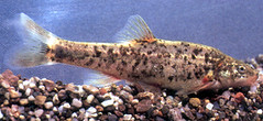
What needs fixing is the fish consumption rate: an official state estimate of how much fish people eat and a key part of Washington’s formula for deciding how much pollution is allowed. The more fish people consume, the more exposure they face to water-borne pollutants, and the less pollution can be discharged into waterways under the Clean Water Act.

The fish-consumption estimate Washington uses is based on a national study conducted in 1973 and 1974 in which people filled out three-day food diaries. According to that study, and in the current state calculations, Washingtonians eat less than half a pound of fish per month, about one serving. In reality, many eat more in a single meal. Starting in the 1990s, more-rigorous studies of Northwest Indian tribes found fish consumption rates of 30 pounds per month or more among the highest consumers in the Suquamish Tribe, for example, where even the average consumer eats 14 pounds a month. Other groups, such as sport fishers and immigrant communities, are also known to eat fish in excess of the state estimate.

Critics of Washington’s one-meal-per-month figure point to Oregon, which in 2011 adjusted its rate to 11 pounds per month, or roughly one fish meal per day, making it the strictest standard in the nation. That move was designed to protect 90 percent of people eating fish in the state to a one-in-1-million standard of increased lifetime risk of cancer.

Following Oregon’s lead, Sturdevant as director of Ecology in 2011 began a process to correct Washington’s fish-consumption estimate. Vigorous protests from business and influential members of the state Legislature failed to stop the rulemaking process by spring 2012. But when Boeing took its complaint all the way to the governor, Gregoire told Ecology to go back to the drawing board.

Tribes protested. After his election, Inslee personally stepped into the controversy, tapping a panel of prominent business, tribal and municipal officials to try to reach agreement on a path forward.

Ten months later, that hasn’t happened. And in the interim, environmentalists filed suit in federal court seeking to compel the federal EPA to force action by the state or take over the whole process

Businesses and local governments rightly point out that wastewater technology is not currently available to meet the strict water-quality standards that would result if Washington adopts a fish consumption rate as high as Oregon’s.

To environmentalists and Indian tribes, that’s not the point. They rightly point out that the Clean Water Act has often required industry and others under its regulation to set a standard to protect public health and rely on that standard to drive technological innovation. That way, at least eventually, even heavy fish consumers are protected, they argue.

At a meeting at the governor’s office in early February, according to several of those who attended, the governor laid out two options, both of which lessen the potential burden on polluters:

Boost the estimate of how much fish Washingtonians are eating, but alter another pivotal part of the formula used to set pollution limits: the additional cancer risk from eating fish that is considered acceptable. Traditionally, Ecology has set that at one additional cancer case for every 1 million people exposed to a given pollutant. That number could be set at one in 100,000 instead, Inslee suggested, and remain within legal bounds. EPA allows states to set the risk at either level, so long as even highly exposed groups such as Indian tribes face risks no greater than one additional cancer case from eating fish per 10,000 people.

Keep the traditional limit of one-in-1-million increased cancer risk, but take steps to help pollution dischargers. This could include giving them variances from the rules; allowing them years or even decades to reduce pollution; or other alternatives. Similar polluter-friendly steps were taken in Oregon but traditionally have not been used in Washington. This second option, Inslee adviser Sturdevant told InvestigateWest, would have to be paired with “creative solutions” that would further protect fish eaters, although such solutions have not yet been outlined.

The EPA’s Seattle-based Region 10 oversees the Ecology Department’s enforcement of the Clean Water Act. Region 10 Administrator Dennis McLerran refused to grant an interview to discuss EPA’s position or provide another spokesman for the agency.

But recently the agency repeated its position in a letter to the Washington Ecology Department, saying an “important part of a final rule is choosing a cancer risk level that provides risk protection for all Washington citizens, including those who eat higher amounts of fish.” If the state doesn’t come up with a rule by the end of the year, EPA plans to step in and do the job itself, the letter said. The suit the environmental groups filed in federal court seeks to force such action by EPA.

Meanwhile, a coalition of business interests, local governments and a labor organization endorsed increasing the allowable cancer risk. Expecting a one-in-1-million increased cancer risk is “unacceptable,” the group wrote in a letter to Inslee.

“We anticipate that this risk level, coupled with a high fish consumption rate, will result in largely unattainable ultra-low numeric criteria, unmeasureable incremental health benefits, and predictable economic turmoil,” the group said.

One signer was Maud Daudon, president and CEO of the Seattle Metropolitan Chamber of Commerce, who served on Inslee’s panel of advisers and attended the meetings where the governor discussed the issue. She told InvestigateWest even the one-in-100,000 cancer rate would lead to significantly tightened water-pollution standards.

By adopting that goal, she said, “you can get industry to invest in ways that will move the needle for human health.”

Business and local governments argue, too, that they are unfairly targeted by the Clean Water Act. Pollution from factories and sewage plants has already been ratcheted down substantially since the landmark legislation was adopted in 1972. Nowadays, quite a bit of pollution flowing into Washington waterways comes not from a sewage plant or factory, but rather from the foul mix that flows off streets, parking lots and other hard surfaces during rainstorms, carrying the detritus of our modern world, including three pollutants that have proved particularly difficult to clean up: PCBs, arsenic and mercury.

Tribal interests, nevertheless, are growing impatient with the Ecology Department’s drawn-out process.

“It’s really concerning to me,” said Jim Peters of the Squaxin Island Tribe. “It seems like they have no problem having heavy fish consumers have a higher risk of getting cancer than other people.

“It’s just not something we can accept. Tribal members and my family do eat a lot of fish. It’s part of our lives and part of our culture and a staple of our diets. And we’d probably eat more fish if there were more around.”

Although Inslee has not yet said publicly how he will resolve the dispute, those involved in the discussions say it seems likely that he will find a way to allow polluters leeway on PCBs, mercury and arsenic. What form that might take remains unclear.

Kelly Susewind, a key adviser to Ecology Director Maia Bellon, argues that one case per 100,000 people “is very, very close to zero” cases, although he acknowledges that one in 1 million “is even closer” to zero.

He said the agency should be given credit for not simply focusing on protecting the average person.

“We’re saying let’s set a number that’s right for high consumers,” Susewind said.

One thing to consider is that the measure of increased cancer risk is based on 70 years of exposure to a given pollutant. Also keep in mind that Washington’s population is about 6.9 million people. So if the allowable cancer rate were to be set at one in 100,000 people instead of one in 1 million people, the difference would be roughly 62 extra cases of cancer over 70 years — if the assumptions are right. It could be more or it could be fewer.

One of Inslee’s advisers is Seattle attorney Rod Brown.

“What’s your social judgment about how much risk is acceptable for a carcinogen?” Brown asks. “It sounds like math, but it’s also a social judgment.”

InvestigateWest is a Seattle-based non-profit journalism organization focused on the environment, public health and government accountability in the Pacific Northwest.


President Obama sees Oso mudslide devastation first-hand

Carolyn Kaster / Associated PressMarine One, carrying President Barack Obama, takes an aerial tour of the Oso mudslide site on Tuesday.
Carolyn Kaster / Associated Press
Marine One, carrying President Barack Obama, takes an aerial tour of the Oso mudslide site on Tuesday.


By Rikki King and Amy Nile, The Herald

EVERETT — President Barack Obama saw the devastation of the Oso mudslide for himself today, touring the area by helicopter.

Marine One flew directly over the site, giving him a view of the massive debris field and blocked North Fork Stillaguamish River

A couple of bright-yellow excavators could be seen operating below, digging in the earth as part of the ongoing effort to recover the bodies of those who died. Amid the wreckage, an American flag flew at half staff.

Marine One touched down at Arlington Airport about 1:30 p.m.

The president then headed off by motorcade to Oso.

The visit marks one month since the disaster that took at least 41 lives and destroyed part of a state highway.

The president planned to meet with victims’ families, survivors and first responders in Oso.

Obama last visited Snohomish County in 2012 to tour the Boeing Co.’s 787 production line at Paine Field. He is the sixth sitting president to set foot in the county, and the first to come here after a public tragedy.

Air Force One, a 747-200 built in Everett, touched down at Paine Field at 12:38 p.m. Those waiting to greet the president included Gov. Jay Inslee, Snohomish County Executive John Lovick, Everett Mayor Ray Stephanson, Seattle Mayor Ed Murray, U.S. Sens. Patty Murray and Maria Cantwell and U.S. Reps. Rick Larsen and Suzan DelBene.

The governor, Murray and Cantwell accompanied Obama in his helicopter.

A sparse crowd gathered nearby to watch, but they were outnumbered by media and officials.

The president was expected to meet face-to-face with people who have been wrestling with the loss and challenges since the hillside fell on March 22.

Police and fire vehicles were lining up along the Arlington Airport entrance by 11:30. Snohomish County Sheriff’s Lt. Rodney Rochon leaned out his window to greet the arriving state motorcycle troopers. Black SUVs with Maryland plates followed them in onto the airfield.

Families and couples with babies and lawn chairs arrived at the airport, hoping for a glimpse of the president. They looked up as helicopters hummed overhead. Some waved at the sky. A toddler in a yellow jacket played in the grass, her mother’s watchful eye following her.

By 1:15 p.m., engines were running in the motorcade. Secret Service agents gave the vehicles a quick rub with dust rags, making them shine. They straightened the small flags on SUVs and applied a presidential seal decal.

Activity in the motorcade became still as multiple CV-22 Ospreys and other aircraft landed on the tarmac at Arlington Airport.

Firefighters from Arlington and Marysville snapped pictures as Obama got into the motorcade and headed away toward Oso.

Larsen, who grew up in Arlington, said in a prepared statement. “The President’s visit today underscores the country’s commitment to helping Oso and Darrington heal and recover. I am pleased President Obama will meet with survivors and community leaders to hear their stories. He will learn about the many challenges of rebuilding but also the incredible resilience of the people in these communities.”

Obama “will see this strength in action today,” Larsen said.

Aboard Air Force One en route to Everett, press secretary Jay Carney told reporters that the Obama administration “remains focused on supporting the state and local efforts, and first responders.”

The president earlier declared a major disaster in Oso, freeing up resources.

“I think the purpose of the visit, which will include remarks delivered at the Oso firehouse, is to view firsthand the aftermath of the terrible mudslide there, and to meet directly with those who lost loved ones and have suffered so much in this terrible tragedy,” Carney said.

Officials have now identified all 41 of the people confirmed to have died in the slide. Two other people presumed killed remain missing.

Highway 530 remains blocked. A flood warning is in place for the area east of the slide along the North Fork Stillaguamish River until Thursday afternoon.

The Secret Service began arriving in Arlington, Darrington and Oso weeks ago after Obama’s visit was announced. Military aircraft could be seen flying in Marysville and Arlington over the weekend as the president’s visit approached.

Obama last was here on Feb. 17, 2012, when he toured The Boeing Co. plant in Everett and spoke to factory workers. That year was the first time in nearly two decades that a serving president visited the county.

After visiting Snohomish County, Obama is scheduled to go to Asia, with stops in Japan, South Korea, the Philippines and Malaysia, according to the Associated Press.

On Monday, the Federal Emergency Management Agency announced that assistance had been approved for people in the Arlington, Darrington and Oso areas whose commutes to work, school and medical appointments are detoured around the slide, through Skagit County. That will happen through individual FEMA assistance applications.

Businesses that need help should contact the Small Business Administration at www.sba.gov/disaster or 800-659-2955.

Pool reports contributed to this story.


Klamath tribal members protest “celebratory” signing of agreement

April 21, 2014. Source: Warrior Publications

klamath-protest-1


U.S. Department of Interior Secretary Sally Jewell, State of Oregon Governor John Kitzhaber, State of California Governor Jerry Brown, Oregon Senator Ron Wyden, Oregon Senator Jeff Merkley, Klamath Tribes elected officials and Klamath Basin irrigators held a “celebratory” signing of the Upper Klamath Basin Comprehensive Agreement last Friday at Collier Park, 4 miles north of Chiloquin.  With strong support from Senator Wyden, he stated “I am going to introduce in the first few days of May, legislation in partnership with Senator Merkley to make this agreement law.”
But the “celebration” was not held without opposition.  Members and descendants of the Klamath, Modoc and Yahooskin tribes came together to object to the UKBCA stating that tribal membership had less than a month to review the 93 page document. Tribal Council only allowed 19 days from the mailing of the ballots by the election company to the deadline for return.

Although their addresses are current and updated, a large portion of membership either did not receive a ballot or did not did receive a ballot in time to cast a vote before the deadline. Therefore, membership feels proper voting procedure was not implemented and they did not have adequate time to make an informed decision in the referendum vote, which had a deadline of April 9th 2014 postmarked by 9 am.


klamath-protest-2-burn


“To me this is a violation of the code of ethics that the Tribal Council signed at the beginning of their term. They showed no moral principal with this act. I hope they can live with themselves after they have ignored their membership.” – Anonymous Klamath Tribal member

Tribal members also stated that this agreement does not reflect the cultural values that they would like to see included in any agreement that brings their Treaty rights into discussion. Tribal membership did not have any direct involvement in the negotiation process and feel that Klamath tribal elected officials do not retain the sovereign authority to make decisions on behalf of the entire tribal membership.

Those in opposition to the agreement held signs stating *“water is life”, *“no more KBRA lies” and “my council does not speak for me.”

As signatories took their place to sign the agreement, tribal members moved to the front of the crowd to deliver a written testimony and to publically state why they were not in agreement with the proposed piece of legislation.

klamath-protest-3


While the signing took place, a Klamath Tribes descendant burned a copy of the UKBCA to symbolize tribal membership’s disdain for the agreement.  Tribal members were not given adequate time to make an informed decision and less than one third of eligible voting membership cast a ballot to grant signatory authority to Klamath Chairman Don Gentry. Many believe as a result, the outcome of the referendum is not reflective of overall enrolled members’ opinions, and therefore is inconclusive.

A statement released by the Hupa Tribe from Northern California criticizes the agreement stating it “surrenders their tribal rights for water and fishing.” Commissioners from Klamath and Siskiyou County were not in attendance, though they will be impacted by any agreement on the Klamath River.   They say they consider this a “surrender” or a “sell-out.”

New Study: Mercury Found In Sport Fish In Remote Northwest Lakes

New research from the U.S. Geological Survey shows some fish in the West's pristine, alpine lakes like Lake Solitude in Grand Teton National Park (pictured here) have high mercury levels. | credit: U.S. Geological Survey/John Pritz | rollover image for more
New research from the U.S. Geological Survey shows some fish in the West’s pristine, alpine lakes like Lake Solitude in Grand Teton National Park (pictured here) have high mercury levels. | credit: U.S. Geological Survey/John Pritz | rollover image for more


Ashley Ahearn, KUOW, April 21, 2014

SEATTLE — Some bad news for backcountry in the West: Some of the fish in the region’s wild alpine lakes contain unsafe levels of mercury, according to a new study by the U.S. Geological Survey.

In the broadest study of its kind to date, the USGS tested various kinds of trout and other fish at 86 sites in national parks in 10 western states from 2008 to 2012. The average concentration of mercury in sport fish from two sites in Alaskan parks exceeded federal health standards, as did individual fish caught in California, Colorado, Washington and Wyoming.

But perhaps more importantly, mercury was detected in all of the fish sampled, even from the more pristine areas of the parks.

The study, conducted jointly by the National Park Service and the USGS, found that mercury levels varied greatly from park to park and even among sites within each park. Overall, 96 percent of the sport fish sampled were within safe levels of mercury for human consumption.

“It’s good news that across this entire study area most of the fish were low,” said Collin Eagles-Smith, a research ecologist with USGS and the lead author of the study. “The concern is that there were some areas, and some fish, that did have concentrations that might pose a threat to either wildlife or humans.”

Screen Shot 2014-04-21 at 3.02.31 PM
Spatial distribution of the 21 national parks sampled in this
study. Size of circle represents percentage of total dataset.
Credit: USGS.


Two percent of the fish sampled in Mount Rainier National Park exceeded the Environmental Protection Agency’s guidelines for safe human consumption. Fish sampled in Olympic National Park had a higher average mercury concentration than some other parks in the region, but none of the samples were above safe human consumption levels.

“Mercury concentrations in those fish in the Pacific Northwest were quite variable,” Eagles-Smith said. “Crater Lake had quite low concentrations in comparison to other parks, whereas Olympic National Park had some of the highest concentrations in comparison to other parks.”

The researchers were surprised to find some of the highest levels of mercury in a small fish called the speckled dace, which were sampled in Capitol Reef and Zion national parks in Utah.

“The concentrations in those fish were comparable to the highest concentrations we saw in the largest, longlived fish in Alaska,” Eagles-Smith said. He added that more research is needed to better understand how mercury is deposited from the atmosphere into the environment and then concentrated at varying levels in different species.

speckleddace_nps
Speckled dace


There was some bad news in the study for birds: In more than half the sites tested, fish had mercury levels that exceeded the most sensitive health benchmark for fish-eating birds, Eagles-Smith said.

“People can regulate their intake of fish and wild fish-eating birds can’t. So, they’re going to take in more fish and more mercury as a result, and it can impact their behavior, ability to reproduce and ability to find food.”

Mercury can come from natural sources, like volcanoes. However, since the industrial revolution atmospheric mercury levels have increased three-fold because of the burning of fossil fuels. Recent studies have shown that particulate pollution from China, which could result from the burning of coal among other sources, can and does make its way across the Pacific Ocean to North America.

The Centers for Disease Control and Prevention warns that exposure to high levels of mercury in humans may cause damage to the brain, kidneys and the developing fetus. Pregnant women and young children are particularly sensitive to the effects of mercury.

Keystone XL and Protecting Mother Earth: A Fight All Native People Should Fight

pepionledgerart.com'Winona LaDuke &Faith Spotted Eagle Make a Stand (detail)' by John Isaiah Pepion, 2014
pepionledgerart.com
‘Winona LaDuke &Faith Spotted Eagle Make a Stand (detail)’ by John Isaiah Pepion, 2014

You ask me to plow the ground. Shall I take a knife and tear my mother’s bosom? Then when I die she will not take me to her bosom to rest.
You ask me to dig for stones! Shall I dig under her skin for bones? Then when I die I cannot enter her body to be born again…

–Wovoka


Power is in the earth; it is in your relationship to the earth.

–Winona LaDuke


The Earth will be fine.

Humans are such an arrogant bunch—“We’re killing the Earth. We’re destroying the Earth.” No you’re not. Shut up. We can’t do that.

Some folks have a God complex.


The Earth is our Mother—she ain’t going no place. In fact, Earth is an Indian mom; powerful, resilient, beautiful and will survive the very worst that the universe can give. Sure, she had it rough early on, but she’s got that elasticity in her skin. “Ancient Native Secret”—those damn brown skinned Natives, they age so well. But like many Indian moms, Mother Earth hasn’t always been appreciated right; she’s been knocked around a little bit.  Quite a bit. Domestic violence is prevalent within our communities. And like a lot of Native moms, folks won’t understand her TRUE beauty, until it’s too late, until that moment when they realize that they won’t get a chance to see her anymore.

But it won’t be because she’s gone. She’ll be fine—she ain’t going no place. It’s us human beings that are in trouble. Our children. Our grandchildren. We’re effing up THEIR prospects.

I’m thankful for all of the people—Native AND non-Native—who have been diligently working to stifle and defeat the Keystone XL pipeline. I’m proud to see Natives who understand that our biggest battles aren’t in blogs and classrooms, but in our homelands—those homelands are the very ESSENCE of being Indigenous (as opposed to simply being legally “Indian”). We must protect those homelands at all costs—thank you, warriors, brothers, sisters, aunties, uncles—for fighting for all of us. Thank you for being there and taking a stand.

Thank you Dallas Goldtooth for looking all handsome and shit and speaking eloquently and moving your eyebrows powerfully.

'Winona LaDuke &Faith Spotted Eagle Make a Stand' by John Isaiah Pepion, 2014, pepionledgerart.com
‘Winona LaDuke &Faith Spotted Eagle Make a Stand’ by John Isaiah Pepion, 2014, pepionledgerart.com


Thank you beautiful and brilliant Aunties Faith Spotted Eagle and Winona LaDuke for CONTINUING to be the voices of reason within Indian Country. It’s sad and ironic—these brilliant sisters who are calling for the most reasonable solution to the current crisis in our homelands—are called “radicals.”

Orwellian. Doublespeak.

You are powerful women. Our lifegivers. Our life sustainers.

There are many more. Thank you to the artists who are taking a stand and giving support to the folks on the ground. For example, John Isaiah Pepion, Blackfeet Ledger Artist, was compelled to action on these fracking and drilling issues when the Blackfeet Tribal Business Council passed a resolution approving the drilling of one of the Blackfeet Holy Sites—Chief Mountain. Pepion said, “It broke my heart—we as a Blackfeet nation—have had oil development for over 100 years and it’s never benefited us. We just get ripped off and it causes a lot of damage to our waters. Illegal dumping from these fracking sites…”

Thank you. Let’s keep up the pressure. Keep supporting our warriors.

Our artists have also joined us. This resistance isn’t new—many Native people have been fighting it for many, many years. In fact, these many brothers and sisters who have taken on this fight on behalf of Mother Earth are fighting the EXACT SAME fight for our precious homelands that we’ve been fighting since Europeans first landed on these shores. We are simply small cogs in this multi-century fight; now, it has ZERO to do with skin color or race. We now have some white allies—the descendants of those who fought against our Native ancestors. We also have some Native adversaries—many of our people are just as prone to scorch the Earth for filthy lucre. There are many Natives who are bought and paid for and whose homelands are suffering from this damage to Mother Earth.

'Holding On (Oil On Chief Mountain)' by John Isaiah Pepion, 2014, pepionledgerart.com
‘Holding On (Oil On Chief Mountain)’ by John Isaiah Pepion, 2014, pepionledgerart.com


It’s complex.

This is a call to action. Right now, the State Department has THANKFULLY delayed approval or rejection of the Keystone XL Pipeline again. That’s positive—that means that all of the actions of Dallas and Faith and Winona and the Niimiipu Tribe and Cheyenne River, Oglala Lakota, Honor the Earth, Owe Aku, and Protect the Sacred and John Pepion and MANY MANY others are paying off. There are literally tipis on the National Mall right now full of Native people taking a stand against the Keystone XL.  Thank you.  You’re making a mark. We have to make a mark—this is about the very essence of Indigenous life—our mother. Our land.

It’s not enough. We have to continue to work, sign petitions, put pressure on, make coalitions. Small steps—John Isaiah Pepion is committing a percentage of all earnings from his ledger art prints above to help this fight by directing it to Honor the Earth and Stronghold Society. Buy a print. They’re beautiful and powerful.

Small steps. Put one foot in front of the other. This is Native power. This is a fight worth fighting and worth winning. For our kids’ sakes.

Get involved. Call your legislator. Encourage NIGA, NCAI and every other Native organization to take a strong stand on this IMMEDIATELY—economic development is cool and important, and it’s good that we’ve worked on those fights. We also, however, have to make sure that we’re protecting our traditional ways of life and being. Our nations absolutely gotta have money, true, but these kinda fights are the very things that make us Indigenous and what we gotta have money FOR! Show these grassroots warriors your support. This fight ain’t over and we really REALLY could win this. The Earth will be fine, but our kids need this. Happy Earth Day.

pepionledgerart.com

honorearth.org

facebook.com/BraveHeartSociety

Gyasi Ross
Blackfeet Nation/Suquamish Territories
Dad/Author/Attorney
New Book, How to Say I Love You in Indian—order today!!
www.cutbankcreekpress.com
Twitter: @BigIndianGyasi


Read more at http://indiancountrytodaymedianetwork.com/2014/04/22/keystone-xl-and-protecting-mother-earth-fight-all-native-people-should-fight-154550

Walk MS raises $90K in Snohomish County

From left, Team 4 Dave members Dennis, Chris and Sarah Coerber round the corner of the final stretch of the Walk MS in Tulalip on April 12.— image credit: Kirk Boxleitner
From left, Team 4 Dave members Dennis, Chris and Sarah Coerber round the corner of the final stretch of the Walk MS in Tulalip on April 12.
— image credit: Kirk Boxleitner


by KIRK BOXLEITNER,  Marysville Globe

TULALIP — Nearly 600 walkers started and ended their course at the Tulalip Amphitheatre for this year’s Walk MS in Tulalip on Saturday, April 12, and while this represented a slightly smaller turnout than last year’s local event, event organizers still considered it a healthy show of support given the other worthy causes close to home that are calling for people’s time and commitment.

“We understand the community is splitting its attention, with the recent tragedy in Oso,” said Sarah Chromy, communications manager for the National Multiple Sclerosis Society’s Greater Northwest Chapter. “It’s still an impressive number for Snohomish County.”

As of Tuesday, April 15, Chromy estimated that the Walk MS in Tulalip had generated nearly $90,000 for the National MS Society in Snohomish County, out of the $1.6 million in funds raised through this year’s Walk MS events throughout the Greater Northwest Chapter. These numbers are actually up from last year’s.

“The Lumpy Bruisers, with team captain Mitzi Ahles, did an amazing job of recruiting and fundraising this year,” Chromy said. “The Snohomish Goat Farmers, with team captain Ray Emery, led the way as our highest local fundraising team, with more than $16,000. Plus, they always bring out at least two goats to Walk MS, which is a sure crowd-pleaser for the children.”

The Mel Walkers team, with joint captains Bruce and Melissa Groenewegen, ranked second in fundraising, with more than $15,000, while Elaine’s Power Walkers, with team captain Jeff Ponton, came in third with more than $4,000.

“Elaine’s Power Walkers also brought tons of team spirit and balloons,” Chromy said. “The face painter was a big hit as well, painting everything from birds to tigers, and everything in between.”

Chromy explained that more than 77 cents of every dollar raised through Walk MS goes directly to improve the lives of people living with MS. Through its donors and fundraisers, the National MS Society is able to:

  • Fund cutting-edge research to stop MS, restore lost functions and end MS forever.
  • Drive change through advocacy.
  • Facilitate professional education.
  • Collaborate with MS organizations around the world.
  • Provide programs and services that help people with MS and their families move forward with their lives.

“Last year, it was pouring rain out here, so everyone was happy to hang around after this year’s Walk MS to catch up with one another, have some lunch and soak up some sunshine,” Chromy said. “Walk MS connects those in our local communities to one another, as we rally together to raise funds and celebrate hope for a future free of multiple sclerosis. It’s an opportunity for everyone affected by MS to meet others who may be going through similar life experiences, and to take action to end MS forever. There’s an incredible network of support, information and resources available, and Walk MS is the rallying point that makes it all possible.”

For more information, log onto www.nationalmssociety.org/Chapters/WAS.

American Indian and Alaska Native death rates nearly 50 percent greater than those of non-Hispanic whites

A patient gets more information about a colonoscopy from his provider at the Alaska Native Medical Center.Photo is courtesy of the Alaska Native Tribal Health Consortium.
A patient gets more information about a colonoscopy from his provider at the Alaska Native Medical Center.
Photo is courtesy of the Alaska Native Tribal Health Consortium.


Source: CDC Media Relations, April 22, 2014


Death records show that American Indian and Alaska Native (AI/AN) death rates for both men and women combined were nearly 50 percent greater than rates among non-Hispanic whites during 1999-2009. The new findings were announced through a series of CDC reports released online today by the American Journal of Public Health.
 
Correct reporting of AI/AN death rates has been a persistent challenge for public health experts. Previous studies showed that nearly 30 percent of AI/AN persons who identify themselves as AI/AN when living are classified as another race at the time of death.
 
“Accurate classification of race and ethnicity is extremely important to addressing the public health challenges in our nation, said Ursula Bauer, Ph.D., M.P.H., director of CDC’s National Center for Chronic Disease Prevention and Health Promotion.  “We must use this new information to implement interventions and create changes that will reduce and eliminate the persistent inequalities in health status and health care among American Indians and Alaska Natives.”
 
CDC’s Division of Cancer Prevention and Control led the project and collaborated with CDC’s National Center for Health Statistics and other CDC researchers, the Indian Health Service, partners from tribal groups, universities, and state health departments.
 
Key findings:
·       Among AI/AN people, cancer is the leading cause of death followed by heart disease. Among other races, it is the opposite.
·       Death rates from lung cancer have shown little improvement in AI/AN populations. AI/AN people have the highest prevalence of tobacco use of any population in the United States.
·       Deaths from injuries were higher among AI/AN people compared to non-Hispanic whites.
·       Suicide rates were nearly 50 percent higher for AI/AN people compared to non-Hispanic whites, and more frequent among AI/AN males and persons younger than age 25.
·       Death rates from motor vehicle crashes, poisoning, and falls were two times higher among AI/AN people than for non-Hispanic whites. 
·       Death rates were higher among AI/AN infants compared to non-Hispanic whites infants. Sudden infant death syndrome and unintentional injuries were more common.  AI/AN infants were four times more likely to die from pneumonia and influenza.
·       By region, the greatest death rates were in the Northern Plains and Southern Plains. The lowest death rates were in the East and the Southwest.
 
“The new detailed examination of death records offers the most accurate and current information available on deaths among the American Indian and Alaska Native populations,” said David Espey, M.D., acting director of CDC’s Division of Cancer Prevention and Control. “Now, we can better characterize and track the health status of these populations – a critical step to address health disparities.” 
 
The studies address race misclassification in two ways. First, the authors linked U.S. National Death Index records with Indian Health Services registration records to more accurately identify the race of AI/AN people who had died. Second, the authors focused their analyses on the Indian Health Services’ Contract Health Service Delivery Area counties (CHSDA) where about 64 percent of AI/AN persons live. Fewer race misclassification errors occur in CHSDA data than in death records.
 
The authors reviewed trends from 1990 through 2009, and compared death rates between AI/AN people and non-Hispanic whites by geographic regions for a more recent time period (1999-2009).
 
The report concludes that patterns of mortality are strongly influenced by the high incidence of diabetes, smoking prevalence, problem drinking, and health-harming social determinants. Many of the observed excess deaths can be addressed through evidence-based public health interventions.
 
“The Indian Health Service is grateful for this important research and encouraged about its potential to help guide efforts to improve health and wellness among American Indians and Alaska Natives,” said Yvette Roubideaux, M.D., M.P.H, acting IHS director.  “Having more accurate data along with our understanding of the contributing social factors can lead to more aggressive public health interventions that we know can make a difference.”
 
For more information, the articles from the report will be in the AJPH “First Look” early online section at 4:00 pm EST today.  Visit: http://ajph.aphapublications.org/toc/ajph/0/0
For information on CDC’s efforts in cancer prevention and control, visit http://www.cdc.gov/cancer/.
 
The Affordable Care Act (ACA), also known as the health care law, was created to expand access to coverage, control health care costs, and improve health care quality and coordination. The ACA also includes permanent reauthorization of the Indian Health Care Improvement Act, which extends current law and authorizes new programs and services within the Indian Health Service. Visit Healthcare.gov or call 1-800-318-2596 (TTY/TDD 1-855-889-4325) to learn more.

Preparations under way for president’s visit

Mark Mulligan / The HeraldMembers of the Washington State National Guard sort through debris south of the berm helping drain water from the mudslide site Friday morning.
Mark Mulligan / The Herald
Members of the Washington State National Guard sort through debris south of the berm helping drain water from the mudslide site Friday morning.


By Rikki King and Eric Stevick, The Herald

EVERETT — President Barack Obama will visit the site of the Oso mudslide today, marking one month since the disaster that took at least 41 lives and destroyed a state highway.

The president will meet with victims’ families, survivors and first responders.

Much of those conversations will be private, though some may be able to catch a glimpse of Air Force One landing at Paine Field in Everett about 12:30 p.m.

Few other details were made public Monday about the president’s itinerary.

The confirmed death toll from the slide rose to 41 Monday, with two people still listed as missing. This weekend, Harborview Medical Center in Seattle released the last of its patients injured in the slide.

A local incident-management team is expected to take over command at the site again this week, another sign that the massive operation is shifting gears.

Highway 530 remains blocked. A flood warning is in place for the area east of the slide along the North Fork Stillaguamish River until Thursday afternoon.

The Secret Service began arriving in Arlington, Darrington and Oso weeks ago after Obama’s visit was announced. Military aircraft could be seen flying in Marysville and Arlington over the weekend as the president’s visit approached.

The day will mark Obama’s second visit to Snohomish County while serving as president. He last was here on Feb. 17, 2012, when he toured The Boeing Co. plant in Everett and spoke to factory workers.

That year was the first time in nearly two decades that a serving president visited the county.

Snohomish County Executive John Lovick said he is looking forward to speaking with Obama.

“To meet the president is just going to be beyond words for me,” Lovick said Monday.

Lovick was raised in Robeline, La., where the population now is just 179 people, he said.

“I never thought I would meet a city councilman let alone the president,” Lovick said.

Many local police officers and firefighters also are expected to play a role in today’s visit. They were unable to provide details, though, deferring questions to the White House.

The presidential visit two years ago cost local police and fire departments and county government more than $30,000. The expenditures included overtime staffing and fuel.

After visiting Snohomish County, Obama is scheduled to go to Asia, with stops in Japan, South Korea, the Philippines and Malaysia, according to the Associated Press.

Lives continue to be disrupted by the slide.

On Monday, the Federal Emergency Management Agency announced that assistance had been approved for people in the Arlington, Darrington and Oso areas whose commutes to work, school and medical appointments are detoured around the slide, through Skagit County. That will happen through individual FEMA assistance applications.

Businesses that need help should contact the Small Business Administration at www.sba.gov/disaster or 800-659-2955.

The Arlington School District has been sending a school bus to pick up students in Darrington, most of whom have opted to stay in the district for the rest of the school year.

Many students who live east of the slide are staying with family and friends in Arlington on school nights. At least two families have transferred students between the Arlington and Darrington school districts to avoid the lengthy detour, school officials said.

Also on Monday, two high-ranking prosecutors urged people to be aware of potential fraud related to the mudslide. Western Washington’s U.S. Attorney Jenny Durkan and Snohomish County Prosecutor Mark Roe warned people thinking about scamming mudslide victims or the government that they will face the full brunt of the law if they are caught.

“We will not be here to throw the book at you,” Roe said. “We will be here to throw the whole library.”

So far, there have been anecdotal reports of possible fraud, but no concrete evidence, Durkan said.

The prosecutors said fraud has been a common problem after other national disasters and they want to get in front of it in Oso.

The National Center for Disaster Fraud has documented many cases that resulted in prosecutions. In one instance, a woman was sentenced to three years in prison after falsely claiming she had a home in Mississippi that was destroyed when Hurricane Katrina hit in 2005. She also received temporary shelter from a charity where she stole the identities of hurricane victims and charged thousands of dollars on credit cards she took out in their names. “We will protect the victims and we will prosecute those that try to turn this tragedy into criminal profit,” Durkan said.

Among other tips, the prosecutors said people making donations should never be feel pressured to contribute and should never give personal or financial information to anyone who solicits money. They also referred anyone suspicious of fraud in relief efforts to contact the National Disaster Fraud Hotline at 866-720-5721 or by email at disaster@leo.gov.

Meanwhile, the Washington State Patrol continues to remind people that there is no public access to view the mudslide. The roadblocks are several miles away.

The Patrol continues to turn away as many as two dozen cars a day, trooper Keith Leary said.

“The area is not a tourist attraction, and the high level of respect for those who are still missing and their families is our priority,” Leary said.


10 Planetary Facts for Earth Day 2014

The Earth as seen from Saturn is a reminder: The Universe is big, and we are not. Happy Earth Day!Photo by NASA/JPL-Caltech/SSI
The Earth as seen from Saturn is a reminder: The Universe is big, and we are not. Happy Earth Day!
Photo by NASA/JPL-Caltech/SSI

By Phil Plait

Slate.com April 22, 2014


Today is Earth Day, a worldwide celebration of our home planet. I know you’ll be hearing a lot of talk about the environment today, humanity’s global impact, and more … which is great, and I wholly support that conversation (obviously).

But as an astronomer and science dork, I do love me some fun factoids. So I gathered together/calculated a few to give you a better appreciation of our planet’s place in the Universe. You might want to check out the ones I posted last year, too. You can’t know too much about Earth.

1) Earth Day is April 22 every year. On average (jumping over leap years and such), between subsequent Earth Days our planet moves about 940 million kilometers (580 million miles), the circumference of its orbit around the Sun. That means it’s faster—way faster—than a speeding bullet: about 30 km/sec (18 miles/sec)! Typical rifle bullets travel 1-2 km/sec, so the Earth outpaces them handily.

2) It’s not a small world after all. The surface area of the Earth is about 510 million square kilometers, or 197 million square miles. It’s not a perfect sphere (see listing No. 4 here), but if it were, using the surface area to find the Earth’s diameter would give you a ball 12,742 km (7,900 miles) across.

3) The Earth is the biggest of the terrestrial (rocky, as opposed to Jupiter-like gas giant) planets in our solar system.

4) Venus, the closest planet in the solar system to Earth’s size, has a diameter of 12,104 km (7,504 miles), 95 percent the width of Earth. It has about 82 percent the mass of Earth, too, making it our twin. However, its thick atmosphere is mostly carbon dioxide, it rains sulfuric acid, the air pressure on its surface is 90 times Earth’s, and the average temperature is a lead-melting 460 C (860 F). So it’s more like our evil twin.

5) Nearly 2,000 confirmed exoplanets (worlds orbiting other stars) have been found so far. The smallest, Kepler-37b, is barely bigger than our own Moon! Another, KOI-314c, has the same mass as Earth but is so hot it’s puffy, with a huge atmosphere. The planet that has the best chance of being most like Earth is Kepler-186f, which has 1.1 times the Earth’s diameter and is the right distance from its star to have liquid water. We really don’t know what it’s like beyond that, though. It might be more like Venus, or Mars.

6) We’ve only just started looking for other planets, though. There may be billions of Earth-size planets in our galaxy alone.

7) Coming back home again, Earth has something no other planet we know of has: a lot of water on the surface. It’s about 71 percent water by area, dominated by the Pacific Ocean, which covers a staggering 155.6 million square km (60 million square miles) of the surface. That’s nearly a third of the planet.

The vast majority of the Southern Hemisphere is water. This is more obvious when you look down from over the South Pole.Photo by Google Earth
The vast majority of the Southern Hemisphere is water. This is more obvious when you look down from over the South Pole.
Photo by Google Earth

8) Most of the Southern Hemisphere (by a long shot) is covered in water: About 80 percent of the planet’s area south of the equator is water. North of the equator it’s about 60 percent.

9) Water exists naturally in all three physical states on Earth’s surface: solid (ice), liquid, and gas (water vapor). Due to a peculiar property of water—called its triple point—it can even exist in all three states at the same location and time. So now when things go wrong, you can say, “Well it could be worse: It could be raining and snowing and steaming!”

10) The more we look, both in our neighborhood and in deep space, the more we find that our Earth is one-of-a-kind. Even if we do eventually spot those billions of other planets similar in size to Earth, it’s unlikely they will be just like ours, with our exact balance of chemistry, temperature, and life. Heck, in the distant past the Earth didn’t look like it does now, and it’s the same planet.

What this tells us is that what we have now is precious, unique, and vital to us and ours. We don’t have an emergency backup, a summer home, a spot we can retreat to. The Earth is all we’ve got. We need to treat it that way.

Phil Plait writes Slate’s Bad Astronomy blog and is an astronomer, public speaker, science evangelizer, and author of Death from the Skies! Follow him on Twitter

Spoil Mom Silly This Mother’s Day At Tulalip Resort Casino

SPOIL MOM SILLY THIS MAY 11
Earn “Brownie Points” with Brunch and a Visit to the T Spa at Tulalip Resort Casino

Tulalip, Washington — Give Mom something to brag about this Mother’s Day…be the kid who got her out of the kitchen, making her the toast of the table.  On Sunday, May 11, children of all ages can celebrate the special woman in their lives at an opulent brunch in the Tulalip Resort Casino Orca Ballroom, with seating at 10:30am and 1:00pm.

Every matriarch will feel like a diva dining her way through a dazzling array of breakfast and lunch favorites, including Carving, Omelet and Egg, Pasta, Quiche, and French Toast/Waffle stations.  If Mom’s a salad lover, she can select among six – from Seafood Pasta with bay scallops and shrimp to Tossed Mexican Caesar with avocado vinaigrette.   Hot entrees run the gamut from Chicken Saltimbocca to Ginger Lemongrass Steamed Clams and Mussels.  Assorted breakfast pastries such as muffins, croissants, and Danish complement the menu.

The dessert buffet could be a meal on its own.  Colorful French Macarons beckon enticingly as does springtime Strawberry Shortcake Trifles.  Whole Tropical Fresh Fruit Tarts hold court, alongside decadent Chocolate Fondant Cakes with raspberries and cream.  If Mom likes her chocolate straight up, she can finish her meal with Milk, White and Dark Chocolate Ganache Disks.  Cheesecake lovers need not despair, as there will also be an alluring assortment of minis.

For the wee folk, there is a kid’s knee high buffet featuring Chicken Strips, Macaroni Cheese Bites, and Mini Pizzas.

Celebrate Mom in the grand style she deserves at Tulalip Resort.  Mother’s Day brunch, including a welcome Mimosa, is priced at $42 inclusive for adults.  Children 4 to 12 are $18. Call  360-716-6888 for reservations.

Those looking for a Mother’s Day gift idea as special as the recipient should consider the T Spa’s “Wildflower Pedicure.”  A perfect post buffet treat, Mom can literally feel the stress ebb during this 60 minute treatment. A floral foot soak infused with Linden and Orange blossom essence is followed by a gentle, but invigorating exfoliating scrub.  This spa pedicure includes a warmed stone massage for tired tootsies, foot mask and paraffin treatment.  For reservations and additional information, call (360) 716-6350.

# # # #

About Tulalip Resort Casino
Award winning Tulalip Resort Casino is the most distinctive gaming, dining, meeting, entertainment and shopping destination in Washington State.  The AAA Four Diamond resort’s world class amenities have ensured its place on the Condé Nast Traveler Gold and Traveler Top 100 Resorts lists, as well as Preferred Hotel & Resorts membership.  The property includes 192,000 square feet of gaming excitement; a luxury hotel featuring 370 guest rooms and suites; 30,000 square feet of premier meeting, convention and wedding space; the full-service T Spa; and 7 dining venues, including the AAA Four Diamond Tulalip Bay Restaurant.  It also showcases the intimate Canoes Cabaret and a 3,000-seat amphitheater. Nearby, find the Hibulb Cultural Center and Natural History Preserve, Cabela’s; and Seattle Premium Outlets, featuring more than 110 name brand retail discount shops. The Resort Casino is conveniently located between Seattle and Vancouver, B.C. just off Interstate-5 at Exit 200. It is an enterprise of the Tulalip Tribes.  For reservations please call (866) 716-7162.