Nevada Indian reservations to grow under Reid bills

Sen. Harry Reid, D-Nev., has introduced a bill that would expand the 75,000-acre Moapa Band of Paiutes reservation outside Las Vegas by more than 26,000 acres. (Las Vegas Review-Journal file)

By Steve Tetreault and Henry Brean, Las Vegas Review-Journal

WASHINGTON – Two bills introduced Tuesday in the U.S. Senate would grant more than 26,000 acres of federal land to the Moapa Band of Paiutes outside Las Vegas and expand reservations of seven Northern Nevada Indian tribes.

One of the bills by Sen. Harry Reid, D-Nev., would expand the 75,000-acre Paiute reservation by about a quarter by putting into trust 26,565 acres currently controlled by the Bureau of Land Management and Bureau of Reclamation. The Moapa tribe consists of 329 people, 200 of whom live on the reservation 30 miles north of Las Vegas.

The second bill would grant almost 93,000 acres to tribes in Humboldt, Elko and Washoe counties, and to the Pyramid Lake Paiutes, whose reservation includes land in Washoe, Storey and Lyon counties.

“Land is lifeblood to Native Americans, and this bill provides space for housing, economic development, traditional uses and cultural protection,” Reid said in a statement.“I take the many obligations that the United States has to tribal nations seriously.”

Reid has a long relationship with Nevada tribes, and has helped them settle land and water disputes over the years. He is also trying to pressure Washington Redskins owner Dan Snyder to changing the team name considered racist and offensive by many American Indians. On Monday, Reid rejected team president Bruce Allen’s invitation to attend a game this fall. Allen said he hoped the experience would persuade the Nevada senator the team name is an expression of “solidarity” with Native Americans.

ECONOMIC FACTORS

Moapa Paiute tribal chairwoman Aletha Tom said Tuesday the additional land “means a great deal.”

“It’s a good idea for our tribe, for our cultural preservation and economic development,” she said.

In recent years, the Moapa Band of Paiutes has pursued development of renewable energy on its land, moving to fulfill a Reid ambition to make Nevada a major player in solar and wind energy generation.

In May, federal officials cleared the way for a new 200-megawatt photo-voltaic array to be built on tribal land with the backing of NV Energy. The facility on 850 acres is expected to generate enough electricity for about 60,000 homes.

In March, the tribe broke ground on a 250-megawatt plant billed as the first utility-scale solar project approved on tribal land. The project could generate electricity to feed 93,000 homes by the end of 2015. The City of Los Angeles has agreed to buy power from the 1,000-acre array for 25 years under a deal worth about $1.6 billion.

Tom said the project is on land the tribe obtained in 1980, when the reservation was last expanded. If Reid’s legislation is successful, the tribe will pursue solar power development on its new land as well, she said.

GARY THOMPSON/LAS VEGAS REVIEW-JOURNAL LOCAL Darren Daboda, chairman of the Moapa Band of Paiute, appears at the Southern Nevada Health District board meeting to voice the tribe's concerns about the waste landfill expansion at Reid Gardner power plant proposed by Nevada Energy. 10-28-10
GARY THOMPSON/LAS VEGAS REVIEW-JOURNAL LOCAL Darren Daboda, chairman of the Moapa Band of Paiute, appears at the Southern Nevada Health District board meeting to voice the tribe’s concerns about the waste landfill expansion at Reid Gardner power plant proposed by Nevada Energy. 10-28-10

In the 1870s, the Moapa Paiute reservation spread over two and a half million acres, including much of what today is Moapa Valley, Bunkerville, Logandale, Glendale, Overton and Gold Butte. But most of it was stripped away by Congress.

In 1980 President Jimmy Carter restored 75,000 acres, roughly 117 square miles.

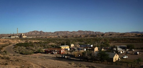
In recent years, Reid has publicly sided with the tribe in its fight against NV Energy over an aging coal-burning power plant next to the reservation. Tribe members blame smoke and blowing dust from the Reid Gardner Generating Station for making them sick and polluting their land. In 2012, Reid described the plant as a “dirty relic” and called on NV Energy to close it.

The utility responded last year by announcing plans to shut down three of the four units at the 50-year-old power plant by the end of this year and shutter it completely in 2017.

Barbara Boyle of the Sierra Club helped the tribe fight the power plant. She said the reservation expansion should help both the tribe and the environment.

“After working with them on this fight, I believe that transferring more of their ancestral lands back to the Moapa Band is just, and will ensure that the land benefits the environment as well as the health of the people and their economy,” Boyle said in a statement from the national conservation group.

Rep. Steven Horsford, D-Nev., whose district includes the Moapa Paiute reservation, said he supports the expansion.

Sen. Dean Heller, R-Nev., is cosponsor of the bill benefiting Northern Nevada tribes, which he sees as a path to economic opportunity for them. But he is still studying the Moapa Paiute bill and seeking input from the tribe, according to spokeswoman Chandler Smith.

OTHER RESERVATION LAND

The second Reid bill introduced Tuesday:

— Conveys 373 acres of BLM land to be held in trust for the Elko band of the Te-Moak Tribe of the Western Shoshone Indians.

— Grants 19,094 acres of BLM land to be held in trust for the Fort McDermitt Paiute and Shoshone Tribe.

— Transfers 82 acres of Forest Service land to be held in trust for the Duck Valley Shoshone Paiute Tribes.

— Conveys 941 acres of BLM land to be held in trust for the Summit Lake Paiute Tribe.

— Gives 13,434 acres of BLM land to be held in trust for the Reno-Sparks Indian Colony.

— Conveys 30,669 acres of BLM land to be held in trust for the Pyramid Lake Paiute Tribe.

— Releases the Red Spring Wilderness Study Area and conveys 28,162 acres of BLM land, including the released land, for the South Fork Band Council.

The bill also includes 275 acres for the city of Elko for a motocross park.

Tribes, BIA and BLM collaborate on oil, gas operations

By The Ranger staff reports

The Arapaho and Shoshone tribes and the Department of the Interior, through the Bureau of Indian Affairs and the Bureau of Land Management, signed a memorandum of understanding Feb. 25 in Fort Washakie.

Through the MOU, the parties said they will engage in a cooperative environmental program to promote compliance on oil and gas properties by lessees and operators on the Wind River Indian Reservation.

“This MOU is a good opportunity for all of us to start fresh, to be on the same page and to work toward the same goals,” said BIA acting Rocky Mountain regional director Darryl LaCounte.

Specifically, the MOU outlines a process and timelines for the parties to:

– review all ongoing oil and gas operations on the reservation with tribal ownership interest to identify actual or potential adverse environmental effects;

– identify prospective sources of federal funding to the tribes to support monitoring, inspection and enforcement;

– develop an environmental plan for oil and gas operations; and

– formalize a structure for future communications between the parties regarding environmental concerns arising from oil and gas operations.

“We look forward to working collaboratively with the Arapaho and Shoshone tribes, as well as with the BIA, to manage oil and gas activities on the Wind River Indian Reservation,” said BLM Wyoming state director Don Simpson.

For more information, call BIA realty officer Marietta Shortbull at 332-4639 or BLM resource adviser Stuart Cerovski at 332-8400.

New rules to address fracking on Indian lands


fracking_graphic_120418By Alysa Landry
Navajo Times
WASHINGTON, May 23, 2013

Hydraulic fracturing on Indian land may become more difficult under new rules proposed by the Department of the Interior and the Bureau of Land Management.

The Interior Department on May 16 issued new draft rules for hydraulic fracturing on public and Indian lands.

Fracturing, or “fracking,” is the process of drilling and injecting a mixture of water, sand and chemicals into the ground at high pressure to crack shale formations and unlock oil and gas.

The process is controversial because fracking releases methane gas and other toxic chemicals, which can contaminate nearby groundwater. This can be especially dangerous on the 56 million acres of Indian land in the country. On the more isolated reservations like the Navajo Nation, people and livestock depend on well water for drinking, cooking and washing.

Approximately 500,000 oil and gas wells are active in the United States. That includes 92,000 on public and tribal land, where about 13 percent of the nation’s natural gas and 5 percent of its oil are produced, according to statistics from the Interior Department.

Ninety percent of wells drilled on federal and Indian lands use fracking. Yet the BLM’s current regulations governing fracking on public and tribal lands are more than 30 years old and were not designed to address modern fracking technology. The revised rules would modernize management of the industry and help establish baseline safeguards to help protect the environment and reduce the human risk.

“We are proposing some common-sense updates that increase safety while also providing flexibility and facilitating coordination with states and tribes,” said Interior Secretary Sally Jewell. “As we continue to offer millions of acres of America’s public lands for oil and gas development, it is important that the public has full confidence that the right safety and environmental protections are in place.”

The new draft rules come after an initial proposal last fall. The Interior Department received more than 177,000 public comments on those rules. The updated draft proposal will be subject to a new 30-day public comment period.

The updated draft keeps the main components of the initial proposal, which requires operators to disclose the chemicals they use in fracking on public or tribal land, verify that fluids are not contaminating groundwater and confirm that management plans are in place for handling fluids that flow back to the surface.

Yet the draft already has drawn criticism from both environmentalists and industry leaders.

Industry officials object to what they call redundant regulation, while environmentalists say the standards do not adequately safeguard drinking water.

Washington snowpack 112 percent, best in West

Washington Snow Water Equivalent map

April 5, 2013 at 1:47 PM

DOUG ESSER
Associated Press

The mountain snowpack in Washington is 112 percent of normal and the best in the West, where the average for other states is about 75 percent, a water supply specialist with the Natural Resources Conservation Service said Friday.

Arizona is the lowest at 40 percent and the Southwest is in “tough shape” for its water outlook for the rest of the year, said Scott Pattee who works for the U.S. Department of Agriculture service in Mount Vernon.

The service compiled reports from measurements taken April 1 — usually the peak time for the mountain snowpack in the water year, which begins Oct. 1. The percent of normal figures are based on a 30-year average.

“The ‘so what’ on this story is that 70 to 80 percent of surface water in the Pacific Northwest comes from mountain snowmelt,” Pattee said.

The snowpack measurement tells utility managers how much power they can expect hydroelectric dams to generate, tells farmers how much irrigation water they can expect to pour on crops, tells fisheries managers whether migrating salmon will have sufficient stream flows. Snowpack information also is used in avalanche forecasts and by river-rafters planning their season.

In Washington, the snowpack is heaviest on the Olympics at 130 percent and lowest in the southeast corner of the state at 85 percent.

“I don’t think there’s going to be much concern,” Pattee said.

The Northwest received plenty of precipitation, especially in the October-December period.

“It just came in surges this year,” he said.

Other states don’t have as much water in the snow bank.

“Most of the Southwest is in pretty tough shape” with a poor stream flow outlook, Pattee said.

Snow measurements for the survey in Washington are taken by about 30 people with utilities, irrigation districts and agencies like the Bureau of Land Management. Data also comes from 70 automated SNOTEL stations in the state, Pattee said. The information goes through computer models for forecasts.

In Washington the snowpack peaked on March 24 and started slowly melting, he said.

The state snowpack averages, according to Natural Resources Conservation Service figures:

Alaska around 100 percent, Arizona 40, Northern California 61, Colorado 72, Idaho 80, Montana 92, Nevada 64, New Mexico 45, Oregon 84, Utah 66, Washington 112, Wyoming 82.

The service only measures Northern California and the state has its own system for the rest of California, Pattee said.

Tribal chairman: Land transfer will benefit timber counties

“The tribe could be the recipient of 14,500 acres of federal timberlands under a proposed transfer”

by Thomas Moriarty, The World

COOS BAY — The chairman of the Confederated Tribes said its proposed acquisition of more than 14,000 acres of federal timberlands will ultimately benefit Oregon timber counties.

The tribe could be the recipient of 14,500 acres of federal timberlands under a proposed transfer circulated for discussion this month by Sens. Jeff Merkley and Ron Wyden, D-Ore. Bob Garcia, chairman of the tribal council for the Confederated Tribes of the Coos, Lower Umpqua and Siuslaw Indians, said its goal is long-term stewardship of culturally important lands.

“We believe our active management will put more people on the ground than are currently there,” Garcia said. “We’re talking more foresters, more biologists, people working on stream restorations.”

None of the lands under consideration for transfer are currently impacted by a federal injunction to protect marbled murrelet populations. “Our attempt was to try to find lands that were non-controversial.”

The chairman said the timberlands will be managed under a very similar model to that currently used in the status quo — including the completion of environmental impact statements.

“We’re talking about lands going from the Bureau of Land management to the Bureau of Indian Affairs, still within the federal government.”

One initial concern, raised by Association of O&C Counties President Doug Robertson, was that O&C counties would lose timberlands, potentially harming county revenue.

The lands in question currently fall under the O&C Act of 1937, which set aside millions of acres of timber land for economic activity in 18 Oregon counties. The act covers land reclaimed by the government in 1916 after the Oregon & California Railroad Company violated the terms of a federal grant.

In a statement Wednesday, Sen. Wyden committed to a no-net-loss policy regarding O&C lands, saying the total acreage will remain the same under any tribal land conveyance legislation

The difference, Garcia said, is that the land will receive much more active management under tribal control than it does under current federal forest planning. And that means more jobs.

The chairman said he believes the tribes and the O&C counties ultimately have similar intentions.

“We’re talking about how we can put people to work and how we can make Oregon counties prosper,” he said. “Tribal control is local control.”

Source


Reporter Thomas Moriarty can be reached at 541-269-1222, ext. 240, or by email at thomas.moriarty@theworldlink.com. Follow him on Twitter at @ThomasDMoriarty.