One More Try: A Renewed Push To Pass Klamath Agreements

PacifiCorp's Copco 1 dam on the lower Klamath River is one of four hydro dams that would be removed to facilitate fish passage under the pending Klamath water deal.Amelia Templeton
PacifiCorp’s Copco 1 dam on the lower Klamath River is one of four hydro dams that would be removed to facilitate fish passage under the pending Klamath water deal.
Amelia Templeton


By: Jefferson Public Radio; Source: OPB


Supporters of a trio of agreements meant to settle the rancorous water disputes in the Klamath Basin are gearing up to take another run at getting Congressional approval for the deal. A Klamath bill by Oregon’s Democratic senators was not included in a massive funding measure passed in the frantic final hours of the last Congress.

Now – amid signs that support for the agreements is growing, the spotlight is turning toward the region’s Republican congressman.

The failure of the Senate bill that would have implemented the Klamath water agreements left a big question mark: what would happen now?

Among stakeholders in the region, the answer was largely that, somehow or another, the deal would move forward.

“Of course we’re going forward,” said Glen Spain with the Pacific Coast Federation of Fishermen’s Associations, a commercial fishing group.

“There is no alternative on the table other than going back to the kind of chaos we saw a decade ago,” he said.

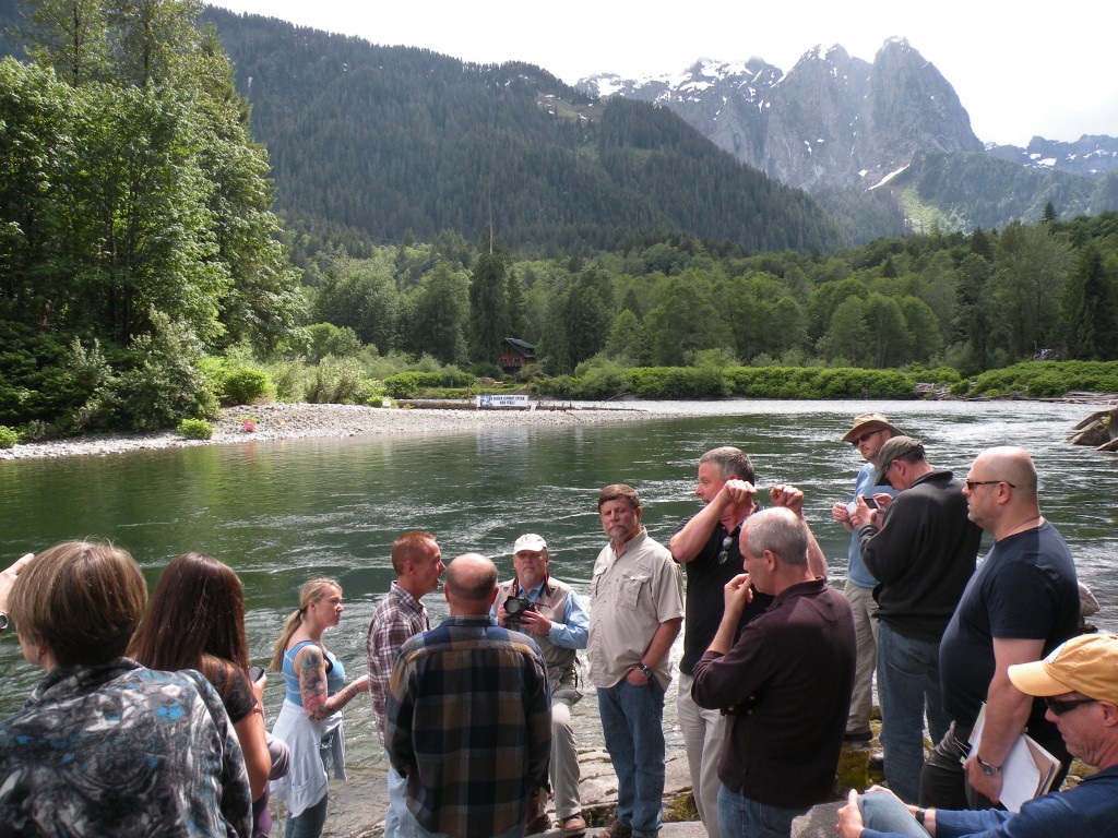
Farmers and ranchers in the Klamath have waged a long and bitter battle with fishermen and Indian tribes over the region’s scarce water, with periodic irrigation water shut-offs and fish die-offs raising the stakes.

Over the course of years, the three water agreements were hammered out as the various stakeholders eventually negotiated compromises most felt they could live with. One federal official said what finally brought everyone to the table was the realization that “part of something is better than all of nothing.”
,
Now – with three interlocking agreements awaiting Congressional approval – stakeholders say it’s crucial to wrap it up.

“This is how we’re going to have stability in resource management in the Klamath Basin as we move forward,” said Greg Addington, who heads the Klamath Water Users Association. It represents farmers and ranchers on the federal Klamath Irrigation Project. Addington says, at this point, making major changes in the deal isn’t feasible.

“As you look at the complexity of these issues and the work that went into crafting these agreements over the last eight or nine years – we’ve been at this for a while – it just makes you more confident that you’ve really crossed all the t’s and dotted all the i’s and looked at all the potential solutions,” he said.

In recent months, a growing number of previously-skeptical groups have come to back the water deal, including the Klamath Falls City Council, the Klamath County Chamber of Commerce and the Klamath Cattlemen’s Association.

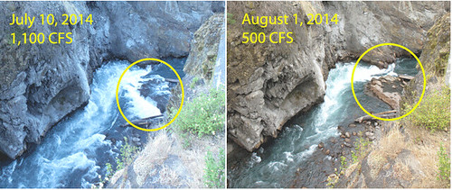
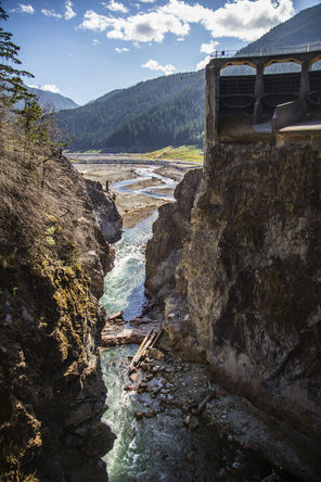
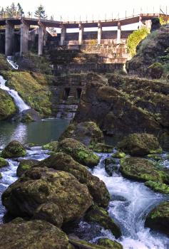
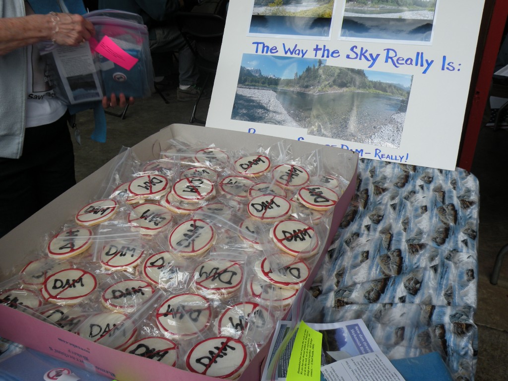
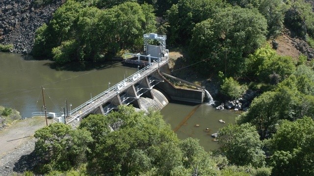
One key player who hasn’t yet signed on is Republican congressman Greg Walden. The Klamath is in Walden’s district and so far he’s had reservations about the agreements, in particular the part that would remove the four hydropower dams on the Klamath River. The dams have blocked fish passage for more than fifty years.

As more Klamath agriculture groups have swung their support to the deal, they’ve urged Walden to get behind it. But if Walden hopes to substantially change the dam removal part of the deal, Don Gentry, who chairs the Klamath Tribal Council, would beg to differ.

“It’s pretty clear that the parties are all on board that that’s a part of the package and without that dam removal component, the agreements will unravel,” he said.

Gentry says removing the dams is crucial to restoring the endangered fish populations the tribes have a treaty right to.

Just as the new session of the US Senate convened this month, Oregon Democrats Ron Wyden and Jeff Merkley re-introduced their Klamath water bill that died last session. Merkley says with the probability of another dry summer approaching, time is running out.

“This has to happen in legislation, to lock in the components as a group,” he said. “And so we could have a major water war or water catastrophe, however you want to put it, for the ranching-farming community if we don’t get this done.”

While there are still parties opposing the agreements – the Klamath County   Commission and the Hoopa Indian tribe among them — the success of this effort would seem to hinge on Greg Walden’s support. Walden’s office declined to comment except to say he’s been meeting with stakeholders and “shares a common goal of finding a viable path forward.”

A Visit To The Largest Elwha River Dam In Its Final Moments

By: Ashley Ahearn, OPB


PORT ANGELES, Wash. — The National Park Service is in the final phase of the largest dam removal in U.S. history, taking place on the Olympic Peninsula.

Just 30 feet of concrete dam stand between the Elwha River and its freedom.

And early next week, it’ll be gone.

A giant orange crane moves slowly overhead as Don LaFord looks down from a narrow walkway over the Elwha River.

LaFord, a contractor for the National Park Service, has overseen the dam removal project from the beginning in 2011. Two hundred feet below where he’s standing, the river rushes by, almost completely free. Almost.

“It’ll be a final dynamite shot,” LaFord says.

Don LaFord
Don LaFord. Credit: Ashley Ahearn


So far, a little more than half of the millions of tons of muck and debris that were lodged above this dam have been released, turning the river a chalky gray color as it empties into the Strait of Juan de Fuca, 13 miles from where we’re standing.

“I spent most of my career building power plants and this is the first one that I’ve been on where we’re demolishing hydroelectric plants,” LaFord said.

When the dams are gone he says he might retire.

Although the dam removal workers will soon be departing, fish and wildlife are doing no such thing. Salmon, otters and bald eagles are arriving upstream from where the dams blocked the flow of this river for more than 100 years.

The park service plans to have walkways installed so the public can see the former Glines Canyon and Lower Elwha dam sites in the next few months.

Screen shot 2014-08-21 at 7.50.41 PM
These two images show the difference in the Elwha River’s flow from July 10 to August 1. The remaining dam is circled in yellow in each image. Now that flows have dropped enough to expose the concrete, dam removal can begin again. Credit: National Park Service.

Back to nature: Last chunk of Elwha dams out in September

Steve Ringman / The Seattle TimesWhat’s left of the 210-foot-high Glines Canyon Dam, a section of about 30 feet, is awaiting a final blast in September. In the distance, the bottom of former Lake Mills today forms part of the new Elwha Valley.
Steve Ringman / The Seattle Times
What’s left of the 210-foot-high Glines Canyon Dam, a section of about 30 feet, is awaiting a final blast in September. In the distance, the bottom of former Lake Mills today forms part of the new Elwha Valley.


Fish are storming back to the Elwha, there’s a sandy beach at the mouth of the river again, and native plants are growing where there used to be lakes.


By: Lynda V. Mapes, Seattle Times

The last dam will be blasted out of the Elwha River sometime next month, cementing the hopes of generations of advocates and tribal leaders who fought to make it happen.

With the concrete out, the long-term revival of a legendary wilderness valley in the Olympics can now unfold unfettered after 100 years dammed.

The watershed already is springing back to life from the mountains to the sea: Salmon are swimming and spawning miles above the former Elwha dam site. Alders stand more than head high as the native forest reclaims the former lake beds. There’s a soft, sandy beach at the river mouth, where before there was only bare cobble. And birds, bugs and mammals are feasting on salmon eggs and carcasses as fish once again nourish the watershed.

The Elwha is a rare chance to start over on a grand scale. The $325 million federal project, begun three years ago, has reopened 70 miles of habitat for steelhead and salmon, rebuilt wildlife populations and restored native plants. The river is hard at work with its restored natural flow, rebuilding its plunge pools, log jams and gravel bars.

While it will never be the Eden it was, the Elwha one day likely will be pretty darn close — and sooner than many expected.

“It goes against my deepest notions of how fast ecosystem recovery can possibly happen,” said Christopher Tonra, a research fellow with the Smithsonian Migratory Bird Center in Washington, D.C., who is tracking the response of dippers, a native, aquatic songbird, to dam removal in the Elwha. “We are all trained, as biologists, to think of things over the long run. I am not saying the Elwha is fully recovered. But it is so mind blowing to me, the numbers of fish, and seeing the birds respond immediately to the salmon being there. It makes the hairs on the back of my neck stand up.”

Early hydropower

The dams were built beginning in 1910 for hydropower, but lacked fish passage. It took an act of Congress, passed in 1992, to finally take down Elwha Dam and then Glines Canyon Dam, about eight miles above it.

Unbuild it, and they will come: Salmon have been storming back ever since Elwha Dam was blasted out of the way in March 2012. Taking down Glines Canyon Dam has taken longer, in part because it holds back a larger load of sediment.

Managing the release of about 27 million cubic yards of sediment as the dams come down is why removal has taken so long. There was so much sediment stuck behind the former Glines Canyon Dam alone that, stacked up, the pile would tower more than twice the height of the Empire State Building, notes Jonathan Warrick, of the U.S. Geological Survey.

The dams were lowered notch by notch, allowing the river to naturally flush about half the total sediment load downriver and out to the Strait of Juan de Fuca.

There have been bumps along the way. A water-treatment plant — the single most expensive part of the project — failed when a critical intake clogged with debris rinsed out by the river, delaying removal by a year while repairs were made.

The tribal hatchery and federal fish-restoration plan, which includes stocking of some hatchery fish, have been a magnet for lawsuits and controversy.

But nature, meanwhile, has carried right on.

Ian Miller, a coastal hazard specialist based in Port Angeles for Washington Sea Grant, has been monitoring the beach at the river mouth.

The surprise to him isn’t the big volume of sediment the Elwha is delivering downstream, but the fact that it is sticking around. “Basically, this is all new land,” Miller said, walking the beach east of the river mouth on a recent visit. “Everything here is less than two years old. You can walk to (sandy) spots on the beach that are 30 feet deep. It is just a dramatically different system.”

A beach that used to be too rocky to comfortably walk on is today used by kids to play soccer.

Meanwhile, fat chinook salmon are cruising up the river. Staff from the Washington Department of Fish and Wildlife started working the Elwha in July with a gill net to eventually capture 1,600 big Elwha fall chinook. The fish, of both wild and hatchery origin, are taken to stock the next generation of Elwha fall chinook raised in the state rearing channel, used since the 1970s to preserve the unique Elwha strain.

2024327957

Stars of the river

Working the fast current was a fish rodeo to capture, then quickly take the powerful, thrashing fish from the net unharmed. Long and thick as a thigh, the chinook, the largest in the Puget Sound region, are the celebrities of Elwha River restoration, and a major reason for dam removal.

Elwha fish populations are projected to grow from about 4,000 to 400,000 over the next 20 to 30 years. Salmon already have hatched and migrated up- and downstream of the former Elwha dam site for the first time in a century.

Revegetation — the most visible piece of the Elwha renewal project — also is unfolding dramatically. Already, terraced banks of the former lakes are burgeoning with alder and cottonwood, the gift of seeds carried by the lakes as they gradually were lowered during the drawdown that started dam removal.

Most difficult to revegetate are the cobbly, gravel flats of the lake bed farther upstream, in the former Lake Mills, a land where many a planted Douglas fir and other seedlings have gone to die.

But in other spots, cottonwood seedlings have established so thickly they look like a lawn. Alder trees seeded in 2011 as lake levels dropped now have grown more than head tall. Where there used to be bald sand, goldenrod buzzes with bees, and a young, stocky Nootka rose bush conceals a bird’s nest full of eggs.

In all, more than 500 acres of former lake bed are being replanted, with nearly 60 varieties of native grasses, flowers, woody shrubs and trees from the Elwha Valley through 2018.

Dam removal also is kick-starting broader effects in the ecological systems of the watershed, from its food chain to the home ranges of animals.

Kim Sager-Fradkin, wildlife biologist for the Lower Elwha Klallam Tribe, already has tracked fish-eating otters to parts of the Elwha that salmon have recolonized since dam removal, and documented an increase in the otters’ nutrient levels derived from fish.

John McMillan, a biologist with National Oceanic and Atmospheric Administration (NOAA) Fisheries walking the tributaries since dam removal began, said that in the first year he saw salmon carcasses on the riverbank. But now he doesn’t because the otters, bears, cougars, bobcats and mink have learned to take advantage of food where for so many years there was none.

“The ecological relationships between the animals are coming back,” McMillan said. To me, that is such a great feeling.”


Walk the river

Take a walking tour of the Elwha River with Park Service rangers on the former Lake Aldwell. Tours are on Tuesdays and Sundays at 1 p.m. through Sept. 2. The hourlong walks are free, and begin at the former boat launch at the end of Lake Aldwell Road, north off of Highway 101 just west of the Elwha River Bridge. For more information, call 360-565-3130.

Federal agency approves PUD’s study of proposed dam

By Bill Sheets, Herald Writer

A plan for studying issues related to a possible mini-dam on the South Fork Skykomish River near Index has been approved by a federal agency, despite Tulalip Tribes concern that the study won’t accurately assess the possible effects on fish.

The Snohomish County Public Utility District study plan will not gather enough information to determine the planned weir’s potential effects on juvenile salmon that migrate downstream, said tribal environmental liaison Daryl Williams in a letter to the Federal Energy Regulatory Commission.

“We have met numerous times with PUD and have provided extensive comments regarding the study plans and the proposed project but believe our comments were not adequately addressed,” Williams wrote in the letter, dated Feb. 18.

FERC determined that the PUD’s study plan was mostly adequate and sent a letter to the utility Jan. 30 giving it the go-ahead. Some small changes were recommended. Williams’ letter was in response to approval of the study.

The PUD could have the study done and ready for public comment by early 2015, spokesman Neil Neroutsos said.

If the utility formally applies to build the mini-dam, which it has yet to do, FERC would have the final say.

The possibility of any type of dam on the scenic stretch of river above Sunset Falls has drawn fierce resistance from neighbors and environmental groups.

The $133 million project would involve diverting water from a pooled area behind a seven-foot inflatable weir above Sunset Falls into a 2,200-foot pipeline downstream to a powerhouse just below the falls. It’s expected to generate enough power for about 10,000 homes. Some water would be allowed to flow over the weir.

Chinook, coho, pink and chum salmon spawn above the falls and head downstream.

The tribes have listed several conditions under which they’d support the project. They include assurance that stream flow will be adequate and establishment of a reliable fish-counting system. They don’t believe the PUD’s study plan accomplishes those goals.

Kim Moore, an assistant general manager for the PUD, acknowledged some differences with the tribes but said he thought the Tulalips and the utility staff were in agreement on most of the points.

“I was caught off guard by the tone of this letter” from the Tulalips, Moore said.

The South Fork Skykomish River is listed as a protected area by the Northwest Power and Conservation Council, a regional planning group based in Portland.

The designation does not prevent development, but FERC must take it into account in its decision on the project.

The PUD has asked the council for a rule change that would allow a mini-dam in a protected area if it can be shown that it’s helpful to fish and wildlife. A decision on that request could come this summer, council spokesman John Harrison said.

The Tulalips have said they could back the rule change if their conditions are met. Otherwise, “it is exceedingly difficult for the tribes to support exempting this site from the protected areas list,” Williams wrote in the Feb. 18 letter.

The PUD has agreed to monitor fish passage after the dam is built but did not include a fish count in the study to be done beforehand. Officials say it’s difficult to accurately measure the number of fry and fingerlings headed downstream.

“It’s an expensive proposition and it’s hard to get really good data,” Moore said.

FERC agreed with the PUD on that issue.

“Studying the out- migration timing of smolts in the project area is unnecessary because the timing is adequately understood,” the FERC letter reads.

The utility and the tribes also disagree on the amount of time needed to measure river flow to make sure that enough water will run over the weir to carry young fish downstream.

The PUD’s plan is to sample one migration season — this spring and summer. The tribes want two years of data.

“We don’t think there’s a need,” Moore said.

The agency again agreed with the PUD, in part. It recommended that the utility study at least three different flow conditions to provide a range of scenarios. If not enough data are collected this year, more studies could be required next year.

Moore said the PUD is doing the fish studies it believes are required by the federal government, 17 in all.

He hopes to work things out with tribal officials.

“We have overall a good relationship with the Tulalips,” Moore said. “I do not think we’re that far apart, quite frankly.”

Williams, too, said agreement is possible.

“I think there’s still some room to work with the PUD to try get part-way there on some of the issues, but we’re not there yet,” he said.

Feds Stand By Current Dam, Salmon Plan For Columbia

The federal government today released its final plan to protect endangered salmon and steelhead in the Columbia River Basin. | credit: Aaron Kunz | rollover image for more

Courtney Flatt, Northwest Public Radio

The federal government is standing by its previous plans for managing the Columbia River to prevent the extinction of its salmon and steelhead. That means little would change for dam operations on the West’s biggest river — but only if it wins court approval.

Officials Friday released the finalized plan, known as the biological opinion or BiOp. It guides dam operations to assure they do not lead to the extinction of 13 species of salmon and steelhead that are protected under the Endangered Species Act. The plan has been the subject of more than 20 years of legal conflict between people who want to protect salmon and people who want the dams to produce hydroelectricity and maintain shipping traditions.

The National Oceanic and Atmospheric Administration is the lead agency in developing the biological opinion. It says the current plan is on track to meet Endangered Species Act goals for the federally protected fish. NOAA officials say the plan may better protect some fish than previously thought.

“The actions outlined in the biological opinion, and the operation of the hydro system, is designed to move us in the direction towards recovery and avoid jeopardy, and this program does that,” said NOAA’s Barry Thom. “It actually does improve the status of the populations over time. But it is not designed to achieve ultimate recovery of the population.”

Officials say the 610-page plan will protect and improve habitat, with specific attention paid to tributaries and estuaries of the Columbia and Snake rivers.

“A major focus of the tributary habitat program is to help us buffer against potential effects of climate change in the system, so that the habitat projects … are designed to maintain and protect the cool water inputs into the system,” Thom said during a conference call with reporters.

NOAA released a draft version of this plan in September.

In 2011, U.S. District Judge James A. Redden rejected the plan and asked the Obama administration to consider more ways to recover the endangered fish.

Redden’s suggestions included spilling more water over the dams to help juvenile salmon safely make it downriver to the ocean, changing reservoirs to help fish passage, and removing the Snake River dams altogether.

The case has been transferred to Judge Michael H. Simon. He has yet to set a court date for the plan’s sponsors and opponents to argue it. He’ll then decide if the plan is adequate to protect Columbia River salmon and steelhead.

Now that the previous version of the plan is partway completed, supporters say a trend toward larger salmon runs shows the plan is working. Terry Flores is with Northwest RiverPartners, which represents commerce and industry groups that defend the presence of hydroelectric dams on the Columbia-Snake system.

“This plan is amazing. It’s the most comprehensive plan we can find anywhere in this country by far,” Flores said.

Environmental groups say they are disappointed with this finalized plan. Gilly Lyons, with advocacy group Save Our Wild Salmon, said the group is frustrated.

“The federal agencies in charge here have re-isuued a slightly tweaked, but largely status quo federal salmon plan that repeats a lot of the same mistakes over the past decade or so that kept them in court and bound them in litigation over these dams and the salmon that they impact,” Lyons said.

Lyons said it is too soon to tell if environmental groups will file another lawsuit.

“With all the stuff that we see in the plan, or that’s not there, as the case may be, it sure looks like the federal government would like to go back to court,” Lyons said.

NOAA officials said there will be a few years before they have to start writing a new 10-year plan beyond 2018.

“One main priority is to carry out this existing biological opinion,” Thom said. “There will be a period of time between [the 2018 discussions] and the next couple of years where I would like to focus our efforts on talking about long-term recovery. … As opposed to focusing either on A) the litigation or B) the details of a new biological opinion beyond 2018.”

Elwha: A River Reborn

Nov. 23, 2013 – Mar. 9, 2014 at the Burke Museum

Photo by Steve Ringman/The Seattle Times

Elwha: A River Reborn, a new exhibit from the Burke Museum, takes you into the Northwest’s legendary Elwha River Valley to discover the people, places, and history behind the world’s largest dam removal project, an unprecedented bet on the power of nature. Once legendary for its pre-dam wild salmon runs and Chinook weighing as much as 100 pounds, today the Elwha is being dramatically rethought as its two massive dams are torn down. With the start of the first dam blasts in September 2011 comes a chance for unprecedented environmental restoration and community renewal.

Based on the book by Seattle Times reporter Lynda Mapes and photographer Steve Ringman, Elwha: A River Reborn exhibit sheds light on this essential part of Washington State’s history through compelling stories, stunning photographs, and Burke collections, from fish to cultural objects from the Elwha region.

Burke Museum of Natural History and Culture

Open daily 10 am – 5 pm | Phone: 206-543-5590
Located on the UW Campus at 17th Ave NE and NE 45th Street

Proposed hydro-energy project has Index saying ‘no dam way’

Snohomish County PUD wants to install a small, inflatable dam at this bend on the south fork of the Skykomish River.Bellamy Pailthorp / KPLU News
Snohomish County PUD wants to install a small, inflatable dam at this bend on the south fork of the Skykomish River.
Bellamy Pailthorp / KPLU News

June 19, 2013

By Bellamy Pailthorp

At a time when Washington state has been making headlines for the largest dam removal project ever on the Elwah River, Snohomish County is proposing a new one.

The Snohomish County Public Utility District says the proposed dam’s modern low-impact design would help the county diversify its energy portfolio and meet the future power demands of a growing population.

But the location of the proposed dam—on a wild and scenic stretch of the Skykomish River near the small town of Index—has many locals banding together against the project. 

Jeff Smith (center, in tan shirt) welcomed a public tour by FERC and the PUD at his property, which borders on the proposed dam site.Bellamy Pailthorp / KPLU News
Jeff Smith (center, in tan shirt) welcomed a public tour by FERC and the PUD at his property, which borders on the proposed dam site.
Bellamy Pailthorp / KPLU News

‘No dam way’

Driving east on Highway 2, evidence of the brewing controversy near Index is hard to miss. Printed signs and hand-painted placards line the roads, calling on the PUD not to dam the Skykomish.

“Did you see our address sign that says ‘no dam way?’” asks homeowner Jeff Smith with a laugh.

Smith is trying to maintain his sense of humor about it all. His riverfront property sits right on the edge of the proposed dam site.

For decades, Smith’s family has enjoyed communing with nature on the shore of the Skykomish as the river rushes by. To the west, the craggy peak of Mount Index looms, to south and east are peaks in the Wild Sky and Alpine Lakes Wilderness areas.

“A lot of people call this truly one of the most spectacular places in the country,” Smith said. “And of course, we believe it’s an inappropriate place to put an industrial project that puts a yoke on a wild and scenic river. And we think it should be allowed to stay free.”  

Bellamy Pailthorp / KPLU News

Meeting a growing demand

A powerhouse would be built to the left of Sunset falls, shown here. PUD says they would not be de-watered, just diminished as with hydro at Snoqualmie or Niagra Falls.

The Skykomish is one of only four rivers in Washington that has earned the wild and scenic designation, which is meant to discourage development.

But the Snohomish PUD has obtained the preliminary permit to put in an inflatable dam on the river. The idea is the dam would take advantage of the water’s power as it flows toward two sets of dramatic waterfalls.

The utility recently toured the site with the Federal Energy Regulatory Commission as part of its first scoping meeting. The commission will determine what kinds of environmental studies will be required for the licensing process.

Snohomish PUD Assistant General Manager Kim Moore pointed across the river, explaining to FERC and the public exactly how the inflatable structure made of steel and rubber would work.

“This is a big inner tube, which has compressed air that allows us to lower or raise it to keep the river at a steady height. Right now, with this kind of flow, probably it would be all deflated,” Moore told the tour.

Moore said the dam would lie flat about a third of the year, not producing power at those times. And there would always be some water flowing over the dam; it would adjust with the strength of the river to keep water levels safe for endangered fish and minimize its environmental impacts.

The dam would provide power for about 10,000 homes—or about 1 percent of the utility’s demand—at a cost of up to $170 million.

The utility says it’s the lowest cost “renewable energy” project it has found. The utility is also actively pursuing additional wind power and exploring geothermal, tidal and large-scale solar installations. Bottom line, says Moore: the utility wants to wean off of dirty fossil fuels.

“So this prevents a natural gas plant or coal plant, you know, because we’re still growing,” he said. “The county’s growing, we’re adding people and there’s a need for additional energy.”

‘Simply inappropriate’

Those arguments haven’t stopped the opposition.

More than a hundred people squeezed into the Index Fire House for the evening scoping meeting. And of the nearly three dozen people commenting, only one man spoke in favor of the dam. The man said the dam could reduce flooding and improve roads in the area.

But the rest of the commenters did not agree. Along with local residents, representatives of groups including the Sierra Club and the League of Women Voters joined the chorus of dissenters. Also testifying was Tom O’Keefe, Pacific Northwest Stewardship Director with American Whitewater.

“I have tremendous respect for my colleagues here at the PUD. I have worked with these folks for over a decade, ” O’Keefe said. “But sometimes your friends make mistakes. And this project is simply inappropriate in our view.”

FERC is taking comments on the plan for the proposed Skykomish River dam proposal through July 19. The final decision on the license is expected to take about five years.