WASHINGTON – Restore America’s Estuaries has released the findings of a groundbreaking study that confirms the climate mitigation benefits of restoring tidal wetland habitat in the Snohomish Estuary, located within the nation’s second largest estuary: Puget Sound. The study, the first of its kind, finds major climate mitigation benefits from wetland restoration and provides a much needed approach for assessing carbon fluxes for historic drained and future restored wetlands which can now be transferred and applied to other geographies.
The Study, “Coastal Blue Carbon Opportunity Assessment for Snohomish Estuary: The Climate Benefits of Estuary Restoration” finds that currently planned and in-construction restoration projects in the Snohomish estuary will result in at least 2.55 million tons of CO2 sequestered from the atmosphere over the next 100-years. This is equivalent to the 1-year emissions for 500,000 average passenger cars. If plans expanded to fully restore the Snohomish estuary, the sequestration potential jumps to 8.8 million tons of CO2 or, in other terms, equal to the 1-year emissions of about 1.7 million passenger cars.
“The study is the first to provide a science-based assessment of climate benefits from restoration at scale. The findings are clear: restoring coastal wetlands must be recognized for their ability to mitigate climate change,” said Jeff Benoit, President and CEO of Restore America’s Estuaries. “The report adds to our list of science-based reasons why restoration is so critical.”
“Healthy estuaries mean healthy economies,” Representative Rick Larsen, WA-02, said. “I have long advocated to restore our estuaries because of the critical role they play in supporting recovery of fisheries. This new study shows that estuary restoration can play a big role in countering climate change too.”
“It is very fitting that we are implementing some of the world’s leading Blue Carbon research here in Puget Sound,” said Steve Dubiel, Executive Director of EarthCorps. “We have always known that wetlands are a kind of breadbasket, thanks to the salmon and shellfish they support. Now we are learning that they are also a carbon sponge.”
In addition to the climate benefits outlined by the study, healthy and restored estuaries act as spawning grounds and nurseries for commercially and recreationally important fish and shellfish species, provide storm buffers for coastal communities, filter pollutants, and provide habitat for numerous species of fish and wildlife, as well as recreational opportunities for hundreds of millions of Americans annually.
“This study illustrates the contribution of tidal wetland restoration to reduce global warming,” said Dr. Steve Crooks, Climate Change Program Manager for Environmental Science Associates and lead author on the study. “From this analysis we find wetlands restoration in Puget Sound likely to be highly resilient to sea level rise while at the same time continuing to sequester carbon within organic soils. Similar opportunities will exist in other coastal regions of the U.S.”
“This report is a call to action. We need to invest more substantially in coastal restoration nationwide and in science to increase our understanding of the climate benefits which accrue from coastal restoration and protection efforts,” said Emmett-Mattox, Senior Director for Restore America’s Estuaries and co-author on the study. “Sea-level rise will only make restoration more difficult and costly in the future. The time for progress is now.”
This report was a collaborative effort of Restore America’s Estuaries, Environmental Science Associates (ESA), EarthCorps, and Western Washington University. Lead funding was provided by NOAA’s Office of Habitat Conservation and additional support was provided by The Boeing Company and the Wildlife Forever Fund.
“Coastal Blue Carbon Opportunity Assessment for Snohomish Estuary: The Climate Benefits of Estuary Restoration” full report is available here, and the Executive Summary is available here.
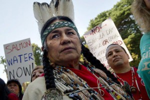
Chief Caleen Sisk will speak at rallies in Sacramento today and Friday and re-affirm the Winnemem Wintu opposition’s against the construction of the peripheral water export tunnels and the Bay Delta Conservation Plan (BDCP), as Governor Jerry Brown’s administration releases the preliminary Environmental Impact Report and the BDCP plan to the public today.
As California’s State Water Project currently operates, far too much water is sucked from the San Francisco/Sacramento Delta, the largest estuary on the Pacific Coast, and sent to the state’s water brokers, who support unsustainable industrial agriculture, destructive hydraulic fracking for oil extraction and municipal developments in the desert.
The proposed peripheral tunnels, with a conservatively estimated price tag of $54 billion, will undoubtedly kill the sensitive Delta, a delicate mix of salt and freshwater, that is vital to the life cycle of California salmon as well as thousands of other fish and species.
“There is no precedent for the killing of an estuary of this size, so how could any study be trusted to protect the Delta for salmon and other fish? How can they even know what the effects will be?” said Chief and Spiritual Leader Caleen Sisk. “The end of salmon would also mean the end of Winnemem, so the BDCP is a threat to our very existence as indigenous people.”
As one of the many traditional salmon tribes in California, the Winnemem rely on access to salmon to maintain our cultural and religious practices. The peripheral tunnels if ever constructed would therefore be in violation of our indigenous rights to maintain our cultural practices with salmon, as outlined in the United Nations Declaration on the Rights of Indigenous Peoples.
Recently at a public meeting in Redding, Governor Brown’s Deputy Director of the Natural Resources Agency Jerry Meral, disclosed that the peripheral tunnels are connected to the U.S. Bureau of Reclamation’s plan to raise Shasta Dam by 18.5 feet, a project that would destroy or submerge nearly 40 sacred sites and destroy potential salmon spawning areas. We are currently working on plans to re-introduce our salmon above the dam into the McCloud River.
The planned Delta tunnels will require more water be taken from the Trinity River and the Shasta Dam, which is fed by the Upper Sacramento, McCloud and Pit Rivers. This will add even more stress to the struggling ecology of these rivers.
This plan is not meant to benefit the public of California, native and non-native, but purely to line the coffers of the lobbyists who have been buying off Gov. Brown all along, such as Beverly Hills Big Ag billionaire Stewart Resnick and his wife Lynda who contributed $99,000 to his 2010 campaign. The Western States Petroleum Association has spent more than $4.5 million in lobbying the state government in 2013 alone.
The peripheral tunnels are a violation of the public’s trust in Gov. Brown, and not the answer to dealing with the state’s forthcoming water shortages. There are better solutions.
The Winnemem are proud to announce that we will be standing with our allies during a press conference today and a rally Friday, Dec. 13 at the West Steps of the Capitol. Chief Sisk will speak.
These events are sponsored by Californians for A Fair Water Policy and dozens of other environmental, fishing, farming, government, and water agencies.
Monday, December 9, 2013
—Press Conference and Rally at the Capitol
—Location: Starting in Room 112, moving to West Steps if needed
—Starting Time: Noon with 12:30 p.m. press conference – arrive as early as 10:30 for possible walk to California Resources Agency.
Friday, December 13, 2013
—Friday the 13th Rally to begin the 120 Day BDCP Response Countdown
—Location: West Steps of the Capitol
—Starting Time: 11:30 a.m.
This rally is sponsored by Californians for A Fair Water Policy and dozens of other environmental, fishing, farming, government, and water agencies.
To stop this boondoggle please writ letters to Governor Brown expressing your opposition to the peripheral tunnels plan! Letters should be addressed to:
TULALIP – Think of the Puget Sound as one massive estuary, fresh water from the creeks, streams and rivers of the uplands flow into the sound and mix during every tide with seawater from the Pacific Ocean. It’s the perfect recipe for salmon rearing habitat. Then add industry, boat traffic, shoreline development, acid rain and a cocktail of other chemicals. Suddenly, the perfect salmon nursery has become a precarious, dangerous and sometimes deadly environment.
Today, in the Puget Sound, about half of historic estuary land remains. Urban areas such as Seattle and Tacoma have lost nearly all of their estuaries, but cities are not the only places losing this vital habitat; according to the Washington Department of Fish and Wildlife, only about a quarter of the Skagit Bay Estuary remains. Our own home, the Snohomish River watershed, which produces between 25-50% of the Coho salmon in Puget Sound, retains only 17% of its historical estuarial land. With the loss of estuaries and pollution on the rise it’s not a mystery why salmon runs and coastal wildlife are diminishing with every passing year.
An estuary is a partially enclosed coastal body of brackish water, (a mix of seawater and fresh water), with one or more rivers or streams flowing into it that also has a connection to the open sea. The Puget Sound is essentially a huge estuary. It’s the second largest in the U.S., Chesapeake Bay, located on the east coast, is the largest. Brackish waters are where young salmon go to feed, grow and make the transition to the salt water; they’re also an ideal place to hide from both freshwater and saltwater predators. Without suitable estuaries, many young salmon don’t survive long enough to make the journey to the ocean.
Enter Qwuloolt, an estuary located within the Snohomish watershed just south of Marysville. The name, Qwuloolt, is a Lushootseed word meaning “salt marsh.” Because of its rich delta soil, early settlers diked, drained and began using the land for cattle and farming. The levees they established along Ebey Slough, as well as the drainage channels and tide gates, significantly degraded the estuary by preventing the salt water from Puget Sound from mixing with the fresh water from Jones and Allen Creeks.
Luckily, levees can be breached and streams rechanneled. In 1994 Tulalip and a number of national and local partners teamed up to begin the second largest estuary restoration in the Puget Sound. In 2000, Tulalip, along with a group of trustees (NOAA, USFW, NRCS and the Washington State Department of Ecology) began purchasing 400 acres of historic estuary between Ebey Slough and Sunnyside Blvd.
In the years that followed, fish and wetlands biologists, hydrologists and experts in salmon recovery have helped reshape the once vibrant estuary turned farmland. Using historic information about the area, they’ve re-contoured the land to create more natural stream flows and removed invasive species. The final step in rehabilitating the habitat is to break through the earthen dikes and levees and allow the tides to once again mix fresh and salt water, to resurrect an estuary that provides shelter and sustenance for fish, wildlife and people.
Qwuloolt will not only help salmon and wildlife habitat, the restoration protects every resident of the Puget Sound. Estuaries store flood waters and protect inland areas. The plants, microorganisms and soils of the estuary filter water and remove pollutants as well as capture and store carbons for long periods of time.
Qwuloolt is:
Physical stream restoration is a complex part of the project, which actually reroutes 1.5 miles of Jones and Allen creek channels. Scientists used historical and field analyses and aerial photographs to move the creek beds near their historic locations.
Native plants and vegetation that once inhabited the area such as; various grasses, sedges, bulrush, cattails, willow, rose, Sitka spruce, pine, fir, crab apple and alder are replacing non-native invasive species.
Building in stormwater protection consists of creating a 6 ½ acre water runoff storage basin that will be used to manage stormwater runoff from the nearby suburban developments to prevent erosion and filter out pollutants so they don’t flow out of the estuary.
Construction of a setback levee has nearly finished and spans 4,000 feet on the western edge on Qwuloolt. The levee was constructed to protect the adjacent private and commercial property from water overflow once the levee is breached.
Breaching of the existing levee that is located in the south edge of the estuary will begin after the setback reaches construction. The breaching of the levee will allow the saline and fresh water to mix within the 400-acre marsh.
Other estuary restoration projects within the Snohomish River Watershed include; Ebey Slough at 14 acres, 400 acres of Union Slough/Smith Island and 60 acres of Spencer Island. The Qwuloolt Estuary Restoration Project has been a large collaboration between The Tulalip Tribes, local, county, state and federal agencies, private individuals and organizations.