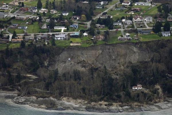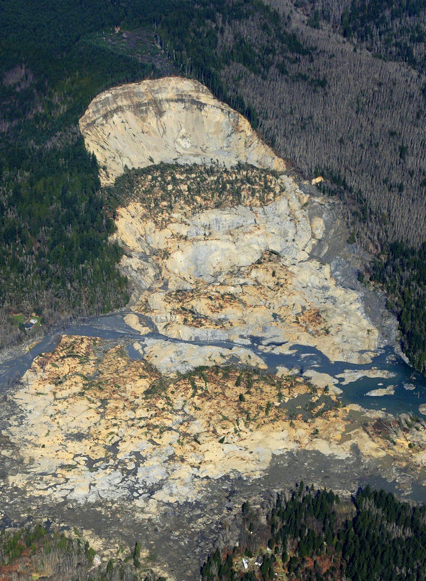
This aerial photo, taken after Saturday’s landslide, shows part of the plateau that has been logged over the decades. Right above where the hill fell away is a 7½-acre patch, shaped like a triangle, that was clear-cut about nine years ago.
In recent decades the state allowed logging — with restrictions — on the plateau above the Snohomish County hillside that collapsed in last weekend’s deadly mudslide.
By Mike Baker, Ken Armstrong and Hal Bernton
Seattle Times staff reporters
The plateau above the soggy hillside that gave way Saturday has been logged for almost a century, with hundreds of acres of softwoods cut and hauled away, according to state records.
But in recent decades, as the slope has become more unstable, scientists have increasingly challenged the timber harvests, with some even warning of possible calamity.
The state has continued to allow logging on the plateau, although it has imposed restrictions at least twice since the 1980s. The remnant of one clear-cut operation is visible in aerial photographs of Saturday’s monstrous mudslide. A triangle — 7½ acres, the shape of a pie slice — can be seen atop the destruction, its tip just cutting into where the hill collapsed.
Multiple factors can contribute to a slide.
With the hill that caved in over the weekend, geologists have pointed to the Stillaguamish River’s erosion of the hill’s base, or toe.
But logging can also play a role in instigating or intensifying a slide, by increasing the amount of water seeping into an unstable zone, according to an analysis of the watershed submitted to the state Department of Natural Resources (DNR).
In May 1988, when a private landowner, Summit Timber, received approval to begin logging above the slope, scientists raised alarms about the removal of trees that intercept or absorb so much water, according to documents obtained by The Seattle Times.
Paul Kennard, a geologist for the Tulalip Tribes, warned regulators that harvesting holds “the potential for a massive and catastrophic failure of the entire hillslope.”
Others echoed his concerns. Noel Wolff, a hydrologist who worked for the state, wrote that “Timber harvesting could possibly cause what is likely an inevitable event to occur sooner.” And Pat Stevenson, an environmental biologist for the Stillaguamish Tribe, cited “the potential for massive failure,” similar to a slide that occurred in 1967.
The agency that issued the permit — the DNR — responded to the concerns by assembling a team of geologists and hydrologists to study the harvest’s potential impact on landslides.
Lee Benda, a geologist with the University of Washington, wrote a report that said harvesting can increase soil water “on the order of 20 to 35 percent” — with that impact lasting 16 to 27 years, until new trees matured. Benda looked at past slides on the hill and found they occurred within five to 10 years of harvests.
In August 1988, the DNR issued a stop-work order, putting Summit Timber’s logging operation on temporary hold.
“1988 was maybe the first time that we were getting serious as to what you should or should not do in terms of logging and road construction around those things,” said Matt Brunengo, at that time a DNR geologist.
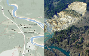
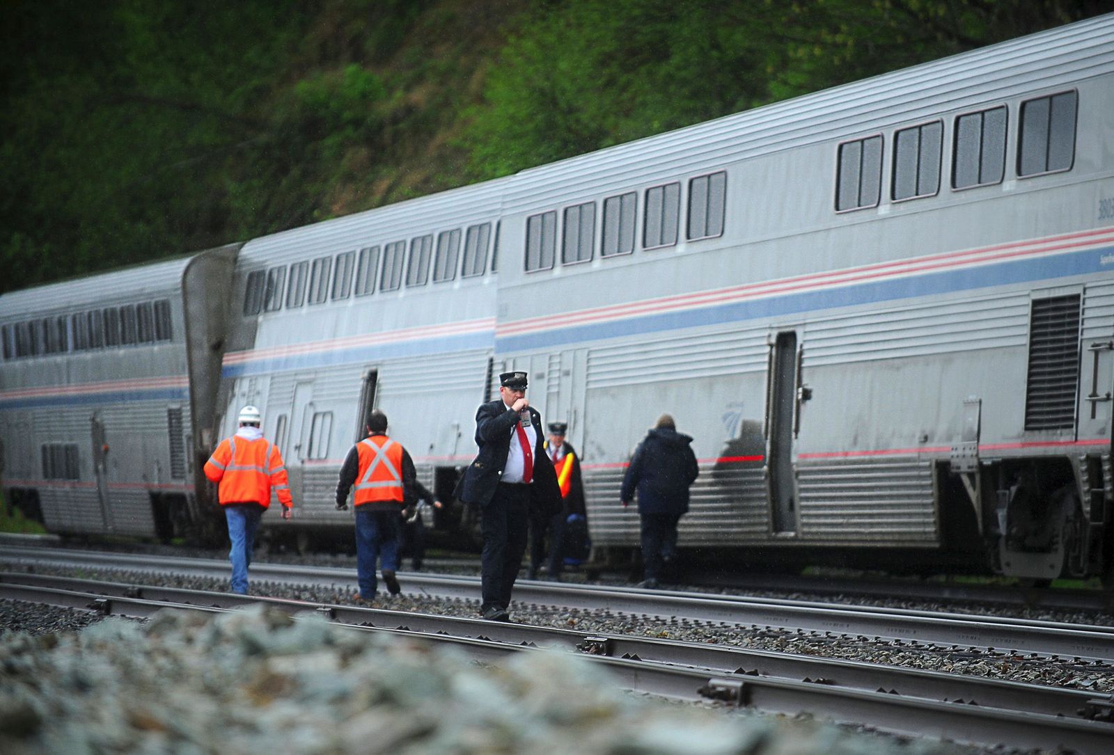
PHOTO BY TED S. WARREN / AP
Use an interactive tool to look at the effects of the mudslide.
A week after the stop-work order, a Summit representative wrote DNR, saying $750,000 to $1 million worth of timber was at stake. He listed alternative steps that could be taken to lessen the risks of a slide — for example, having the state relocate the channel of the Stillaguamish River that was cutting into the hill’s base.
“I can only conclude that the real issue here is not slides and water quality, but timber cutting,” he wrote.
Although records indicate that at least 300 acres were harvested on the plateau in the late 1980s, the state moved to prevent Summit Timber from clear-cutting 48 acres considered most likely to discharge water down the slope.
Mapping out the areas most likely to feed water into unstable terrain is “fraught with uncertainty,” wrote one geologist who studied this landslide zone in the 1990s.
Summit Timber was a family-logging business led by Gary Jones, who grew up in nearby Darrington. Jones believed the acreage atop the hill was second-growth forest, initially logged in the 1920s or 1930s. He said the company eventually backed away from its request to log the 48 acres, given the hill’s history.
“It was a little bit risky,” Jones told The Seattle Times. “We decided not to do it.”
Jones said he was always cautious when working around the river, especially considering he was an avid fly fisherman fond of the Stillaguamish.
Kennard, who now works as a geomorphologist at the National Park Service, said the 1988 application was contentious because the state rarely objected to proposed harvests. Getting the DNR to limit the cut’s scope was no small task, he said.
“That was considered kind of a big victory,” Kennard said.
Concerns about landslides surfaced again in 2004, when property owner Grandy Lake applied for a permit to clear a 15-acre tract near the plateau’s edge.
The state rejected the application, saying some of the proposed logging fell within a sensitive area that could feed water into the slope. Working in that zone would require years of intensive monitoring of precipitation and groundwater.
Grandy Lake revised its application, halving its proposed harvest to avoid the sensitive zone. The final plan — a clear-cut shaped like a right triangle — had an eastern border that abutted the area.
The state approved Grandy Lake’s application while attaching conditions, including: “All yarding and log-hauling activities will cease at the onset of heavy or steady rain and will not resume until the rain has subsided for at least 24 hours.”
Harvesting in that area was finished by August 2005.
Officials with Grandy Lake did not return calls seeking comment Tuesday.
In January 2006, a large slide hit, with so much mud crashing into the Stillaguamish that the river was diverted. Where the hill fell away was maybe 600 feet southwest of the clear-cut area.
Saturday’s slide took more of the hill, reaching right up to that triangle.
Grandy Lake has done selective logging on the plateau in more recent years. Following the approval of a 2009 permit that also included an area abutting the sensitive zone, the company reported to the state that it removed 20 percent of the area’s trees. It returned in 2011 and got approval to take 15 percent more.
Staff reporter Justin Mayo contributed to this report. Mike Baker: mbaker@seattletimes.com or 206-464-2729; Ken Armstrong: karmstrong@seattletimes.com or 206-464-3730