Lummi Nation challenges Bellingham plans for work related to new Costco


Shoppers enter the Bellingham Costco store Jan. 8, 2013. City officials are continuing to work on projects designed to clear the way for development of a West Bakerview Road site that could accommodate a new Costco store. THE BELLINGHAM HERALD |Buy Photo

By JOHN STARK

THE BELLINGHAM HERALD May 16, 2014

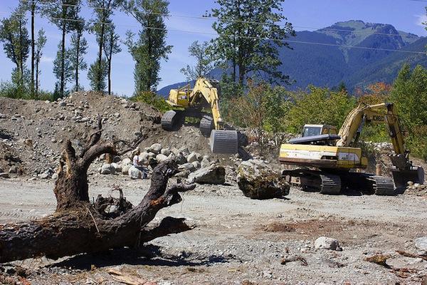
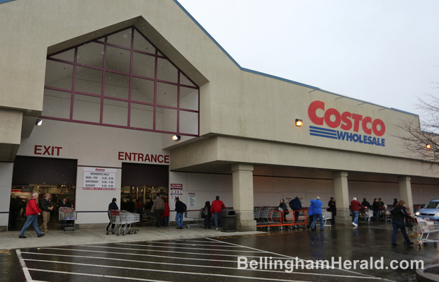
BELLINGHAM – Lummi Nation and Fred Meyer Stores have appealed the city’s preliminary approval of wetlands, stormwater and street modifications along West Bakerview Road to accommodate a new Costco store.

The appeals will trigger a city hearing examiner review of the development proposal. In technical terms, the review will determine whether City Planning Director Jeff Thomas was justified in issuing a “mitigated determination of non-significance” for the work in and around the proposed Costco store. Thomas’ finding meant that the project could move ahead without a more extensive review of environmental issues, as long as steps were taken to deal with traffic and other impacts.

Brian Heinrich, Mayor Kelli Linville’s executive coordinator, said there was no way to know how long that process might delay final approval of the project. The hearing examiner will set a hearing date after checking with attorneys representing the tribe and Fred Meyer.

“Any delay can have an impact, but we trust the process and are confident that city staff have acted appropriately in application of our land use and environmental regulations,” Heinrich said in an email.

In a press release, Lummi Nation Chairman Tim Ballew said the appeal was based on concern about the project’s potential impact on salmon and the Nooksack River.

“Filling wetlands that nourish salmon-spawning streams is significant,” Ballew said. “It is significant to the health of the river, the Lummi people, and everyone who calls the Nooksack River watershed home. As the steward of the environment, it is the Lummi Nation’s responsibility to protect these waters and the fish that live in them.”

In an email, Heinrich said the city shares the Lummi concern with the environment and salmon. Because of those concerns, the city is following the law in requiring the project to add wetlands to make up for those that will be filled, while restoring a salmon-bearing stream.

Heinrich noted that Lummi Nation also has offered developers the opportunity to compensate for wetland-filling projects by buying shares in the tribe’s wetlands bank to help cover the cost of creating new wetlands to make up for those lost to development.

Lummi Nation has its own long-term plans for major retail development on tribally owned real estate farther north. In the past, tribal leaders have negotiated with the city of Ferndale on division of tax revenues from major retail development of tribally owned property inside that’s city’s boundaries. So far that issue has not been settled, and no specific development plans for the tribal real estate have emerged.

Fred Meyer’s objections to the West Bakerview project are based on traffic impacts on its existing store on the other side of West Bakerview.

“The proposed development will significantly and adversely affect (Fred Meyer’s) interests by, among other things, substantially interfering with access to the Fred Meyer store by unreasonably increasing traffic on West Bakerview Road.”

Seattle attorney Glenn Amster, representing Fred Meyer, asks the hearing examiner to order preparation of an environmental impact statement, or the imposition of other measures to reduce the traffic impacts.

The city already has decided to impose the cost of some traffic improvements on Costco as a condition of city approval, including the construction of added turning lanes for cars entering the site. The city will require Costco to provide a right-turn lane into the store parking lot for westbound traffic, plus an additional left-turn lane for eastbound traffic.

Costco has agreed to pay for those improvements, Heinrich said, but as yet there is no cost estimate.

The 20-acre Costco site is on the north side of West Bakerview Road near Pacific Highway.

Reach John Stark at 360-715-2274 or john.stark@bellinghamherald.com . Read the Politics Blog at bellinghamherald.com/politics-blog or get updates on Twitter at @bhampolitics.

Landmark Study Demonstrates Climate Benefits of Estuary Restoration

Snohomish_estuary

Source: Restore America’s Estuaries

WASHINGTON – Restore America’s Estuaries has released the findings of a groundbreaking study that confirms the climate mitigation benefits of restoring tidal wetland habitat in the Snohomish Estuary, located within the nation’s second largest estuary: Puget Sound. The study, the first of its kind, finds major climate mitigation benefits from wetland restoration and provides a much needed approach for assessing carbon fluxes for historic drained and future restored wetlands which can now be transferred and applied to other geographies.

The Study, “Coastal Blue Carbon Opportunity Assessment for Snohomish Estuary: The Climate Benefits of Estuary Restoration” finds that currently planned and in-construction restoration projects in the Snohomish estuary will result in at least 2.55 million tons of CO2 sequestered from the atmosphere over the next 100-years.   This is equivalent to the 1-year emissions for 500,000 average passenger cars. If plans expanded to fully restore the Snohomish estuary, the sequestration potential jumps to 8.8 million tons of CO2   or, in other terms, equal to the 1-year emissions of about 1.7 million passenger cars.

“The study is the first to provide a science-based assessment of climate benefits from restoration at scale. The findings are clear: restoring coastal wetlands must be recognized for their ability to mitigate climate change,” said Jeff Benoit, President and CEO of Restore America’s Estuaries. “The report adds to our list of science-based reasons why restoration is so critical.”
“Healthy estuaries mean healthy economies,” Representative Rick Larsen, WA-02, said. “I have long advocated to restore our estuaries because of the critical role they play in supporting recovery of fisheries. This new study shows that estuary restoration can play a big role in countering climate change too.”
“It is very fitting that we are implementing some of the world’s leading Blue Carbon research here in Puget Sound,” said Steve Dubiel, Executive Director of EarthCorps. “We have always known that wetlands are a kind of breadbasket, thanks to the salmon and shellfish they support. Now we are learning that they are also a carbon sponge.”
In addition to the climate benefits outlined by the study, healthy and restored estuaries act as spawning grounds and nurseries for commercially and recreationally important fish and shellfish species, provide storm buffers for coastal communities, filter pollutants, and provide habitat for numerous species of fish and wildlife, as well as recreational opportunities for hundreds of millions of Americans annually.
“This study illustrates the contribution of tidal wetland restoration to reduce global warming,” said Dr. Steve Crooks, Climate Change Program Manager for Environmental Science Associates and lead author on the study. “From this analysis we find wetlands restoration in Puget Sound likely to be highly resilient to sea level rise while at the same time continuing to sequester carbon within organic soils. Similar opportunities will exist in other coastal regions of the U.S.”
“This report is a call to action. We need to invest more substantially in coastal restoration nationwide and in science to increase our understanding of the climate benefits which accrue from coastal restoration and protection efforts,” said Emmett-Mattox, Senior Director for Restore America’s Estuaries and co-author on the study. “Sea-level rise will only make restoration more difficult and costly in the future. The time for progress is now.”
This report was a collaborative effort of Restore America’s Estuaries, Environmental Science Associates (ESA), EarthCorps, and Western Washington University. Lead funding was provided by NOAA’s Office of Habitat Conservation and additional support was provided by The Boeing Company and the Wildlife Forever Fund.
“Coastal Blue Carbon Opportunity Assessment for Snohomish Estuary: The Climate Benefits of Estuary Restoration” full report is available here, and the Executive Summary is available here.

Salmon Killers: Top 10 Threats to the King of Fish

Northwest Indian Fisheries CommissionA dike is removed from Illabot Creek to restore its historic channel, one of several initiatives under way by Northwest tribes to bring back salmon habitat. This effort is by the Swinomish and Sauk-Suiattle tribes under the auspices of the Skagit River System Cooperative.

Northwest Indian Fisheries Commission
A dike is removed from Illabot Creek to restore its historic channel, one of several initiatives under way by Northwest tribes to bring back salmon habitat. This effort is by the Swinomish and Sauk-Suiattle tribes under the auspices of the Skagit River System Cooperative.

Richard Walker, Indian Country Today Media Network

As Indigenous Peoples of the Northwest work to restore salmon habitat and with it lost culture and treaty rights, they are grappling with the reality that continued development is undoing their efforts as they go. In September 2012 the Northwest Indian Fisheries Commission released a report, “State of Our Watersheds,” documenting the results of local and state planning that have been in conflict with salmon habitat-recovery goals. Below are the principle findings as to what salmon habitat faces.

RELATED: Northwest Pacific Salmon Habitat Restoration Efforts Hampered by Development

1. Estuaries are losing functional habitat because of population increases in lower portions of watersheds. “In the Suquamish Tribe’s area of concern, there has been a 39 percent loss of vegetated estuarine wetland area and a 23 percent loss of natural shoreline habitats, particularly small ‘pocket’ estuaries,” the report states. “Moreover, there are now 18 miles of bulkheads, fill and docks armoring the shoreline and degrading near-shore salmon habitat.”

All told, some 40 percent of Puget Sound shorelines have some type of shoreline modification, with 27 percent of the shoreline armored.

2. Rapidly increasing permit-exempt wells threaten water for fish. Since 1980, there has been an 81 percent increase in the number of new wells being drilled per 100 new Puget Sound residents moving into the area. The number of exempt wells in the Skagit and Samish watersheds since 1980 has increased by 611 percent, from an estimated 1,080 exempt wells to approximately 7,232.

“When more water is extracted from an aquifer than is being recharged, aquifer volume is reduced and the natural outflow from the aquifer decreases,” the report states. “This reduces the amount of fresh water available to lakes, wetlands, streams and the Puget Sound nearshore, which can harm salmon at all stages of their life cycle.”

3. Degraded nearshore habitat is unable to support forage fish. “In the Port Gamble S’Klallam Tribe’s focus area, according to studies since the 1970s, herring stocks have decreased from a status of healthy to depressed,” the report states. “In Port Gamble and Quilcene bays, which contain two of the largest herring stocks in Puget Sound, approximately 51 percent of spawning areas inventoried by [the] Port Gamble [S’Klallam] Tribe have been either modified or armored.”

4. Timber harvest has removed vast amounts of forest cover throughout all watersheds. In the Stillaguamish watershed, only 23 percent of the 1,777 acres of riparian area currently have any forest cover. In the Snohomish River basin, the Salmon Conservation Plan recommends that 150-foot buffers on both sides of fish-bearing streams be at least 65 percent forested. In 2006, those buffers were just 41 percent forested, with no gain since 1992 and little increase since that time.

5. Streams lack large woody debris. Large woody debris plays an important role in channel stability and habitat diversity. Estimates of large woody debris in the Green and Cedar rivers are 89 to 95 percent below the levels necessary for “properly functioning conditions” for salmon habitat.

6. Barriers cut off vast amounts of fish habitat. Despite extensive restoration efforts, many fish passage barriers, such as culverts, tide gates and levees still block salmon from accessing many stream miles of habitat. In the Quileute management area, culverts fully or partially block more than 168 miles of stream habitat. Most of these culverts are located on private forestlands. Culverts in the Chehalis basin block or impede salmon access to more than 1,500 miles of habitat.

7. Agricultural practices negatively impact floodplains and freshwater wetlands. Diking, draining and removing trees have resulted in a loss of stream buffers, stream channels and wetlands, and resulted in increased sediment and polluted runoff from agricultural activities.

In 1880, the Nooksack basin contained 4,754 acres of wetland to 741 acres of stream channel. By 1938, nearly 4,500 acres (95 percent) of off-channel wetland area had been cleared, drained and converted to agriculture. As of 1998, the lower mainstem retained less than 10 percent of its historical wetlands.

As of 2006, riparian areas of the Skagit River delta region are 83 percent impaired. Of that amount, only 12 percent are developed; the remaining 71 percent of impaired lands support crops and pasture.

8. Sensitive floodplains are being overdeveloped. In the Lower Elwha Tribe’s area of concern, 37 percent of the Morse Creek floodplain has been zoned for development — from utility rights of ways to single-family homes. Downstream of Highway 101, nearly half of the floodplain has also been zoned for similar development.

9. Puget Sound-area impervious surface increased by 35 percent from 1986 to 2006. It is projected that by 2026, the amount of impervious surface will increase another 41 percent.

“The Puget Sound Salmon Recovery Plan (2007) lists ‘Minimize impervious surfaces’ as a key strategy for protecting habitat,” the report states. “Impervious surface causes increases in stream temperatures; decreases in stream biodiversity, as evidenced by reduced numbers of insect and fish species; and contributes to pollutants in storm-water runoff, which can contaminate local aquatic systems.”

10. Loss of forest cover continues. From 1988-2004, Western Washington forestlands have declined by 25 percent—a loss of 936,000 acres of state and private forestland converted to other uses. Recent research from the University of Washington indicates that nearly one million more acres of private forestland are threatened with conversion.

The Skagit River System Cooperative—operated by the governments of the Sauk-Suiattle Tribe and the Swinomish Tribe, in partnership with the Bureau of Indian Affairs, U.S. Forest Service, Northwest Indian Fisheries Commission, Environmental Protection Agency, Pacific Salmon Commission and the state—recommends no new construction of riprap without mitigation. However, since 1998, at least one mile of riprap has been added to the existing 14 miles of riprap shoreline along the middle Skagit River.

“Shoreline armoring contributes to river channel degradation by impeding natural bank erosion and river meandering, and disconnecting terrestrial and aquatic ecosystems, directly impacting salmon habitat,” according to the NWIFC’s report, “State of Our Watersheds.” “Young juvenile chinook have been shown to use river banks modified with riprap at densities five times lower than natural banks.”


Read more at http://indiancountrytodaymedianetwork.com/2013/09/03/state-our-watersheds-top-10-threats-northwest-salmon-habitat-151131