For Tulalips, protecting treaty rights means restoring habitat

From a research boat on Oct. 12, Tulalip Tribes treaty rights commissioner Terry Williams points out a steep hillside near Mission Beach that has been gradually eroding for years. (Ian Terry / The Herald)


By Chris Winters, The Herald, Oct 22, 2016


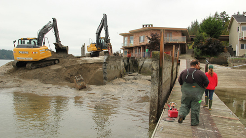
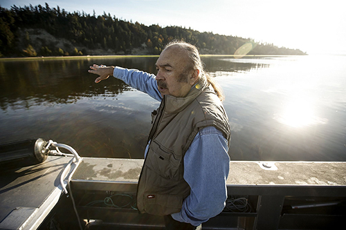
TULALIP — From the deck of a 30-foot research boat owned by the Tulalip Tribes, Terry Williams pointed out the remnants of a bulkhead along Mission Beach where not long ago there was a string of beach houses.

In 2013, the leases on the tribal property weren’t renewed and the homes were removed. The main concern was erosion of the beach and the bluffs overhead damaging the fragile marine environment below.

Williams, who is the Tulalips’ treaty rights commissioner, said increased rainfall and stronger windstorms would saturate the sandy bluffs and cause them to slide down onto the houses below.

“It gets to the consistency of a milkshake and tends to fall,” Williams said.

On a bright fall day, several parts of the bluff showed clear evidence of slides. Houses were visible above.

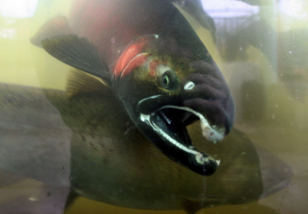
Coastal landslides tend to silt up the nearshore environment, which is considered a critical piece of the salmon ecosystem.

“Those areas are really important for forage fish for threatened and endangered salmon,” said Joshua Meidav, the Tulalip Tribes’ conservation science program manager.

The beaches were created and rejuvenated over millennia by the gradual erosion of the bluffs. Development along the shore, including bulkheads, docks and clifftop homes, interrupted that natural process.

Now when the bluff slides, it tends to come down all at once, Williams said.

“The reality is that this is all changing,” he said.

An issue of rights 

Climate change is a concern to Williams and the Tulalips in ways that go well beyond the usual worries about flooding and slides. It’s an issue of treaty rights.

While treaty rights are most commonly understood in the context of dividing the salmon harvest, their reach extends beyond the fishing grounds to tribal relationships with local, state and federal governments, said Ray Fryberg Sr., the Tulalips’ Executive Director of Natural Resources.

Most commonly that manifests in cooperative work with federal, state and local governments, and even private landowners, on many kinds of projects designed to restore salmon habitat.

On other occasions, the tribes have sought redress in the federal courts when they felt government wasn’t living up to its obligations.

“We’re like the last vanguard,” Fryberg said. “They have policies and procedures but there’s no enforcement.”

Most recently, that manifested in the “culverts case.”

In 2001, 21 tribes argued successfully that Washington state violated their treaty rights because culverts that carried streams under roads harmed salmon runs.

The 9th U.S. Circuit Court of Appeals upheld that decision in June, and ordered the state Department of Transportation to replace or fix 818 culverts at an estimated cost of $2.4 billion over the next 17 years.

It was a significant advancement of treaty rights into the realm of habitat restoration.

“The culvert case is the case that says there has to be a restoration so that ongoing harm doesn’t continue,” said Robert Anderson, a law professor and the director of the Native American Law Center at the University of Washington.

In this case, the state of Washington was found to have damaged habitat for salmon, and was ordered to make repairs.

Habitat protection and restoration were key elements in the second phase of a landmark decision by U.S. District Court Judge George Boldt.

In 1974, the first phase of the Boldt decision provided the basis for the co-management system, in which tribal and non-tribal fishermen divide the salmon harvest each year. The second phase, decided in 1984, focused on the habitat for the salmon.

“Phase II said that there’s not going to be a treaty resource of the salmon unless the environment is protected,” Fryberg said. “We get a certain amount of say-so in that.”

The part of the Phase II Boldt decision that obligated the federal government to restore habitat was overturned on appeal. However, the federal appeals court still said that the state of Washington and the tribes needed to take steps to protect and enhance the fisheries.

What those steps should be was left unstated.

“It’s difficult to argue that the federal government has an obligation to restore the ecosystem to, say, pre-treaty conditions, or treaty-time conditions,” Anderson said.

Some of the damage to habitat had already been done by that time, he said. Also, it’s a lot harder to assess the damage done by small changes, such as a single tide gate on private land, compared with the cumulative effects of the state’s culvert construction.

Momentum for restoration work can be created, however, when treaty rights are considered in tandem with the Endangered Species Act’s listing of various populations of salmon and steelhead.

“I think there’s a strong argument with the federal government to take steps to restore habitat,” Anderson said. “Maybe not a legal argument, but a treaty trust obligation to do it, and that they should do it.”

A seat at the table 

In practical terms, that means that the tribes have been aggressive in forming partnerships to pursue environmental projects.

Representatives from the Tulalips and the Suquamish Tribes were included in last week’s announcement of a new governmental task force to identify goals to protect Puget Sound.

Tribes also have broad leeway to take on projects of their own that help restore habitat, or at least halt the progress of degradation.

It’s not a blanket authority to do anything anywhere, but it means tribes have a seat at the table whenever a treaty trust resource is affected.

As a coordinating body among the 20 treaty tribes of Western Washington, the Northwest Indian Fisheries Commission has a role supporting restoration programs to have a greater impact.

A lot of the commission’s work focuses on the marine nearshore environment, said Fran Wilshusen, the NWIFC’s habitat services director. That also means studying how the marine environment interacts with estuaries, river systems and the upland watersheds.

“We’re trying to pull the lens back and look at how the whole system is connected,” Wilshusen said.

That includes small projects, such as the Tulalips’ 2013 pilot study to release beavers in the western Cascades, where their activity of building dams is expected to help return the upper reaches of streams to their natural state, which happens to be better spawning territory for salmon.

Larger efforts include the Tulalips’ restoration of the 400-acre Qwuloolt Estuary in Marysville. A similar project was restoration of the 762-acre estuary in the Nisqually National Wildlife Refuge outside Tacoma by the Nisqually Tribe.

The ongoing Nearshore Restoration Project focuses on restoring beaches and marine environments damaged by beach erosion. It’s a Snohomish County project, and local tribes have a place at the table, serving on the boards of several organizations that provided money for the project, including the county’s Marine Resource Committee and the Northwest Straits Commission.

One project under way is an agreement between the Tulalip Tribes and the U.S. Forest Service to maintain a 1,280-acre tract in the Mount Baker-Snoqualmie National Forest as a source of wild huckleberries.

There aren’t that many places left in the mountains that are accessible by road that still provide habitat for the berries, which are important to tribal culture, said Libby Halpin Nelson, a senior environmental policy analyst with the Tulalips.

“They are healthy and they are a traditional food that is always looked for in ceremonies,” Nelson said.

The project includes removing small conifers that could “shade-out” the berries. In essence, the tribe is mimicking the effect forest fires used to have before fire suppression became standard response, she said.

Rights at risk 

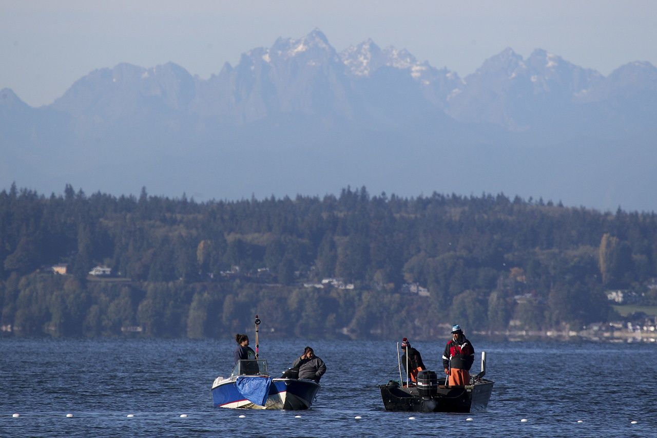
For all the work that’s been done to protect and restore salmon habitat, the fish runs continue to decline.

In spring, projections of low numbers of returning salmon, especially coho, led to a breakdown of negotiations between the tribes and the state. Tempers flared and fishermen protested when tribes were given permission to catch a small number of spring Chinook while the non-native sportsmen had to wait.

July report from the Northwest Indian Fisheries Commission’s “Treaty Rights at Risk” initiative pointed out just how dire the situation was for many watersheds, including the Snohomish and Stillaguamish rivers: Habitat was being lost faster than it could be replaced and nearly every single indicator of the health of salmon populations was trending downward.

The challenges looming on the horizon are even more formidable.

A poster on Fryberg’s office wall has a picture of the late Nisqually leader Billy Frank Jr. and his warning to all Native American tribes: “As the salmon disappear, so do our tribal cultures and treaty rights. We are at a crossroads, and we are running out of time.”

With each new study, it becomes clearer that changes are elapsing at an increasing speed.

“Ten, 15 years ago, what we said would happen in 50 years is already happening,” Fryberg said.

The Tulalip Tribes hosted two summits this year, one in April concerning rising sea levels, and another in September that looked at adapting to climate change in general. Fryberg said the tribe is planning a third focused on the state of salmon recovery.

“Collectively, we have to be making some effort,” Fryberg said. “We have a responsibility to the future to try and do something.”

The quote from Billy Frank was from an essay he wrote in 2012, and it’s the next sentence that points to what needs to be done: “That’s why we are asking the federal government to come to align its agencies and programs, and lead a more coordinated recovery effort.”

Williams’ entire career has been focused on building bridges between tribal, state and federal governments.

Shortly after the Boldt decision, he was involved in setting up the co-management regime in the state, and then negotiating the Pacific Salmon Treaty with Canada and its First Nations, backed by research developed by Tulalip staff scientists.

In the 1990s he was tapped to open the Indian Office in the Environmental Protection Agency. But many efforts to restore salmon runs were coming up short.

“We were putting tremendous amount of money into restoration and we were losing ground,” Williams said.

He realized that many federal and state agencies operated in their own silos, and often they might set regulations that aren’t in line with each other or broader goals.

“It’s the authority of each individual agency, federal, state or local, that gives them the ability to create rules and standards,” Williams said. “Eleven agencies have independent programs and authorities in Puget Sound. Most are not geared toward Puget Sound recovery goals.”

At the climate change summit in September, Williams noted the decision by the U.S. Army Corps of Engineers and other federal agencies to temporarily halt work on the Dakota Access Pipeline after months of protests at the Standing Rock Sioux reservation. He said that was recognition that regulators were out of alignment with the Obama Administration’s agenda.

While a court has allowed some of that work to start up again, the government’s order came with an announcement that the federal government would consult with tribes on major infrastructure projects in the future.

The consultation process already existed since President Obama created a cabinet-level position to coordinate government-tribal relations, Anderson said.

“Here the Obama Administration seems to be signaling that, ‘Hey, maybe we ought to be doing more,’” he said.

That may lead simply to more federal agencies talking to each other and more often with tribal governments, which is still a step forward.

From the Tulalip research boat, Williams pointed out a section of Hermosa Point where he’s lived since the 1970s. Here too, the bluffs have slid, and some of the houses are perched on the edge, hanging over the lip.

“When I bought my house we were looking at getting closer to the bluff, but decided that wasn’t a good idea,” he said.

If stronger regulations are enacted, it would prevent some houses from being built, and that would translate into lower insurance costs for government. That would also help protect fragile ecosystems.

“The more we can understand it, the better we can prepare,” Williams said.

“What we’re seeing in climate impacts right now is just the beginning.”


An eroding hillside near Hermosa Point on the Tulalip Reservation. (Ian Terry / The Herald)


Evidence of a recent slide along a hillside near Arcadia Road on the Tulalip Reservation on Oct. 12. (Ian Terry / The Herald)


Fishermen in Tulalip Bay with the Olympic Mountains looming in the background. (Ian Terry / The Herald)


Chris Winters: 425-374-4165; cwinters@heraldnet.com. Twitter: @Chris_At_Herald.

Quinault Indian Nation hosts crude oil protest rally

When tribes stand together is when we are strongest


Quinault Indian Nation President Fawn Sharp, along with many tribal members and Grays Harbor community member rally in protest of crude oil in their county. Photo/Kalvin Valdillez, Tulalip News 


By Kalvin Valdillez, Tulalip News

Grays Harbor County is the vacation destination for Washingtonians who are looking for a relaxing affordable getaway. Grays Harbor is the home to popular beach towns like Ocean Shores, Seabrook, and Westport. Hikers and nature lovers who visit the Hoh Rainforest and Lake Quinault frequently admire the northern borders of the county because it shares the Olympic Peninsula with Jefferson and Clallam Counties. This county with breathtaking views almost everywhere you look is in danger of jeopardizing its greatest tourist attraction: it’s natural resources.

Westway Terminal is seeking to build and operate oil terminals in Grays Harbor. The company wants to bring in large amounts of oil via train, store it on the shoreline, and ship it out of the harbor in tanker vessels. Westway is the third company attempting to bring crude oil business into the Grays Harbor community in recent years. Imperium Terminal Services and Grays Harbor Rail Terminal have both attempted and failed largely due to the communities’ opposition. Westway argues that the company will create thousands of job opportunities in a community that is economically struggling, and that Washington State has one of the best oil spill prevention and response teams in the country, so if a spill were to ever occur, the damage would be significantly less than other states.


Photo/Kalvin Valdillez, Tulalip News


Grays Harbor recognizes the point the company is trying to make and although some citizens find the possibility of an economic boost appealing, the majority of Grays Harbor feel the risk is greater than the reward. The Quinault Indian Nation (QIN) is the most prominent among the many active voices in the community regarding this issue.

QIN hosted a march and rally in the city of Hoquiam on Friday July 8, protesting crude oil in Grays Harbor County. Hundreds of tribal and community members united in an effort to save the county from Westway’s purposed oil terminals. The rally began when traditional canoes docked at the Hoquiam River. Once everybody was ashore the protesters, with banners raised high, marched onto Hoquiam City Hall.


Quinautl_oil-1
Photo/Kalvin Valdillez, Tulalip News


“Our ancestors gave up so much when signing the treaties. They worked to ensure that our generation, and we are the seventh generation since the Quinault Nation signed our treaty in the 1800’s, would be secured by treaty rights. This generation is standing up for our treaty rights to ensure that our natural resources are preserved for the next seven generations to come,” stated QIN President, Fawn Sharp, as the large crowd began to chant “No crude oil!”


Photo/Kalvin Valdillez, Tulalip News


President Sharp commissioned an economic study in regards to what would happen to the community if the county approves the oil terminals. The study found that in the case of an oil spill, approximately 10,000 jobs would be threatened including 700 tribal fisherman, 400 non-tribal fisherman, and over 4,000 tourism based jobs. According to the study, more jobs would be lost in the community in the event of a spill than the jobs that would be created by approving Westway’s move to the harbor. Not to mention the damage a spill would cause the environment.

Sharp stated, “We are at a critical place in Grays Harbor. A decision is going to be made soon. The future of this harbor is going to go in one direction or the other. We need it to go in the direction of no crude oil forever!”

Several community leaders gave testimonies opposing Westway at Hoquiam City Hall that afternoon. Tribal leaders from Lummi, Neah Bay, and Quileute were in attendance to show support for Quinault. With the majority of the community on the same page, the purposed oil terminal seems to facing a losing battle. The QIN’s effort to preserve its natural resources for it’s future tribal members is a battle that the Nation is always prepared for. The protection of treaty rights is a fight that all tribes throughout Native America are familiar with, and when tribes stand together is when we are strongest. No crude oil!


Photo/Kalvin Valdillez, Tulalip News


Photo/Kalvin Valdillez, Tulalip News

“Being Frank” More Salmon Habitat Protection Needed


By Lorraine Loomis, Chair, Northwest Indian Fisheries Commission


We’ve seen some incredible salmon habitat restoration projects the past few years, but there’s a big difference between restoring habitat and protecting it.  We must remember that restoration without protection does not lead us to recovery.

The Elwha River on the Olympic Peninsula continues to heal itself after the largest dam removal effort in U.S. history. Two dams on the river had blocked salmon migration and denied Lower Elwha Klallam Tribe’s treaty fishing rights for more than 100 years.

In another big project, the Tulalip Tribes and partners recently returned tidal flow to the 400-acre Qwuloolt Estuary. The estuary was drained and diked for farming in the early 1900s, blocking access to important salmon habitat.

Both were huge, costly projects that took decades of cooperation to accomplish. Every habitat restoration project – large or small – contributes to salmon recovery. But if we are going to achieve recovery, we must do an equally good job of protecting habitat, and that is not happening.

Treaty Indian tribes are seeking federal leadership to help turn this tide.

Salmon recovery efforts cross many federal, state and local jurisdictions, but it is the federal government that has both the legal and trust responsibility to recover salmon and honor tribal treaty-reserved rights. Through our Treaty Rights at Risk initiative, we are asking the federal government to lead a more coordinated and effective salmon recovery effort.

One way is to ensure that existing federal agency rules and regulations do not conflict with salmon recovery goals.

An example is the U.S. Army Corps of Engineers’ jurisdictional boundary they use for permitting shoreline modifications. The Corps regulates construction of docks and bulkheads in marine waters, and uses a high water mark based on an average of each day’s two high tides to determine its jurisdiction under the Clean Water Act.

But the Clean Water Act specifies the protection boundary should be the single highest point that an incoming tide can reach.

In Puget Sound, the Corps’ boundary is 1.5 to 2.5 feet below the highest tide. When you apply that to 2,000 miles tidelands, a large portion of important nearshore habitat is left unprotected.

That needs to change. We need to be protecting more habitat, not less.

Another example is agricultural easements issued by the federal Natural Resources Conservation Service that can block salmon habitat restoration efforts.

Federally funded agricultural easements pay landowners to lock in agricultural land uses permanently, regardless of whether those areas historically provided salmon habitat and need to be restored to support recovery.

The federal government needs to change the program to ensure agricultural easements do not restrict habitat restoration and other salmon recovery efforts.

These are just a couple of examples of how federal actions can conflict with salmon recovery goals to slow and sometimes stall our progress.

We know that habitat is the key to salmon recovery. That’s why we focus so much of our effort on restoring and protecting it. Many amazing restoration projects are being accomplished, but the more challenging task of protecting that habitat is falling short.

We must do everything we can to protect our remaining habitat as we work to restore even more. One way to do that is to harmonize federal actions and make certain they contribute effectively to recovering salmon, recognizing tribal treaty rights and protecting natural resources for everyone.

Tulalips, Forterra to preserve land near Wallace River for salmon


By Chris Winters, The Herald

GOLD BAR — A 1.25-mile stretch of forested land along the Wallace River will now be protected forever as salmon habitat.

The land, covering 121 acres on five parcels, was purchased by the environmental nonprofit Forterra in July for $490,000. Forterra, formerly known as the Cascade Land Conservancy, transferred the property to the Tulalip Tribes in November for future management.

A conservation easement ensures the property will never be developed.

“There’s a stewardship plan that we’ll be working on with the Tulalips” to maintain the tract’s value to the watershed, said Michelle Connor, Forterra’s executive vice president of strategic enterprises.

The property on the north bank of the Wallace River consists of five parcels that are a mix of wetlands and mature second-growth forests. It was last logged several decades ago.

“The trees have grown back nicely and the land is actually in pretty good shape,” said Daryl Williams, the Tulalip Tribes’ natural resources liaison.

The tract is located just west of Gold Bar and close to the Mt. Baker-Snoqualmie National Forest, the Wild Sky Wilderness and other protected lands managed by the state Department of Natural Resources.

The land lies across the Wallace River from a state salmon hatchery, and provides habitat for bull trout as well as four types of salmon: chinook, coho, pink and chum. The land is also home to black bear, elk, deer and beaver.

Williams said the land is likely to remain in its present state, as it already provides ideal habitat for fish in the water as well as for land mammals.

“Right now we don’t have any money to do anything with the property,” Williams said. “Perhaps we’ll thin some of the trees to allow some of the others to grow faster.”

The deal came together when Forterra learned the owner of the parcels, a property investment firm called Robinett Holdings, soon would put them up for sale, Connor said.

“When we first learned the property was coming on the market, we contacted the Tulalip Tribes to see if (the land) would be conservationally significant,” Connor said.

That turned out to be the case, she said.

“The property itself has historical oxbows and natural features that in and of themselves are very, very important,” she said.

It also fit in with the Tulalips’ efforts to restore the watersheds associated with the Snohomish, Skykomish and Snoqualmie rivers.

“We’ve been spending a lot of time and effort trying to restore areas on the watershed,” Williams said.

“With new development and redevelopment, we’re losing habitat faster than we’re replacing it,” he said. “We need to do a better job with what we have.”

The deal marks the second large habitat protection project the Tulalips have undertaken. Last year the tribes breached the levees and restored tidal influence to the Qwuloolt Estuary in Marysville. The 315-acre tract took 20 years to convert from farmland to a salt marsh and cost nearly $20 million.

The transfer of the Wallace River tract is also consistent with Forterra’s goals in working with local Native American tribes on preservation, Connor said.

Last year Forterra carried out a similar property transfer with the Makah Tribe involving 240 acres near Lake Ozette on the Olympic Peninsula that is considered critical salmon habitat.

“We see that repatriation of indigenous lands is an important part of our conservation mission,” Connor said.

Snohomish County was the primary provider of funds for the land purchase and transfer, providing $280,000 in Conservation Futures funds toward the purchase, and toward other costs associated with obtaining the conservation easements and transferring the property to the tribes.

County Parks Director Tom Teigen said the Conservation Futures Advisory Board often tries to strike a balance between acquiring land for active recreation, agriculture and habitat preservation, but this particular exchange stood out for its potential benefits to salmon.

“At the end of the day, preserving that property and getting that much acreage as well as the riverfront is significant,” Teigen said.

Forterra also received $250,000 from the state Recreation and Conservation Office toward the property purchase.

Tulalip turning tide on diminishing salmon


 KING5 News


It has been 100 years since water flowed in this now former farmland along Ebey Slough. The place is unrecognizable from what it was just four months ago.

“A lot of things are going to change really fast in here,” said Todd Zackey, as he and a team of researchers from the Tulalip Tribes navigated the waters Monday.

In August, the Tulalip, along NOAA and Snohomish County breached a levee along the slough, flooding the land and returning its natural state.

Now, researchers are casting nets into the water to see what fish are showing up. The goal is to create a salmon spawning habitat to help in increase their numbers around Puget Sound.


Researchers are casting nets into the Ebey Slough to see what fish are showing up.(Photo: Eric Wilkinson / KING)
Researchers are casting nets into the Ebey Slough to see what fish are showing up.
(Photo: Eric Wilkinson / KING)


Right now, though, there are far more questions than answers.

“Can we punch a hole in the dike and have the salmon respond in a positive way?” asked researcher Matt Pouley. “Are we going to see a population response over a reasonable amount of time?”

So far only a few salmon have been spotted, but that’s to be expected for this time of the year. There are plenty of other fish, though, and that’s a good sign.

No one is in a hurry. This is a long term project. It will likely take a century for full restoration of these waters.

And this project is about more than strengthening the fish supply. It’s about a way of life that goes back thousands of years for the Tulalip, and preserving that tradition for generations to come.

“The tribe is, in essence, losing part of its culture,” said Zackey. “Restoring salmon is restoring the culture of the tribe.”

Nisqually Tribe Taking Chinook Into Protective Custody

By: Northwest Treaty Tribes


Chinook born in the Nisqually River are being taken into protective custody by the Nisqually Indian Tribe.

The tribe is trapping and spawning natural-origin chinook this fall because so few have returned in recent years. Instead of passing naturally produced chinook above a tribally operated weir, the tribe will truck them to its nearby Kalama Creek Hatchery.

“We’re seeing a sharp decline of natural-origin chinook returning to the river, so we want to make sure these fish are as successful as they can be,” said David Troutt, natural resources director for the tribe.

At Kalama Creek, the fish are being spawned by hand. Their offspring will be released into the river next spring.

To make sure some chinook spawn in the wild, the tribe will release up to 600 adult hatchery-produced chinook into the upper watershed. That way, even more naturally produced chinook will leave the river next year.

“The genetic difference between natural and hatchery-origin chinook on the Nisqually is small,” Troutt said. All of the chinook in the river are descendants from an imported hatchery stock planted decades ago.

The native chinook stock was killed off in the 1960s in large part due to poor hydroelectric practices that left the river dry for months at a time.

Five years ago, the tribe began closely managing the mix of natural and hatchery-spawned fish in the river to help mitigate hatchery influence on the stock.

“Our goal is to let the natural habitat, instead of the hatchery environment, drive adaptation of the stock,” Troutt said. “By mixing in natural-origin fish at the hatchery, we bring in better genetic traits to improve salmon productivity. This means more fish for everyone.”

Recent declines in chinook productivity because of poor ocean conditions drove this year’s drastic action. “Instead of bringing in just a few, we need to bring in every single natural fish we can to protect them,” Troutt said.

Indigenous women take climate matters into their own hands

Native American drummers demonstrate at the steps of City Hall during a rally to take strong action on the climate change on February 17, 2013 in Los Angeles, California. David McNewGetty Images
Native American drummers demonstrate at the steps of City Hall during a rally to take strong action on the climate change on February 17, 2013 in Los Angeles, California.
David McNewGetty Images


By Justine Calma, Global Post


NEW YORK — Not far from the negotiations for a new global development agenda that took place between heads of state at the United Nations General Assembly last month, a small group of female leaders gathered out of the limelight to sign another historic agreement.

The delegation chose not to meet at UN headquarters in east Midtown but on a traditional Native American tribal territory in Central Park’s East Meadow.

Seven women representing eight different tribes signed a treaty to unite the indigenous women of the Americas in friendship to protect the land and people from the harms of climate change and environmental degradation.

In what organizers said was the first-ever indigenous women’s treaty, the women pledged to support the rights of indigenous peoples, commit nonviolent acts of civil disobedience to protect the planet, and demand immediate changes to laws that have led to environmental destruction.

“We’re saying this is the line. We’re done. The destruction stops now,” said Pennie Opal Plant, one of the treaty’s lead signers.

The United Nations recognizes that women are more vulnerable to the effects of climate change because they constitute a majority of the world’s poor and are more dependent on natural resources for their livelihood.

“Women’s role as central stakeholders is one of the most important, yet untold stories of climate change. If we are to have a fighting chance at restoring the health of the Earth and our communities, women’s experiences and knowledge must be brought to the forefront,” said Osprey Orielle Lake, the executive director of Women’s Earth and Climate Action Network (WECAN), at an event where the treaty was later presented.

The signed treaty contends that the laws of Mother Earth “have been violated to such an extreme degree that the sacred system of life is now threatened and does not have the capacity for life to continue safely in the way in which it has existed.”

Opal Plant, who is of the Yaqui, Choctaw and Cherokee tribes, was instrumental in shaping the treaty. She grew up in the shadow of Chevron and Shell refineries in the eastern part of the San Francisco Bay Area, where she saw environmental degradation first-hand. She has organized nonviolent prayer walks in her home city led by Native American elders, but after connecting with other women during a gathering of nature rights advocates in Ecuador 2014, Opal Plant saw opportunity to launch a worldwide movement. She joined several other indigenous leaders from the US and Ecuador — Casey Camp-Horinek of the Ponca tribe, Patricia Gualinga Montalvo and Blanca Chancoso of the Kichwa, and Gloria Hilda Ushigua Santi of the Sápara.

“When women unite and commit to something, shifts happen,” said Montalvo, speaking through an interpreter. “I feel strongly that it’s a time to be heard and for actions to take place.”

Montalvo played a large role in successfully fighting the Ecuadorian government in 2012 in a landmark Inter-American Court of Human Rights case, Sarayaku v. Ecuador, in which the Ecuadorian government was found guilty of rights violations after authorizing oil exploration on Sarayaku lands without prior consultation with the indigenous community.

Opal Plant and her treaty co-signers presented their document at an event hosted by WECAN on Sept. 29, a Global Women’s Climate Justice Day of Action.

Women are disproportionately impacted by climate change, and they are central to solutions, said Orielle Lake at the event.

In the coming months, Opal Plant and her co-signers will create a website to expand the treaty beyond the Americas and allow other groups to sign online. In December, they plan to bring the treaty to COP21, the Paris Climate Conference, and hold another ceremony where more indigenous women leaders will join.

Montalvo’s indigenous community in Sarayaku is constructing a canoe that will travel from Ecuador to France. “The canoe is a symbol of Sarayaku, a symbol of our living forest,” said Montalvo. “We will bring it all the way to Paris so it can navigate the River Seine and so we will be heard.”

In New York, WECAN also presented a Women’s Climate Declaration, which includes a demand to bring back atmospheric carbon dioxide concentrations to below 350 parts per million — which many scientists agree is a level that avoids catastrophic global warming — and an aim to ensure that women’s groups have access to funding to adapt to climate change that is already happening. The declaration already has garnered over 2 million signatures and will be delivered at COP21 later this year.

Women comprise 20 million of the 26 million people estimated to have been displaced by climate change, according to a 2010 report by the Women’s Environmental Network.

“I ask that as temperature rises, that we rise,” said Orielle Lake.

Toxic road runoff kills adult coho salmon in hours, study finds

A three-year-old adult coho makes its way through the Issaquah Salmon Hatchery. (Mike Siegel / The Seattle Times)


By  Sandi Doughton, Seattle Times


A new study shows that stormwater runoff from urban roadways is so toxic to coho salmon that it can kill adult fish in as little as 2½ hours.

But the research by Seattle scientists also points to a relatively easy fix: Filtration through a simple, soil-based system.

“It’s basically … letting the Earth do what it does so well, what it has done for eons: cleaning things up,” said Julann Spromberg, a toxicologist for the National Oceanic and Atmospheric Administration and co-author of the report published Thursday in the Journal of Applied Ecology.

Scientists have long suspected that the mixture of oil, heavy metals and grime that washes off highways and roads can be poisonous to coho, but the study is the first to prove it.

The research got its start more than a decade ago, when habitat-restoration projects began coaxing a trickle of coho back to several urban streams in the Puget Sound area. But many of those fish died before they could spawn. And the deaths seemed to coincide with rainstorms that sent runoff surging through drainage pipes and into the waterways.

In some place, like Longfellow Creek in West Seattle’s Delridge area, up to 90 percent of females were killed.

“It was apparent that something coming out of those pipes was causing it,” Spromberg said.

She and her colleagues tried to reproduce the effect in the lab. But the artificial mixture of oil and other chemicals they concocted had no effect on the fish.

So their next step was to try the real thing: Actual runoff, collected at NOAA’s Northwest Fisheries Science Centerfrom a downspout that drains a Highway 520 onramp near Montlake.

“When we brought out the real urban runoff: Bang! They were down, they were sick, they were dead,” said co-author Jenifer McIntyre, a researcher at Washington State University’s Puyallup Research and Extension Center.

In experiments at the Suquamish tribal hatchery near Poulsbo, every coho exposed to the runoff died — some within a few hours, all within a day. Before death, the fish became lethargic, rolled around and swam to the surface as if gulping for air, McIntrye said.

The fact that actual runoff proved fatal while the scientists’ concoction did not underscores an unsolved mystery about which chemical or combination of chemicals are so toxic to the fish. It could be any number of compounds that weren’t part of the artificial brew, including byproducts of oil and gasoline combustion, chemicals released by tires or tiny particles from brake linings, Spromberg said.

 “We still need to keep looking at what exact compounds are involved.”

But whatever the chemical culprit, the scientists found it could be removed by passing the runoff through 55-gallon drums packed with layers of gravel, soil and compost. None of the fish exposed to the filtered stormwater died or fell ill.

“It was remarkable,” McIntyre said.

 The finding is a strong endorsement of rain gardens, grassy swales and other “green” alternatives to traditional drains and pipes designed to collect stormwater. The idea is instead to let the runoff percolate through the ground, as it did before so much of the area was paved and developed.

State regulations strongly encourage developments to use such approaches, according to the Washington Department of Ecology. A project called 12,000 Rain Gardens in Puget Sound is also promoting their use.

“We should be seeing more and more of these systems in the future,” McIntyre said.

Coho, which were once abundant throughout the Northwest, may be particularly vulnerable to toxic runoff because they spawn in the fall, prompted by seasonal rains. Habitat destruction, fishing and other factors almost certainly contributed to the species’ precipitous decline, Spromberg said.

Chum salmon, whose habitat and spawning seasons overlap those of coho in many places, don’t appear to be as affected by runoff — something the scientists plan to investigate this fall.

Perhaps the major limitation of the study is the small sample size. Only 60 coho were used in the experiments, 20 in each of two experimental and one control groups. The scientists were lucky to get that many, thanks to the cooperation of the Suquamish Tribe, McIntryre said.

Also, the urban runoff collected near Montlake was undiluted in the experiments and represents about the worst possible case: runoff from a busy highway in a big city, a DOE official who was not involved in the study pointed out.

“It’s great that the treatment gets rid of toxicity from this nasty stuff,” Karen Dinicola of DOE’s stormwater program wrote in an email. But it’s particularly challenging to retrofit urban-collection systems with greener alternatives, she said.

But the results of the research could help guide future development in rural watersheds where coho runs remain, the researchers said. And it can also be used to help inform urban-restoration projects as well, so fish aren’t lured back to appealing habitats, only to be clobbered by toxic runoff.

The researchers are preparing for their next round of studies, which will include tests to zero in on what is actually killing the coho.

The rain that soaked the region Wednesday also filled their runoff-collection barrels, Spromberg said.

“We only have one shot a year, when the fish come back and we can do the experiments and take the samples,” she said. “Hopefully, with this rain we’ll have more fish coming in soon.”

Squaxin Island Tribe Restoring Vital Shoreline in Puget Sound

IMG_1063-copy-874x492


Source: Northwest Treaty Tribes


The Squaxin Island Tribe is working with the South Puget Sound Salmon Enhancement Group to restore vital forage fish habitat by removing a 70-foot-long boat basin and a 137-foot-long boat ramp to reconnect a large drift cell along the shoreline.

“This kind of habitat, that forage fish use to spawn in, is critically important for deep South Sound,” said Scott Steltzner, salmon biologist for the Squaxin Island Tribe. A drift cell is a portion of shoreline that has a common source of sediment. When the habitat within these cells is disconnected, the actual amount of habitat available to forage fish can shrink.

The boat basin takes the form of a perpendicular cut into the beach near the mouth of Hammersly Inlet. Ten foot high walls were designed to protect a resident’s boat from the surf and tide and the boat ramp provided access to Puget Sound, but they also cause a lot of problems for what salmon like to eat.

After removing the concrete boat basin and ramp, the Tribe will restore the original slope of the beach, recovering the spawning habitat lost to forage fish This will allow sediment to naturally move supplying sediment to beach spawning forage fish and those off shore.

Forage fish, such as herring, sandlance, and surfsmelt, are important food for juvenile and adult salmon. Where they spawn marks critical habitat for salmon. “Forage fish spawn in the same places as juvenile salmon feed,” said Scott Steltzner, salmon biologist for the Squaxin Island Tribe. “Restoring this habitat will mean more food for salmon, which will help recovery depressed stocks.”

A few years ago, the tribe completed another fish friendly project when they replaced an aging, outdated boat ramp with a new ramp that would allow sediment to more naturally move. “This boat ramp is not only important to tribal fishers, but for shellfish companies and the general public,” said Andy Whitener, natural resources director for the tribe. “When we set out to replace it, it seemed fitting we’d do it in a fish friendly manner.”

In addition to providing more room for forage fish, nearshore habitat also provides important rearing areas for juvenile salmon before they move out to the open ocean. Nearshore habitat is a productive swath of land close in to the coast that serves an important role in the life-cycle of salmon.

After levee breach, Marysville starts work on a trail

By Chris Winters, The Herald 


MARYSVILLE — The levee at the Qwuloolt Estuary has been breached for nearly a month and the ecosystem is slowly transforming from a weed-covered lowland into a salt marsh.

With the Tulalip Tribes doing the last bits of finishing work, the city of Marysville is now looking at its next big project: building 1.8 miles of new trail around the new estuary.

The city is planning a 12-foot wide paved trail that would lead from Ebey Waterfront Park down to the estuary. Another segment will run on the east side of the breached levee up to Harborview Park in the Sunnyside neighborhood.

If all goes according to plan, the two segments of trail would be complete by the end of 2016.

It’s a big deal for the city, which has relatively little in the way of publicly available waterfront.

“We’ve only had about 900 feet of access to our shoreline and this will change that significantly,” said Jim Ballew, Marysville’s director of Parks and Recreation.

The project is estimated to cost between $1 million and $1.2 million, $500,000 of which was in the most recent budget from the Legislature.

That also meant that the city’s trail project was delayed due to the extended budget debates in Olympia this year. The original plan was to have the western segment of the trail done by the end of the year.

“We had to wait for the Legislature to approve the funding, and that was so delayed this year that we don’t even have a contract yet,” Ballew said.

The rest of the trail’s funding includes a $347,000 grant from the state’s Aquatic Lands Enhancement Account, which will require the city to put up matching funds.

“We’ve got it within our capital budget; it’s ready to go,” Ballew said.

The new plan calls for finishing the design work by the end of the year and expanding the project to include not just the trail, but other waterfront improvements and interpretive signs along the route.

Further out, the plans will include the eventual construction of a mile-long loop around the estuary connecting the trail’s west and east legs.

Funding so far only exists for the initial segments, meaning there will be a gap in the trail until some time in the future.

The Qwuloolt Estuary restoration project is intended to create better habitat in the Snohomish River watershed for migratory salmon, especially juveniles that need a place to mature for up to a year or two while they gradually get used to a marine environment.

The Tulalip Tribes have spent $20 million over 20 years on the estuary, with the final levee breach taking place Aug. 28.

All that’s left now is to seal off the former tide gates and dig a final stormwater pond, said Josh Meidav, a restoration ecologist with the Tulalip Tribes.

So far, Meidav said, the results of the levee breach have met their expectations.

“The channel itself at low tide or incoming tide is actually capturing a good amount of the Ebey Slough inflow,” he said.

Some marine fish have been seen in the upper reaches of the estuary and the reed canary grass is starting to die off, Meidav said.

The city plans to reach out to the scientific community, the tribes and even the birdwatching community to provide input into the interpretive elements of the trail.

“We’ll be spending a lot of time with those specialists,” Ballew said.